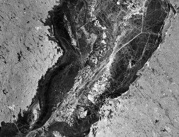
PALSAR Overview

Phased Array L-band Synthetic Aperture Radar (PALSAR) was a successor sensor to the synthetic aperture radar on-board JERS-1 with more advanced functions such as higher spatial resolution capability, variable off-nadir angles and additional modes such as full-polarimetry mode and ScanSAR mode.
PALSAR was jointly developed by JAXA, JAROS (Japan Resources Observation System Organisation) and METI (Japanese Ministry of Economy, Trade & Industry). PALSAR is a side-looking phased array L-band instrument with a pointing capability from 8 to 60° of incidence angle. The SAR antenna is of size: 8.9 m (length) and 3.1 m in width. An array of 80 transmitting/receiving modules (T/R) is mounted behind the antenna panels. Electrical beamsteering in elevation is provided.
PALSAR featured four operational modes:
FB (Fine resolution Beam) mode. FB comprises 18 selections in the off-nadir angle range between 9.9° and 50.8°, each with four alternative polarisations: single polarisation HH or VV, and dual polarisation HH+HV or VV+VH. The bandwidth is 28 MHz in single polarisation and 14 MHz in the dual-polarisation modes. Out of the 72 possible FB modes, two have been selected for operational use.
The 14 MHz polarimetric mode provides the full quad-polarisation (HH+HV+VH+VV) scattering matrix with 12 alternative off-nadir angles between 9.7° and 26.2°.
ScanSAR is available at a single polarisation only (HH or VV) and can be operated with 3, 4, or 5 sub-beams transmitted in short (14 MHz) or long bursts (28 MHz). Out of the 12 ScanSAR modes available, the sort-burst, HH polarisation, 5-beam mode has been selected for operational support. It features a 350 km swath width with an incidence angle range of 18-43°.
The direct transmission (or downlink) mode is a contingency backup mode which allows the downlink of the (degraded, 14 MHz) FB mode data to local ground stations in case the high-speed DRTS (Data Relay and Test Satellite) becomes unavailable.
Polarisation was changed in every pulse of transmission signal, and dual polarisation signals were simultaneously received. The operation was limited in lower incident angle in order to achieve higher performances. At the nominal off-nadir angle (21.5°), the swath width was 30 km with 30 m spatial resolution under the maximum data rate condition (240 Mbit/s).
Instrument Operations
The PALSAR acquisition strategy featured routine observations at four pre-selected sensor modes as shown in the table below. The mode selection represents a compromise solution where scientific requirements, user requests, programmatic aspects and satellite operational constraints had been taken into consideration.
| Sensor mode | Polarization | Off-nadir angle | Pass designation | Caverage | Time window | Observation frequency |
| Fine Beam Single pol. | HH | 34.3° | Ascending | Global | Dec-Feb | 1-2 obs/year |
| Fine Beam Dual pol. | HH+HV | 34.3° | Ascending | Global | May-Sept | 1-4 obs/year |
| Fine Beam Polarimatric | HH+HV+ VH+VV | 21.5° | Ascending | Regional | March-May | 2 obs/2 year |
| Fine Beam Polarimatric | HH+HV+ VH+VV | 23.1° | Ascending | Regional | April-May | 1 obs/2 year |
| ScanSAR 5-beam short burst | HH | 20.1°- 36.5° | Descending | (a) Global (b) Regional | Jan-Dec | (a) 1 obs/year (b) 8 obs/1 year |
| Fine Beam Dual pol. | HH+HV | 49.0° | Ascending | the Arctic Circle | June-Oct | 1-3 obs/year |
To assure spatially and temporally homogeneous data collection over regional scales, acquisitions were planned in units of whole (46-day) repeat cycles, during which only one of the available default modes was selected. The PALSAR strategy was furthermore separated into one plan for ascending (evening) passes, and one for descending (morning) passes.
For a detailed view of which regions were scheduled for ascending acquisitions by PALSAR during a particular cycle, please see the Ascending PALSAR Acquisition Plan.
For a detailed view of which regions were scheduled for descending acquisitions by PALSAR during a particular cycle, please see the Descending PALSAR Acquisition Plan.