- All Categories (30697)
- Data (135)
- News (287)
- Missions (41)
- Events (75)
- Tools (40)
- Activities (47)
- Campaigns (32)
- Documents (30040)
DATA
Discover and download the Earth observation data you need from the broad catalogue of missions the European Space Agency operate and support.
Data - External Data (Restrained)
ADAM Surface Reflectance Database v4.0
ADAM enables generating typical monthly variations of the global Earth surface reflectance at 0.1° spatial resolution (Plate Carree projection) and over the spectral range 240-4000 nm. The ADAM product is made of gridded monthly mean climatologies over land and ocean surfaces, and of a companion API toolkit that enables the calculation of hyperspectral (at 1 nm resolution over the whole 240-4000 nm spectral range) and multidirectional reflectances (i.e. in any illumination/viewing geometry) depending on user choices. The ADAM climatologies that feed the ADAM calculation tools are: For ocean: Monthly chlorophyll concentration derived from SeaWiFS-OrbView-2 (1999-2009); it is used to compute the water column reflectance (which shows large spectral variations in the visible, but is insignificant in the near and mid infrared). Monthly wind speed derived from SeaWinds-QuikSCAT-(1999-2009); it is used to calculate the ocean glint reflectance. For land: Monthly normalized surface reflectances in the 7 MODIS narrow spectral bands derived from FondsdeSol processing chain of MOD09A1 products (derived from Aqua and Terra observations), on which relies the modelling of the hyperspectral/multidirectional surface (soil/vegetation/snow) reflectance. Uncertainty variance-covariance matrix for the 7 spectral bands associated to the normalized surface reflectance. For sea-ice: Sea ice pixels (masked in the original MOD09A1 products) have been accounted for by a gap-filling approach relying on the spatial-temporal distribution of sea ice coverage provided by the CryoClim climatology for year 2005.
Data - EO Sign In Authentication (Open)
Aeolus L2A Aerosol/Cloud optical product
The Level 2A aerosol/cloud optical products of the Aeolus mission include: Geo-located consolidated backscatter and extinction profiles Backscatter-to-extinction coefficient LIDAR ratio, scene classification Heterogeneity index Attenuated backscatter signals. Resolution: Horizontal resolution of L2A optical properties at observation scale (~87 km); Exceptions are group properties (horizontal accumulation of measurements from ~3 km to ~87 km) and attenuated backscatters (~3 km). Note: The resolution of "groups" in the L2A can only go down to 5 measurements at the moment, i.e. ~15 km horizontal resolution. This could be configured to go to 1 measurement - Vertical resolution 250-2000 m (Defined by Range Bin Settings).
Data - Data Description
Aeolus Level 2C assisted wind fields resulting from NWP (Numerical Weather Prediction) assimilation processing
The Level 2C wind product of the Aeolus mission provides ECMWF analysis horizontal wind vectors at the geolocations of assimilated L2B HLOS wind components. The L2C can therefore be described as an Aeolus-assisted horizontal wind vector product. The L2C is a distinct product, however the L2C and L2B share a common Earth Explorer file template, with the L2C being a superset of the L2B. The L2C consists of extra datasets appended to the L2B product with information which are relevant to the data assimilation of the L2B winds.
Data - EO Sign In Authentication (Open)
Aeolus preliminary HLOS (horizontal line-of-sight) wind observations for Rayleigh and Mie receivers
The Level 1B wind product of the Aeolus mission contains the preliminary HLOS (horizontal line-of-sight) wind observations for Rayleigh and Mie receivers, which are generated in Near Real Time. Standard atmospheric correction (Rayleigh channel), receiver response and bias correction is applied. The product is generated within 3 hours after data acquisition.
Data - EO Sign In Authentication (Open)
Aeolus Scientific L2B Rayleigh/Mie wind product
The Level 2B wind product of the Aeolus mission is a geo-located consolidated HLOS (horizontal line-of-sight) wind observation with actual atmospheric correction applied to Rayleigh channel. The product is generated within 3 hours after data acquisition.
Data - Campaigns (Open)
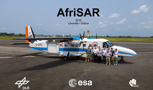
AfriSAR 2016
In order to further support the BIOMASS mission development, especially concerning the mission concept verification and the development of geophysical algorithms, ESA funded the AfriSAR campaign.
Data - Campaigns (Open)
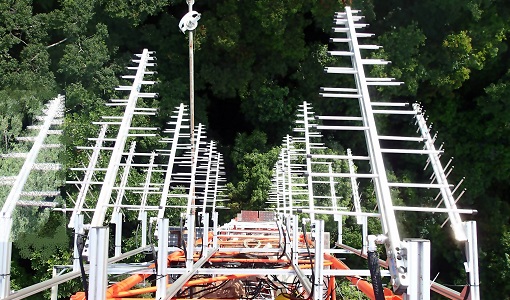
AfriScat
AfriScat campaign, a follow on to TropiSCAT campaign, was to acquire long-term P-Band radar data in an African tropical forest.
Data - Campaigns (Open)
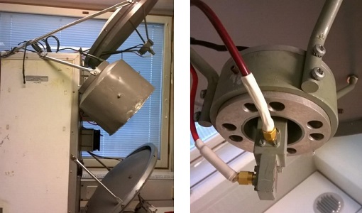
AirScatterGNSS
In this project an Airborne Wind Vector Scatterometer (AWVS) system was designed and built for measurements of sea surface backscattering from an aircraft.
Data - Fast Registration with approval (Restrained)
ALOS PALSAR International Polar Year Antarctica
International Polar Year (IPY), focusing on the north and south polar regions, aimed to investigate the impact of how changes to the ice sheets affect ocean and climate change to the habitats in these regions. IPY was a collaborative project involving over sixty countries for two years from March 2007 to March 2009. To meet the project goal, world space agencies observed these regions intensively using their own Earth observation satellites. One of these satellites, ALOS - with the PALSAR (Phased Array type L-band Synthetic Aperture Radar) sensor - observed these regions independently from day-night conditions or weather conditions. Carrying on this initiative, ESA is providing the ALOS PALSAR IPY Antarctica dataset, which consists of full resolution ALOS PALSAR ScanSAR WB1 products (100 m spatial resolution) over Antarctica from July 2008 (cycle 21) to December 2008 (Cycle 24) and from May 2009 (cycle 27) to March 2010 (cycle 31). Missing products between the two periods above is due to L0 data over Antarctica not being available in ADEN archives and not processed to L1. Spatial coverage: Check the spatial coverage of the collection on a map available on the Third Party Missions Dissemination Service.
Data - Fast Registration with approval (Restrained)
ALOS PALSAR products
The dataset contains all ESA acquisitions over the ADEN zone (Europe, Africa and the Middle East) plus some products received from JAXA over areas of interest around the world. Further information on ADEN zones can be found in this technical note. ALOS PALSAR products are available in following modes: Fine Beam Single polarisation (FBS), single polarisation (HH or VV), swath 40-70 km, resolution 10 m, temporal coverage from 02/05/2006 to 30/03/2011 Fine Beam Double polarisation (FBD), double polarisation (HH/HV or VV/VH), swath 40-70 km, resolution 10 m, temporal coverage from 02/05/2006 to 30/03/2011 Polarimetry mode (PLR), with four polarisations simultaneously: swath 30 km, resolution 30 m, temporal coverage from 26/08/2006 to 14/04/2011 ScanSAR Burst mode 1 (WB1), single polarisation: swath 250-350 km, resolution 100 m, temporal coverage from 12/06/2006 to 21/04/2011. Following processing levels are available: RAW (Level 1.0): Raw data generated by every downlink segment and every band. Divided into an equivalent size to one scene SLC (Level 1.1): Slant range single look complex product. Not available for WB1 GDH (Level 1.5): Ground range Detected, Normal resolution product GEC (Level 1.5): Geocoded product. The table summarises the ALOS PALSAR offer. Instrument mode Product type Processing level description JAXA processing level equivalent Fine Beam Single polarisation (HH or VV) FBS_RAW_0P Raw data generated by every downlink segment and every band. Divided into an equivalent size to one scene 1.0 FBS_GDH_1P Ground range Detected, Normal resolution product 1.5 FBS_GEC_1P Geocoded product 1.5 FBS_SLC_1P Slant range single look complex product 1.1 Fine Beam Double polarisation (HH/HV or VV/VH) FBD_RAW_0P Raw data generated by every downlink segment and every band. Divided into an equivalent size to one scene 1.0 FBD_GDH_1P Ground range Detected, Normal resolution product 1.5 FBD_GEC_1P Geocoded product 1.5 FBD_SLC_1P Slant range single look complex product 1.1 Polarimetry mode (4 polarisation) PLR_RAW_0P Raw data generated by every downlink segment and every band. Divided into an equivalent size to one scene 1.0 PLR_GDH_1P Ground range Detected, Normal resolution product 1.5 PLR_GEC_1P Geocoded product 1.5 PLR_SLC_1P Slant range single look complex product 1.1 ScanSAR Burst mode 1 (single polarisation) WB1_RAW_0P Raw data generated by every downlink segment and every band. Divided into an equivalent size to one scene 1.0 WB1_GDH_1P Ground range Detected, Normal resolution product 1.5 WB1_GEC_1P Geocoded product 1.5
Data - Announcement of Opportunity (Restrained)
Announcement of Opportunity for Aeolus Cal/Val
An Announcement of Opportunity call is open for the Aeolus mission. Scientists, new groups and individuals are invited to participate in Aeolus Cal/Val throughout the mission lifetime.
Data - Announcement of Opportunity (Restrained)
Announcement of Opportunity for G-POD
ESA is offering all scientists the possibility to perform bulk processing and/or validation of their own algorithms exploiting the large ESA Earth-observation archive.
Data - Announcement of Opportunity (Restrained)
Announcement of Opportunity for NovaSAR-1
ESA is launching an Announcement of Opportunity for the international scientific community to access data from the NovaSAR-1 mission for science and EO-based applications development.
Data - Announcement of Opportunity (Restrained)
Announcement of Opportunity for S3VT (Sentinel-3 Validation Team)
In the framework of a Copernicus collaborative agreement ESA and EUMETSAT invite interested groups and individuals to support the Sentinel-3 Validation Team (S3VT).
Data - Campaigns (Open)
AROMAT-I
The main objective of this AROMAT-I campaign was to test newly developed airborne sensors and to evaluate their capabilities as validation tools for future air quality space borne sensors, in particular TROPOMI.
Data - Campaigns (Open)
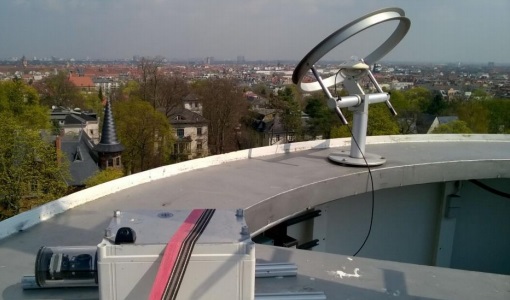
AROMAT-II
This campaign covers the fields of atmospheric composition: NO2, SO2, aerosols, over Romania (Bucharest and Turceni) and Germany (Berlin).
Data - EO Sign In Authentication (Open)
Atmospheric Thematic Data Product [MWR_TDPATM]
This is the Atmospheric Thematic Data Product (TDP) V1 resulting from the ESA FDR4ALT project and containing Total Column Water Vapour (TCWV), Cloud Liquid Water Path (LWP), Atmospheric Attenuation of the altimeter backscattering coefficient at Ku-band (AttKu), and Wet Tropospheric Correction (WTC), retrieved from observations of the Microwave Radiometer (MWR) instruments flown on-board the ERS-1, and ERS-2, and Envisat satellites. Compared to existing datasets, the Atmospheric TDP demonstrates notable improvements in several aspects: Improved temporal coverage, especially for ERS-2 Improved L0 -> 1 processing Two different corrections are provided based on a neural network retrieval or on a 1D-VAR approach The FDR4ALT products are available in NetCDF format. Free standard tools for reading NetCDF data can be used. Information for expert altimetry users is also available in a dedicated NetCDF group within the products. Please consult the FDR4ALT Product User Guide before using the data. The FDR4ALT datasets represent the new reference data for the ERS/Envisat altimetry missions, superseding any previous mission data. Users are strongly encouraged to make use of these datasets for optimal results.
Data - Campaigns (Open)
BACCHUS-DOC
The BACCHUS-DOC Radar and Optical Campaign was an area mapping project of vineyards near Frascati (Italy). ESA required high resolution geo-referenced airborne SAR data of different wavelength and polarisation (preferably polarimetric).
Data - Campaigns (Open)
BioSAR 2007
The BioSAR campaign aimed to support geophysical algorithm development, calibration/validation and the simulation of future spaceborne Earth Observation missions.
Data - Campaigns (Open)
BioSAR 2008
The main objective of BioSAR-2 (BioSAR 2008) campaign was to record SAR data over boreal forests with topographic effects to investigate the effect on biomass retrieval.
