- All Categories (26)
- Data (3)
- News (17)
- Missions (3)
- Tools (1)
- Activities (2)
News - Data Release news
Two new ESA archive collections have been opened for PlanetScope and SkySat
PlanetScope ESA archive and SkySat ESA archive collections are available through ESA’s Third Party Missions programme via Fast Approval Registration.
Activity - Quality
SLAP
The SLAP (Systematic Landsat Archive Processing) project covers the MSS, TM and ETM+ products from Landsat missions 1 – 7, and is the first systematic reprocessing of the ESA Landsat archive.
News - Thematic area articles
Satellite data boost global understanding of land surface
Understanding our changing land surface is essential in the study of climate change. Satellites are used to monitor changes to the material that covers Earth’s surface, so-called land cover, such as vegetation and water.
News - Thematic area articles
Remote sensing data underpin research on soil
Environmental data disseminated by ESA’s Earth observation programmes provide knowledge about the stresses on Earth’s soils – aiding many applications such as crop management, drought and flood forecasting, and ecosystem protection.
News - Thematic area articles
Remote sensing data map impacts of natural hazards
As climate change increases the frequency and severity of natural disasters, remote sensing data can warn about extreme events and help tackle emergency situations.
News - Success Stories
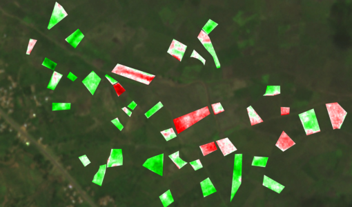
Predicting crop yield using Planet data
The world’s population continues to grow, while the climate crisis is raising Earth’s temperatures and increasing the likelihood of extreme weather events – all of which affect food security.
Data - Sample Data (Open)
PlanetScope Sample Data
Download free PlanetScope sample datasets to preview products available for this mission.
Data - Project Proposal (Restrained)
PlanetScope Full Archive
The PlanetScope Level 1B Basic Scene and Level 3B Ortho Scene full archive products are available as part of Planet imagery offer. The Unrectified Asset: PlanetScope Basic Analytic Radiance (TOAR) product is a Scaled Top of Atmosphere Radiance (at sensor) and sensor corrected product, without correction for any geometric distortions inherent in the imaging processes and is not mapped to a cartographic projection. The imagery data is accompanied by Rational Polynomial Coefficients (RPCs) to enable orthorectification by the user. This kind of product is designed for users with advanced image processing and geometric correction capabilities. Basic Scene Product Components and Format Product Components Image File (GeoTIFF format) Metadata File (XML format) Rational Polynomial Coefficients (XML format) Thumbnail File (GeoTIFF format) Unusable Data Mask UDM File (GeoTIFF format) Usable Data Mask UDM2 File (GeoTIFF format) Bands 4-band multispectral image (blue, green, red, near-infrared) or 8-band (coastal-blue, blue, green I, green, yellow, red, Rededge, near-infrared) Ground Sampling Distance Approximate, satellite altitude dependent Dove-C: 3.0 m-4.1 m Dove-R: 3.0 m-4.1 m SuperDove: 3.7 m-4.2 m Accuracy <10 m RMSE The Rectified assets: The PlanetScope Ortho Scene product is radiometrically-, sensor- and geometrically- corrected and is projected to a UTM/WGS84 cartographic map projection. The geometric correction uses fine Digital Elevation Models (DEMs) with a post spacing of between 30 and 90 metres. Ortho Scene Product Components and Format Product Components Image File (GeoTIFF format) Metadata File (XML format) Thumbnail File (GeoTIFF format) Unusable Data Mask UDM File (GeoTIFF format) Usable Data Mask UDM2 File (GeoTIFF format) Bands 3-band natural colour (red, green, blue) or 4-band multispectral image (blue, green, red, near-infrared) or 8-band (coastal-blue, blue, green I, green, yellow, red, RedEdge, near-infrared) Ground Sampling Distance Approximate, satellite altitude dependent Dove-C: 3.0 m-4.1 m Dove-R: 3.0 m-4.1 m SuperDove: 3.7 m-4.2 m Projection UTM WGS84 Accuracy <10 m RMSE PlanetScope Ortho Scene product is available in the following: PlanetScope Visual Ortho Scene product is orthorectified and colour-corrected (using a colour curve) 3-band RGB Imagery. This correction attempts to optimise colours as seen by the human eye providing images as they would look if viewed from the perspective of the satellite. PlanetScope Surface Reflectance product is orthorectified, 4-band BGRN or 8-band Coastal Blue, Blue, Green I, Green, Yellow, Red, RedEdge, NIR Imagery with geometric, radiometric and corrected for surface reflection. This data is optimal for value-added image processing such as land cover classifications. PlanetScope Analytic Ortho Scene Surface Reflectance product is orthorectified, 4-band BGRN or 8-band Coastal Blue, Blue, Green I, Green, Yellow, Red, RedEdge, NIR Imagery with geometric, radiometric and calibrated to top of atmosphere radiance. As per ESA policy, very high-resolution imagery of conflict areas cannot be provided.
News - Data Release news
PlanetScope and Skysat data available through ESA’s Third Party Missions Programme
Through ESA’s Third Party Missions Programme, researchers, scientists and companies from around the world can apply to access Planet’s high-frequency, high-resolution satellite data for non-commercial use.
News - Infographics
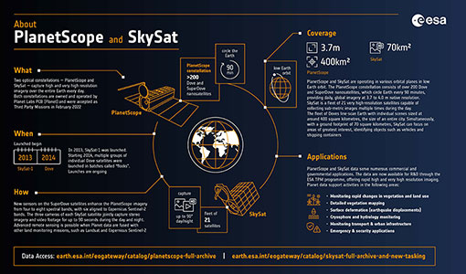
PlanetScope and SkySat - The high-resolution nanosatellite constellation
Find out more about the PlanetScope and SkySat missions in our new infographic.
Mission - Third Party Missions
PlanetScope
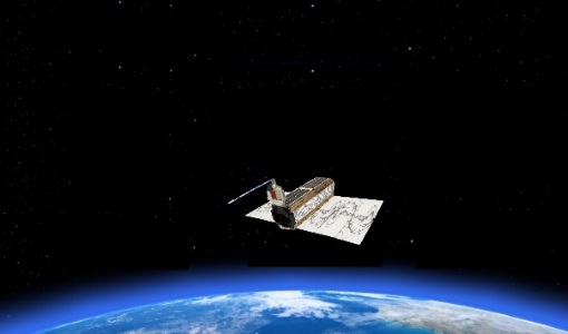
The PlanetScope satellite constellation consists of multiple launches of groups of individual cubesats (Doves and SuperDoves).
News - Data Release news
New reprocessed Landsat data on a new dissemination server
The full ESA Landsat archive has been reprocessed with the latest version of the processor to provide a homogenous dataset covering MSS, TM and ETM+ data.
News - Success Stories
New life for Landsat historical data
45 years of data, more than 1.8 million images, these are the numbers of an adventure started 48 years ago with the launch of the first Landsat satellite.
News - Data Release news
New Data Voucher for Planetscope on-demand
ESA’s Third Party Missions Programme offers researchers, scientists and companies from around the world access to Planet’s high-frequency, high-resolution satellite data for non-commercial use.
Mission - Heritage Missions
Landsat-4 and Landsat-5
The Landsat-4 and Landsat-5 missions continued the Landsat programme's goal of providing moderate-resolution optical remote sensing for land, coastal areas and shallow waters.
Mission - Heritage Missions
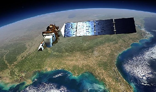
Landsat Series
The Landsat Series is the world's longest running system of satellites for moderate-resolution optical remote sensing for land, coastal areas and shallow waters.
Data - Data Description
Landsat MSS ESA Archive
This dataset contains all the Landsat 1 to Landsat 5 Multi Spectral Scanner (MSS) high-quality ortho-rectified Level 1 GEO and GTC dataset acquired by ESA over the Fucino, Kiruna (active from April to September only) and Maspalomas (on campaign basis) visibility masks. The acquired Landsat MSS scene covers approximately 183 x 172.8 km. A standard full scene is nominally centred on the intersection between a path and row (the actual image centre can vary by up to 200 m). The altitude changed from 917 km to 705 km and therefore two World Reference Systems (WRS) were used. A full image is composed of 3460 pixels x 2880 lines with a pixel size of 60 m. Two different product levels are available: Geometrically and terrain corrected GTC Products (L1T): The most accurate level of processing as they incorporate Ground Control Points (GCPs) and a Digital Elevation Model (DEM) to provide systematic geometric and topographic accuracy; with geodetic accuracy dependent on the number, spatial distribution and accuracy of the GCPs over the scene extent, and the resolution of the DEM used. Geometrically corrected GEO Product (L1G): Normally generated where there is a lack of GCPs, and are derived purely from data collected by the sensor and spacecraft e.g. ephemeris data. Matera density and coverage map Kiruna density and coverage map Maspalomas density and coverage map
News - Thematic area articles
How to use space data to probe humankind’s ancient past
Data disseminated by ESA’s Third Party Missions (TPM) programme are enabling archaeological investigations that could help to unravel the mysteries of past societies and cultures.
News - Thematic area articles
How satellite data help to shape society
Data from ESA’s Earth observation archives are improving understanding of the interactions between human activities and the environment, helping to power green economic development and boosting prosperity in Europe and beyond.
News - General News
Go-to guide to Third Party Mission data offering
ESA’s latest Third Party Missions Data Access Guide has been published, providing technical details and information on available data collections for all current or past Third Party Missions.
