- Learn & Discover
- Satellite data boosts global u...
Satellite data boost global understanding of land surface
02 Feb 2022
Understanding our changing land surface is essential in the study of climate change. Satellites are used to monitor changes to the material that covers Earth’s surface, so-called land cover, such as vegetation and water. Those satellites scanning Earth’s surface, reveal large scale and accurate information that is impossible to obtain from in-situ ground-level observations. This article showcasing land surface monitoring is the first instalment of a new series of Earth Online articles on Thematic Areas.
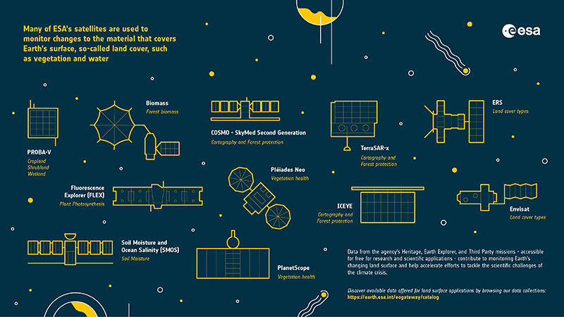
The European Space Agency (ESA) has several such land-monitoring satellites utilising both optical and radar instruments. The data acquired by these missions are used to map the changing earth surface in varying land types, from wetlands to grasslands.
What are the different types of land?
Earth’s surface is divided into four main types of land biomes:
- Desert
- Forest
- Grassland
- Tundra
They can be distinguished by the flora and fauna that inhabit them and there are many sub-types for different regions. Satellites measure these biomes and provide long-term data about how the land is changing.
The data give insight into land use, vegetation cover and its changes, as well as helping to locate hotspots prone to environmental challenges. Land monitoring using satellite data maps our changing environment to help us plan mitigation responses to negative consequences such as desertification.
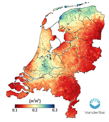
ESA’s Earth Explorer missions play an essential part in land monitoring. The Soil Moisture and Ocean Salinity (SMOS) mission makes global observations of soil moisture over land using a radiometer instrument. Estimating soil moisture is important for modelling plant growth and also for flood forecasting.
Future Earth Explorer’s are expected to further this key role, with Biomass aiming to chart the biomass of Earth’s forests and investigate how it changes over time. The FLourescence EXplorer (FLEX) mission was chosen to make global observations of photosynthesis through measurements of chlorophyll-fluorescence, thus providing key information on the terrestrial vegetation layer and plant health. Datasets from these missions will help climate change scientists better understand the role vegetation plays in Earth’s carbon and water cycles.
Several of ESA’s Third Party Missions also provide optical and radar datasets for land-surface monitoring. For example, COSMO-SkyMed Second Generation, TerraSAR-X and ICEYE provide synthetic aperture radar (SAR) services supporting a range of applications such as land management, cartography and forest protection.
Similarly for optical missions, the Red-Edge band, as provided by WorldView-2 and -3, PlanetScope and Pléiades Neo, is sensitive to changes in chlorophyll content and assists in monitoring vegetation health, as well as measuring protein and nitrogen content in biomass.
Serving as a bridge to Copernicus Sentinel-3, the long-established Vegetation (VGT) instrument flown on the French SPOT (Satellite Pour l’Observation de la Terre) satellites, also mapped land cover and vegetation growth. This data set was extended further with PROBA-V when the satellite’s VGT could distinguish between different land cover types and plant species, using an imager which collected light in the blue, red near-infrared and mid-infrared wavebands.
Data from PROBA-V provided a continuous daily picture of the state of vegetation across our planet and are still used to assess the sustainability of forest operations and monitor illegal logging.
Understanding changes in land cover over a longer period of time is possible with the heritage datasets from the non-operational EO missions managed and kept accessible today by ESA’s Heritage Space Programme. Missions such as the first European Remote Sensing (ERS) satellite, launched over 30 years ago, pioneered datasets on Earth’s surface using microwave, infrared and visible spectrum-based environmental monitoring and a comprehensive payload with several instruments including SAR and radar altimeter.
Historically ERS datasets were called upon to monitor environmental and natural disasters such as flooding and earthquakes. However, to this day the ERS data acquired for some 20 years still provide invaluable land monitoring information and are continuously improved to build long time data series with newer missions.
Continuity of the observations started with the ERS satellites was ensured with its successor, Envisat. Envisat’s Advanced Along-Track Scanning Radiometer facilitated products for the study of vegetation and long-term LST measurements. LST trends are being studied in relation to the effects of global warming and have commercial potential to evaluate water requirements in agricultural crop development.
What is land surface temperature?
The land surface temperature is the temperature of Earth’s land heated by solar radiation. Satellites measure this by detecting the amount of solar energy reflected back from the surface into space.
Envisat is one of ESA’s pioneering satellites for land surface monitoring
Land surface data from ESA’s missions are useful in a variety of sectors to understand how we use our land and how vegetation cover is changing. The full list of data products for this thematic area are available on Earth Online: Land Surface Data