- Data
- Landsat MSS ESA Archive
Landsat MSS ESA Archive
Navigate To
How to Access Data
EO Sign In Authentication (Open)
- Go to the Dissemination Service
- Find the product you want via a map
- Register or log in to EO Sign In
- Download.
Search the products in this collection on the Landsat Online Dissemination Service, which offers an interactive map for identifying available products and previews of the products.
Landsat products can also be discovered through ESA's EO Catalogue (EO CAT), which allows users to browse and download products among the available datasets from ESA and Third Party Missions and instruments, using various criteria (spatial, temporal).
New users can register an account on EO Sign In. For further information about the EO Sign In Service you can visit TellUs.
ESA internal users can use their ESAAD account.
Should you need support to access the data, please contact EOHelp.
Available to Residents of the Following Countries
Collection Description
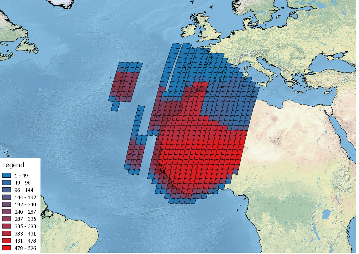
This dataset contains all the Landsat 1 to Landsat 5 Multi Spectral Scanner (MSS) high-quality ortho-rectified Level 1 GEO and GTC dataset acquired by ESA over the Fucino, Kiruna (active from April to September only) and Maspalomas (on campaign basis) visibility masks.
The acquired Landsat MSS scene covers approximately 183 x 172.8 km. A standard full scene is nominally centred on the intersection between a path and row (the actual image centre can vary by up to 200 m). The altitude changed from 917 km to 705 km and therefore two World Reference Systems (WRS) were used. A full image is composed of 3460 pixels x 2880 lines with a pixel size of 60 m.
Two different product levels are available:
- Geometrically and terrain corrected GTC Products (L1T): The most accurate level of processing as they incorporate Ground Control Points (GCPs) and a Digital Elevation Model (DEM) to provide systematic geometric and topographic accuracy; with geodetic accuracy dependent on the number, spatial distribution and accuracy of the GCPs over the scene extent, and the resolution of the DEM used.
- Geometrically corrected GEO Product (L1G): Normally generated where there is a lack of GCPs, and are derived purely from data collected by the sensor and spacecraft e.g. ephemeris data.
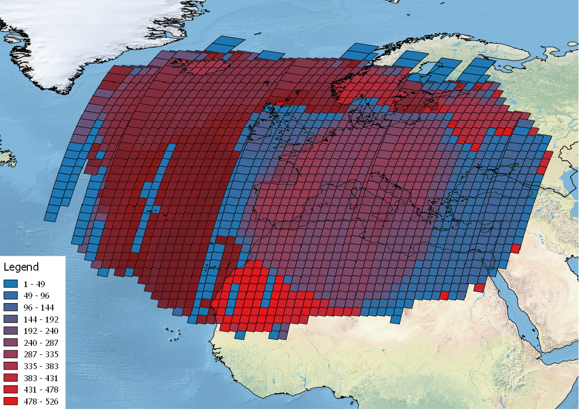
Matera density and coverage map

Technical Details
DATA SET SPECIFICATIONS
- European Space Agency, 2020, Landsat MSS ESA Archive, Version SLAP_03.08https://doi.org/10.57780/esa-c9d5673
PROCESSING LEVEL
APPLICABLE TERMS & CONDITIONS
DATA CITATION
Having Problems Accessing Data?
Resources
Discover Latest Data
Announcement of Opportunity for Spire data
ESA is launching an Announcement of Opportunity for the international scientific community to access data from the Spire mission for science...
ERS ATSR L1B Brightness Temperature/Radiance [ER1_AT_1_RBT / ER2_AT_1_RBT]
Band measurements with associated uncertainty estimates. The ERS-1/2 ATSR Level 1B Brightness Temperature/Radiance products (RBT) contain to...
TomoSense
The TomoSense experiment was conceived to provide the scientific community with unprecedented data to study the features of radar scattering...
WIVERNex-UK
This campaign was designed to extend the Chilbolton ground measurement record that involved analysis of radar observations made by the 94 GH...