- All Categories (23)
- Data (5)
- News (11)
- Missions (4)
- Events (1)
- Activities (2)
Data - Sample Data (Open)
GEOSAT-1 sample data
Download free GEOSAT-1 sample datasets to preview products available for this mission.
Data - Sample Data (Open)
GEOSAT-2 Sample Data
Download free GEOSAT-2 sample datasets to preview products available for this mission.
News - Data Release news
GEOSAT-2 Spain Coverage 2022 collection open to users
ESA’s Earthnet Third Party Missions Programme presents the latest addition to its collection: the GEOSAT-2 Spain Coverage 2022.
News - General News
GEOSAT collaborates with ESA to boost understanding of the planet
Researchers around the world are exploring innovative scientific applications of high quality satellite data from commercial provider GEOSAT, thanks to a successful collaboration between the firm and ESA’s Third Party Missions (TPM) programme.
News - Data Release news
GEOSAT-2 Spain coverage new collection open for users
In the framework of ESA’s Earthnet Third Party Missions programme, we are glad to announce that there is a new collection open for users: the GEOSAT-2 Spain Coverage collection.
Data - Fast Registration with approval (Restrained)
GEOSAT-2 Spain Coverage
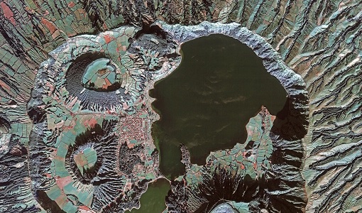
The GEOSAT-2 Spain Coverage collection consists of two separate coverages of Spain, including the Balearic and Canary islands, acquired by GEOSAT-2 between March and November of 2021 and 2022, respectively. The available imagery have a geolocation accuracy of < 4 m RMSE, a cloud cover percentage of < 10 %, and were acquired at an off-nadir angle from -30° to 30°. Spatial coverage of the 2021 collection. The following product types are available: Pan-sharpened: A four-band image, resulting from adding the information of each multispectral band to the panchromatic band. The fusion does not preserves all spectral features of the multispectral bands, so it should not be used for radiometric purposes. Resolution 1 m; Bands: All. Bundle: Panchromatic (1 m resolution) + Multispectral bands (4 m resolution): five-band image containing the panchromatic and multispectral products packaged together, with band co-registration. The available processing level is L1C orthorectified: a calibrated and radiometrically corrected product, manually orthorectified and resampled to a map grid. Property Spatial Resolution Pan-sharpened 1.0 m Bundle (PAN + MS) 1.0 m (PAN), 4.0 m (MS)
News - Thematic area articles
Cloud-free collections key for land monitoring
Satellite imagery is a crucially important tool for monitoring the land, but cloud cover can often block parts of Earth’s surface from view, limiting subsequent analyses.
News - Data Release news
New data available: GEOSAT-2 Portugal Coverage 2021
A new collection is available to the public through ESA’s Earthnet Third Party Missions Programme: the GEOSAT-2 Portugal Coverage 2021.
Data - Project Proposal (Restrained)
GEOSAT-2 Portugal Coverage 2021
GEOSAT-2 Portugal coverage is a collection of 2021 data over the Portugal area, including islands. The available dataset has a cloud cover less than 10%, and is acquired up to 1m resolution with Geometric accuracy <6m CE90 based on Copernicus DEM @10m. GEOSAT-2 Portugal 2021 - Spatial Coverage of the Dataset The following product types are available: Pan-sharpened (4 bands, 321 Natural Colours or 432 False Colours): A four-band image, resulting from adding the information of each multispectral band to the panchromatic band. The fusion does not preserves all spectral features of the multispectral bands, so it should not be used for radiometric purposes. Resolution 1m; Bands: All, R-G-B or Ni-R-G Bundle: Panchromatic (1m resolution) + Multispectral bands (4m resolution): five-band image containing the panchromatic and multispectral products packaged together, with band co-registration. The available processing level is L1C orthorectified: a calibrated and radiometrically corrected product, manually orthorectified and resampled to a map grid. Product Type Processing Level and Spatial Resolution L1B (native) L1C (ortho) Pan-sharpened 1.0m 1.0m Bundle (PAN+MS) 1.0m (P), 4.0m (MS) 1.0m (P), 4.0m(MS)
News - Data Release news

Full European Landsat data collection now available under the same catalogue
The Full European Landsat data collection, from Landsat-1 to Landsat-8, is now available under the same catalogue
News - Success Stories

How GEOSAT helps to unlock the potential of Earth observation data
High-resolution imagery delivered by a privately-owned system of European satellites is facilitating international efforts to boost prosperity, protect the environment, and tackle urgent global challenges.
News - Infographics

An overview of the GEOSAT-2 high-resolution mission
The GEOSAT series consists of two very high-resolution satellites, capable of acquiring sub-metric multispectral images. The missions are part of ESA's Third Party Missions programme, and GEOSAT-2 is summarised in our latest infographic.
News - Infographics

An overview of ESA's Third Party Missions programme
ESA’s Third Party Missions programme consists of almost 50 satellite missions, which are owned by organisations around the world. ESA has agreements with these organisations to acquire, process, and distribute data from their missions
News - Data Release news

New reprocessed Landsat data on a new dissemination server
The full ESA Landsat archive has been reprocessed with the latest version of the processor to provide a homogenous dataset covering MSS, TM and ETM+ data.
Data - Data Description
Landsat MSS ESA Archive
This dataset contains all the Landsat 1 to Landsat 5 Multi Spectral Scanner (MSS) high-quality ortho-rectified Level 1 GEO and GTC dataset acquired by ESA over the Fucino, Kiruna (active from April to September only) and Maspalomas (on campaign basis) visibility masks. The acquired Landsat MSS scene covers approximately 183 x 172.8 km. A standard full scene is nominally centred on the intersection between a path and row (the actual image centre can vary by up to 200 m). The altitude changed from 917 km to 705 km and therefore two World Reference Systems (WRS) were used. A full image is composed of 3460 pixels x 2880 lines with a pixel size of 60 m. Two different product levels are available: Geometrically and terrain corrected GTC Products (L1T): The most accurate level of processing as they incorporate Ground Control Points (GCPs) and a Digital Elevation Model (DEM) to provide systematic geometric and topographic accuracy; with geodetic accuracy dependent on the number, spatial distribution and accuracy of the GCPs over the scene extent, and the resolution of the DEM used. Geometrically corrected GEO Product (L1G): Normally generated where there is a lack of GCPs, and are derived purely from data collected by the sensor and spacecraft e.g. ephemeris data. Matera density and coverage map Kiruna density and coverage map Maspalomas density and coverage map
News - Success Stories
New life for Landsat historical data
45 years of data, more than 1.8 million images, these are the numbers of an adventure started 48 years ago with the launch of the first Landsat satellite.
Mission - Heritage Missions

Landsat Series
The Landsat Series is the world's longest running system of satellites for moderate-resolution optical remote sensing for land, coastal areas and shallow waters.
Mission - Heritage Missions

Landsat-1 to Landsat-3
The Landsat-1 to 3 satellites were the first in the United States' Landsat programme, dedicated to monitoring the Earth's land mass.
Mission - Heritage Missions
GEOSAT
The GEOSAT series consists of GEOSAT-1 and GEOSAT-2 missions. They are Earth imaging satellites. GEOSAT-2, a high resolution satellite, became the first European fully-private satellite capable of providing sub-metric multi-spectral imagery.
Activity - Quality

EDAP
The ESA Earthnet Data Assessment Pilot (EDAP) project will perform assessments for various missions to ensure the delivered data is fit for purpose.