- All Categories (35)
- Data (7)
- News (15)
- Missions (2)
- Events (9)
- Tools (1)
- Documents (1)
Mission - Heritage Missions
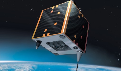
GEOSAT-1
GEOSAT-1 is part of a group of satellites collectively known as the Disaster Monitoring Constellation (DMC).
Event - Conference

Living Planet Symposium 2019
ESA's Living Planet Symposia are amongst the biggest Earth observation conferences in the world. Scientists present their latest findings on Earth's environment and climate.
Event - Meeting

VH-RODA and CEOS SAR workshop
The workshop provided an open forum for the presentation and discussion of current status and future developments related to the calibration and validation of space borne very high-resolution SAR and optical sensors and data products.
Mission - Earth Watch

PROBA-V
The PROBA-V mission provides multispectral images to study the evolution of the vegetation cover on a daily and global basis.
Data - External Data (Restrained)
PROBA-V 1 km, 333 m, and 100 m products
The PROBA-V VEGETATION Raw products and Synthesis products provided coverage of all significant landmasses worldwide with, in the case of a 10-day synthesis product, a minimum effect of cloud cover, resulting from selection of cloud-free acquisitions during the 10-day period. It provided a daily coverage between Latitudes 35°N and 75°N, and between 35°S and 56°S, and a full coverage every two days at the equator. The VEGETATION instrument was pre-programmed with an indefinite repeated sequence of acquisitions. This nominal acquisition scenario allowed a continuous series of identical products to be generated, with the goal to map land cover and vegetation growth across the entire planet every two days. Level Synthesis Resolution resolution (m) Reflectance Level-1C n/a TOA Level-2A n/a 100 m TOA 333 m TOA 1 km TOA Level-3 S1 100 m TOA TOC TOC NDVI 333 m TOA TOC 1 km TOA TOC S5 100 m TOA TOC TOC NDVI S10 333 m TOC TOC NDVI 1 km TOC TOC NDVI Raw Products Overview Product Description Level-1C Level-1C segments (P – product): Radiometrically corrected Level-1B data, in raw sensor geometry (unprojected) Contains: - Top Of Atmosphere reflectance in the four spectral bands - Longitude/latitude information for every pixel - Geometric viewing conditions - Information on the status map (indicating missing and interpolated measurements). Format: HDF5 & GeoTiFF Level-2A Level-2A segment: projected Level-1C (P–product) data, radiometrically and geometrically corrected. Contains: - TOA reflectance values in the four spectral bands without atmospheric correction being performed - Information on the status map (containing identification of radiometric quality, snow, ice, shadow, clouds, land/sea for every pixel) - Geometric viewing conditions Plate carrée projection (EPSG:4326) with spatial resolution of 100 m, 333 m and 1 km Format: HDF5 & GeoTiFF Synthesis Products Overview Level-3 S1 = daily, S5 = 5 days, S10 = decade Different spatial resolution: 100 m, 333 m and 1 km Divided into so called granules, each measuring 10 degrees x 10 degrees, each granule being delivered as a single file Plate carrée projection (EPSG:4326) Format: HDF5 & GeoTiFF Products Content TOA - Top Of Atmosphere reflectance in the four spectral bands (no atmospheric correction applied) - Normalized Difference Vegetation Index (NDVI) -Information on the composite status map (containing identification of snow, ice, shadow, clouds, land/sea for every pixel) - Geometric viewing conditions & date and time of selected measurement TOC Level-2A segment: projected Level-1C (P–product) data, radiometrically and geometrically corrected. Contains: - Top Of Canopy (ground surface) reflectance in the four spectral bands, the atmospheric correction being performed using the SMAC (Simplified Method for Atmospheric Corrections) algorithm - Normalized Difference Vegetation Index (NDVI) - Information on the composite status map (containing identification of snow, ice, shadow, clouds, land/sea for every pixel) Normalized Difference Vegetation Index (NDVI) from Top Of Canopy product (SMAC algorithm for atmospheric corrections applied) - Geometric viewing conditions & date and time of selected measurement TOC NDVI Normalized Difference Vegetation Index (NDVI) from Top Of Canopy product (SMAC algorithm for atmospheric corrections applied)
Data - Data Description
TropForest - ALOS, GEOSAT-1 & KOMPSAT-2 optical coverages over tropical forests
The objective of the ESA TropForest project was to create a harmonised geo-database of ready-to-use satellite imagery to support 2010 global forest assessment performed by the Joint Research Centre (JRC) of the European Commission and by the Food and Agriculture Organization (FAO). Assessments for year 2010 were essential for building realistic deforestation benchmark rates at global to regional levels. To reach this objective, the project aimed to create a harmonised ortho-rectified/pre-processed imagery geo-database based on satellite data acquisitions (ALOS AVNIR-2, GEOSAT-1 SLIM6, KOMPSAT-2 MSC) performed during year 2009 and 2010, for the Tropical Latin America (excluding Mexico) and for the Tropical South and Southeast Asia (excluding China), resulting in 1971 sites located at 1° x 1° geographical lat/long intersections. The project finally delivered 1866 sites (94.7% of target) due to cloud coverages too high for missing sites. Spatial coverage: Check the spatial coverage of the collection on a map available on the Third Party Missions Dissemination Service.
News - Infographics
PROBA-V - ESA's vegetation monitoring mission
ESA's vegetation-monitoring mission - Proba-V - will end operations in June 2020 after seven years.
Document - General Reference

PROBA-V-QWG-10-Report-Summary.pdf
This report provides a summary of PROBA-V QWG meeting 10.
Event - Meeting
PROBA-V QWG meeting 10
The 10th PROBA-V Quality Working Group (QWG) meeting took place in Antwerp, Belgium on 23 and 24 October 2019.
Event - Meeting
PROBA-V QWG meeting 9
The 9th Proba-V QWG took place in Brussels on 17th - 18th Apr, 2019.
News - Operational News

New experimental phase for PROBA-V
PROBA-V has begun a new experimental phase that will continue through to October 2021.
Event - Meeting
PROBA-V QWG meeting 12
The main discussion points for the QWG meeting #12 are recalled: 1. Mission Status: the operational phase was discontinued on 30 June 2020 to limit the impact of the orbital drift and the new experimental phase started on 1st July 2020 with focus on acquiring data over Africa and Europe together with ad-hoc acquisition campaigns. Flight and Ground Segment overall performances are excellent with no sign of degradation.
News - Success Stories

1 km resolution aerosol optical thickness retrieved from PROBA-V
The ESA SPAR@MEP project aims to deliver a long-term data record (LTDR) of aerosol optical properties and surface reflectance from SPOT-VGT and PROBA-V observations.
Event - Meeting
PROBA-V QWG meeting 13
The status of the mission was recalled: Experimental Phase is running since July 2020 with the perspective to prepare the ground for the launch and exploitation of PV-CC mission. The latest delay in the schedule of the PV-CC launch (currently Q1/Q2 2022) changed the approach for exploitation, notably owing to the degrading Proba-V illumination conditions at the time of the launch. On the processing side, the main priority is to finalize the verification phase for the C2 and start the full mission reprocessing.
News - Infographics

An overview of ESA's Third Party Missions programme
ESA’s Third Party Missions programme consists of almost 50 satellite missions, which are owned by organisations around the world. ESA has agreements with these organisations to acquire, process, and distribute data from their missions
Data - Project Proposal (Restrained)
GEOSAT-2 full archive and tasking
GEOSAT-2 full archive and new tasking products are available in different bands combinations: Pan-sharpened (4 bands, 321 Natural Colours or 432 False Colours): A four-band image, resulting from adding the information of each multispectral band to the panchromatic band. The fusion does not preserves all spectral features of the multispectral bands, so it should not be used for radiometric purposes. Resolution 1m (L1B), 0.75m (L1C) or 0.40m (L1D); Bands: All, R-G-B or Ni-R-G Panchromatic: Single-band image coming from the panchromatic sensor. Resolution 1m (L1B) or 0.75m (L1C) Multispectral: Four-band image coming for the multispectral sensor, with band co-registration. Resolution 4m (L1B) or 3m (L1C) Bundle: Panchromatic + Multispectral bands: five-band image containing the panchromatic and multispectral products packaged together, with band co-registration. Resolution 1m+4m (L1B), 0.75m+3m (L1C) or 0.40m+1.6m (L1D); And in addition: Stereo Pair: Obtained from two acquisitions of the same target performed from different viewpoints in the same pass by using the agility feature of the platform. It can be provided as a pair of pan-sharpened or panchromatic images. The image products are delivered in GeoTIFF image format by default. JPEG-2000 format is also available on demand. Available processing levels are ortho-ready L1B (not resampled) and ortho L1C (orthorectified and resampled ). In addition, for Pan-sharpened and Bundle, also L1D (enhanced ortho) super-resolution products are available: based on artificial intelligence, this technology increases the original resolution and detail of an image without losing quality with respect to the original product. Product Type Processing Level and Spatial Resolution Spectral Bands L1B (orthoready) L1C (ortho) L1D (Enhanced Ortho) Pan-sharpened 1.0 m 0.75 m 0.4 m All R, G, B NI, R, G Pan 1.0 m 0.75 m Only Pan band MS 4.0 m 3.00 m Only MS band Bundle (PAN+MS) 1.0 m (P), 4.0 m (MS) 0.75 m (P), 3.0 m (MS) 0.4 m (P), 1.6 m (MS) All As per ESA policy, very high-resolution imagery of conflict areas cannot be provided.
Data - Project Proposal (Restrained)
GEOSAT-1 full archive and tasking
GEOSAT-1 full archive and new tasking products are available at 22 m resolution in two processing levels. L1R (Basic Geopositioned): All 3 spectral channels combined into a band-registered image. Geopositioned product based on sensor model. Coefficients derived from satellite orientation parameters coming from telemetry and appended to metadata L1T (L1R orthorectified): Orthorectified to sub-pixel accuracy (10 metres RMS error approximately) with respect to Landsat ETM+ reference data and hole-filled seamless SRTM DEM data V3, 2006 (90 m). GEOSAT-1 products are provided in DIMAP format. The image products are delivered in the TIFF and GeoTIFF image formats by default. All products can be provided in False Colours (R,G,NIR) or Natural Colours (R, G, Synthetic Blue).
News - Thematic area articles

Satellite data boost global understanding of land surface
Understanding our changing land surface is essential in the study of climate change. Satellites are used to monitor changes to the material that covers Earth’s surface, so-called land cover, such as vegetation and water.
News - Infographics

An overview of the GEOSAT-2 high-resolution mission
The GEOSAT series consists of two very high-resolution satellites, capable of acquiring sub-metric multispectral images. The missions are part of ESA's Third Party Missions programme, and GEOSAT-2 is summarised in our latest infographic.