- News
- 1 km resolution aerosol optica...
1 km resolution aerosol optical thickness retrieved from PROBA-V
15 Mar 2021
The ESA SPAR@MEP project aims to deliver a long-term data record (LTDR) of aerosol optical properties and surface reflectance from SPOT-VGT and PROBA-V observations. The project exploits the Mission Exploitation Platform (MEP) developed by VITO, to gather and process the satellite data.
The LTDR is obtained by processing PROBA-V images with the CISAR algorithm, developed by Rayference. Standard aerosol retrieval algorithms make use of a cloud mask to discriminate cloud-free atmosphere and only perform the inversion on these pixels. CISAR, instead, includes the retrieval of clouds, moving towards an algorithm that does not rely on any external cloud mask. One advantage of this innovative approach for aerosol retrieval is the possibility of retrieving high aerosol load, which are often discarded by traditional algorithms due to erroneous classification of these pixels as cloudy.
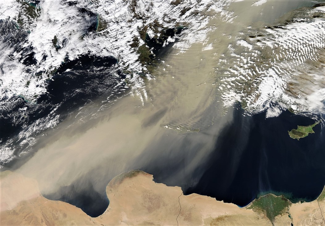
The following image shows an RGB image obtained with MODIS observations on 1 February 2015 over the Mediterranean Sea. The image shows a thick dust plume moving from North Africa towards Greece. However, the PROBA-V cloud mask, reported in the Status Map, classifies the entire plume as cloud. Traditional algorithms, only processing clear-sky pixels, would therefore not be able to perform an aerosol retrieval over these pixels. Nevertheless, thanks to the capability of processing simultaneously cloudy and cloud-free pixels, CISAR is capable of correctly retrieving the high aerosol load, as shown in Figure 2.
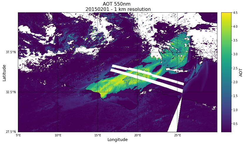
The following image shows Aerosol Optical Thickness (AOT) retrieved by the CISAR algorithm on 1 February 2015 over the Mediterranean Sea. This product was obtained by combining three orbits, the first of which was acquired while passing over the region at 08:30. The large dust plume moving from North Africa to Greece is correctly retrieved by CISAR, despite being classified as cloud by the PROBA-V masking algorithm. Additionally, performing an aerosol retrieval at 1 km provides the opportunity to appreciate aerosol spatial features.
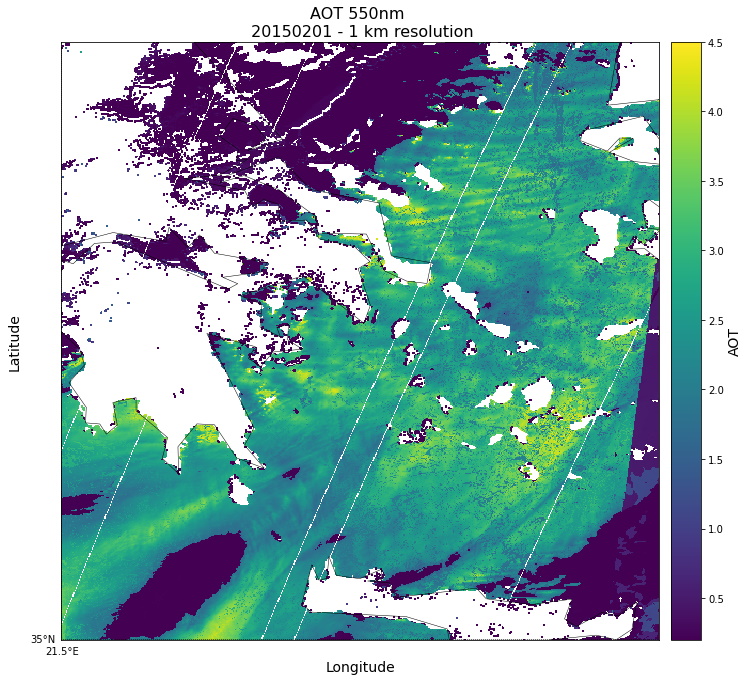
In the following image, focusing on an over the South of Greece and Crete, it is possible to observe orographic waves within the dust plume, which are also visible in the MODIS RGB image, demonstrating the accuracy of the product.
The CISAR algorithm paves the way to a new aerosol retrieval approach, independent from cloud masking algorithms, less affected by cloud-related issues, such as cloud contamination, reduced spatial coverage and high aerosol loads misclassifications.