- All Categories (199)
- Data (10)
- News (30)
- Missions (2)
- Events (14)
- Tools (11)
- Activities (3)
- Campaigns (1)
- Documents (128)
Document - Proceedings

1st MSG RAO Workshop
Proceedings of the workshop organised by ESA and EUMETSAT held in CNR of Bologna, Italy in May 2000.
Event - Training
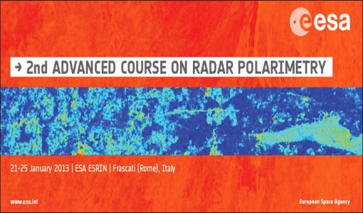
2nd Advanced Course on Radar Polarimetry 2013
The advanced ESA course provided an introduction to the basics and advanced concepts of theory, scattering concepts, systems and applications typical of radar polarimetric remote sensing.
Event - Workshop

2nd CHRIS PROBA Workshop
This 2004 workshop was on the treatment of Compact High Resolution Images Spectrometer (CHRIS) data.
Document - Proceedings
2nd-MSG-RAO-Workshop.pdf
Proceedings of the 2nd MSG RAO Workshop, held on 9-10 September 2004 in Salzburg, Austria
Event - Workshop
3rd CHRIS PROBA Workshop
This 2005 workshop was on the treatment of Compact High Resolution Images Spectrometer (CHRIS) data.
Document - Proceedings
3rd-CHRIS-Proba-Workshop.pdf
Proceedings of the 3rd CHRIS/Proba Workshop, held from 21-23 March 2005 at ESA-ESRIN in Frascati, Italy.
Document - Proceedings
3rd-MSG-RAO-Workshop.pdf
Proceedings of the 3rd MSG RAO Workshop held on 5 June 2006 in Helsinki, Finland
Event - Workshop
4th CHRIS PROBA Workshop
Workshop on the treatment of Compact High Resolution Images Spectrometer (CHRIS) data.
Event - Training

5th Advanced Course on Radar Polarimetry 2019
The course was dedicated to training the next generation of EO scientists to exploit dual and fully polarimetric data for science and applications development.
News - Success Stories
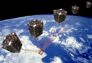
A long way for a little satellite
The PROBA-1 satellite, a technology demonstrator later turned into an Earth observation mission – and just a cubic metre in volume – is reaching 20 years of continuity, making it a huge success.
News - Infographics

A summary of ESA Third Party Mission collections
A new summary is available, showcasing the ESA archives for Third Party Mission collections.
Document - Technical Note

A-comparison-of-superresolution-reconstruction-methods-for-multiangle-CHRIS-Proba-images.pdf
This paper presents the results of three superresolution methods applied to multiangular CHRIS/Proba data: three methods, namely non-uniform interpolation and de-convolution, iterative back-projection, and total variation are examined.
Document - Product Specifications

ADEN-Data-Products-Description-and-Ordering-Recommendations.pdf
This document describes the ALOS ADEN data products and JAXA's recommendations for downloading them.
Document - Proceedings
Advances-in-Atmospheric-Science-and-Applications.pdf
Proceedings in Advances in Atmospheric Science and Applications held in 18-22 June 2012 in Bruges, Belgium.
Data - EO Sign In Authentication (Open)
ALOS African Coverage ESA archive
ALOS Africa is a dataset of the best available (cloud minimal, below 10%) African coverage acquired by AVNIR-2 in OBS mode and PRISM in OB1 mode (all Backward, Nadir and Forward views, in separated products), two different collections one for each instrument. The processing level for both AVNIR-2 and PRISM products is L1B. This dataset is a subset of the main ALOS AVNIR-2 and ALOS PRISM ESA collections. ALOS AVNIR-2: https://doi.org/10.5270/AL1-d9cfa6d ALOS PRISM: https://doi.org/10.5270/AL1-5e400fd.
Data - Fast Registration with approval (Restrained)
ALOS AVNIR-2 L1C
This collection provides access to the ALOS-1 AVNIR-2 (Advanced Visible and Near Infrared Radiometer type 2) L1C data acquired by ESA stations in the ADEN zone plus some worldwide data requested by European scientists. The ADEN zone was the area belonging to the European Data node and covered both the European and African continents, a large part of Greenland and the Middle East. The full mission archive is included in this collection, though with gaps in spatial coverage Time window: from 2006-04-28 to 2011-04-20 Orbits: from 1375 to 27898 Path (corresponds to JAXA track number): from 1 to 670 Row (corresponds to JAXA scene centre frame number): from 370 to 5230. One single Level 1C product type is offered for the OBS instrument mode: AV2_OBS_1C. The Level 1C product is a multispectral image (three bands in VIS and one in NIR) in GEOTIFF format with 10 m resolution.
Data - Fast Registration with approval (Restrained)
ALOS PALSAR International Polar Year Antarctica
International Polar Year (IPY), focusing on the north and south polar regions, aimed to investigate the impact of how changes to the ice sheets affect ocean and climate change to the habitats in these regions. IPY was a collaborative project involving over sixty countries for two years from March 2007 to March 2009. To meet the project goal, world space agencies observed these regions intensively using their own Earth observation satellites. One of these satellites, ALOS - with the PALSAR (Phased Array type L-band Synthetic Aperture Radar) sensor - observed these regions independently from day-night conditions or weather conditions. Carrying on this initiative, ESA is providing the ALOS PALSAR IPY Antarctica dataset, which consists of full resolution ALOS PALSAR ScanSAR WB1 products (100 m spatial resolution) over Antarctica from July 2008 (cycle 21) to December 2008 (Cycle 24) and from May 2009 (cycle 27) to March 2010 (cycle 31). Missing products between the two periods above is due to L0 data over Antarctica not being available in ADEN archives and not processed to L1. Spatial coverage: Check the spatial coverage of the collection on a map available on the Third Party Missions Dissemination Service.
Data - Fast Registration with approval (Restrained)
ALOS PALSAR products
The dataset contains all ESA acquisitions over the ADEN zone (Europe, Africa and the Middle East) plus some products received from JAXA over areas of interest around the world. Further information on ADEN zones can be found in this technical note. ALOS PALSAR products are available in following modes: Fine Beam Single polarisation (FBS), single polarisation (HH or VV), swath 40-70 km, resolution 10 m, temporal coverage from 02/05/2006 to 30/03/2011 Fine Beam Double polarisation (FBD), double polarisation (HH/HV or VV/VH), swath 40-70 km, resolution 10 m, temporal coverage from 02/05/2006 to 30/03/2011 Polarimetry mode (PLR), with four polarisations simultaneously: swath 30 km, resolution 30 m, temporal coverage from 26/08/2006 to 14/04/2011 ScanSAR Burst mode 1 (WB1), single polarisation: swath 250-350 km, resolution 100 m, temporal coverage from 12/06/2006 to 21/04/2011. Following processing levels are available: RAW (Level 1.0): Raw data generated by every downlink segment and every band. Divided into an equivalent size to one scene SLC (Level 1.1): Slant range single look complex product. Not available for WB1 GDH (Level 1.5): Ground range Detected, Normal resolution product GEC (Level 1.5): Geocoded product. The table summarises the ALOS PALSAR offer. Instrument mode Product type Processing level description JAXA processing level equivalent Fine Beam Single polarisation (HH or VV) FBS_RAW_0P Raw data generated by every downlink segment and every band. Divided into an equivalent size to one scene 1.0 FBS_GDH_1P Ground range Detected, Normal resolution product 1.5 FBS_GEC_1P Geocoded product 1.5 FBS_SLC_1P Slant range single look complex product 1.1 Fine Beam Double polarisation (HH/HV or VV/VH) FBD_RAW_0P Raw data generated by every downlink segment and every band. Divided into an equivalent size to one scene 1.0 FBD_GDH_1P Ground range Detected, Normal resolution product 1.5 FBD_GEC_1P Geocoded product 1.5 FBD_SLC_1P Slant range single look complex product 1.1 Polarimetry mode (4 polarisation) PLR_RAW_0P Raw data generated by every downlink segment and every band. Divided into an equivalent size to one scene 1.0 PLR_GDH_1P Ground range Detected, Normal resolution product 1.5 PLR_GEC_1P Geocoded product 1.5 PLR_SLC_1P Slant range single look complex product 1.1 ScanSAR Burst mode 1 (single polarisation) WB1_RAW_0P Raw data generated by every downlink segment and every band. Divided into an equivalent size to one scene 1.0 WB1_GDH_1P Ground range Detected, Normal resolution product 1.5 WB1_GEC_1P Geocoded product 1.5
News - Data Release news
ALOS PRISM collection now open
A Japanese Earth-imaging satellite from JAXA, the Advanced Land Observing Satellite (ALOS-1) was part of ESA's Third Party Missions Programme, in which ESA has an agreement with JAXA to distribute its data products.
Data - Fast Registration with approval (Restrained)
ALOS PRISM L1B
This collection provides access to the ALOS-1 PRISM (Panchromatic Remote-sensing Instrument for Stereo Mapping) L1b data acquired by ESA stations in the ADEN zone, in addition to worldwide data requested by European scientists. The ADEN zone was the area belonging to the European Data node and covered both the European and African continents, a large part of Greenland and the Middle East. The full mission archive is included in this collection, though with gaps in spatial coverage outside of the ADEN zone. The full mission is covered, though with gaps outside of the ADEN zone: Time window: from 2006-07-09 to 2011-03-31 Orbits: from 2425 to 24189 Path (corresponds to JAXA track number): from 1 to 668 Row (corresponds to JAXA scene centre frame number): from 55 to 7185. Two different Level 1B product types (Panchromatic images in VIS-NIR bands, 2.5 m resolution at nadir) are offered, one for each available sensor mode: PSM_OB1_11 -> Composed of up to three views; Nadir, Forward and Backward at 35 km swath PSM_OB2_11 -> Composed of up to two views; Nadir view at 70 km width and Backward view at 35 km width. All ALOS PRISM EO-SIP products have, at least, the Nadir view which is used for the frame number identification. All views are packaged together; each view, in CEOS format, is stored in a directory named according to the view ID according to the JAXA naming convention.