- All Categories (24)
- Data (3)
- News (16)
- Missions (2)
- Events (1)
- Activities (2)
News - General News
Go-to guide to Third Party Mission data offering
ESA’s latest Third Party Missions Data Access Guide has been published, providing technical details and information on available data collections for all current or past Third Party Missions.
News - Thematic area articles
Space data support Earth’s ecosystems
ESA’s Earth observation (EO) missions are making a critical contribution to monitoring transformations in our planet’s ecosystems, helping track changes in the vegetation, soil, and ocean that affect these systems.
News - Thematic area articles
How to use space data to probe humankind’s ancient past
Data disseminated by ESA’s Third Party Missions (TPM) programme are enabling archaeological investigations that could help to unravel the mysteries of past societies and cultures.
News - Success Stories
Commercial and international data for fire monitoring
As climate change sparks a surge in the frequency and intensity of wildfires, satellite data disseminated through ESA’s Third Party Missions (TPM) programme are helping scientists to track and investigate these potentially damaging natural events.
News - Events and Proceedings
Scientists to showcase value of Earth observation data at EGU
Remote sensing scientists are getting ready to present innovative and exciting applications of satellite data at the European Geosciences Union general assembly which will take place from 24 to 28 April in Vienna, Austria.
News - Data Release news
New Landsat RBV data collection opened to users
ESA is pleased to announce that the Landsat RBV data collection has been opened to users.
Data - EO Sign In Authentication (Open)
Landsat RBV
This dataset contains Landsat 3 Return Beam Vidicon (RBV) products, acquired by ESA by the Fucino ground station over its visibility mask. The data (673 scenes) are the result of the digitalization of the original 70 millimetre (mm) black and white film rolls. The RBV instrument was mounted on board the Landsat 1 to 3 satellites between 1972 and 1983, with 80 metre resolution. Three independent co-aligned television cameras, one for each spectral band (band 1: blue-green, band 2: yellow-red, band 3: NIR), constituted this instrument. The RBV system was redesigned for Landsat 3 to use two cameras operating in one broad spectral band (green to near-infrared; 0.505–0.750 µm), mounted side-by-side, with panchromatic spectral response and higher spatial resolution than on Landsat 1 and Landsat 2. Each of the cameras produced a swath of about 90 km (for a total swath of 180 km), with a spatial resolution of 40 m.
News - Thematic area articles
Global understanding of Earth's land surfaces greatly boosted by satellite data
ESA perform land surface monitoring with a range of instruments onboard satellites acquiring optical and radar data. Collections of data from these missions are freely available for research purposes.
News - Thematic area articles

How satellite data help to shape society
Data from ESA’s Earth observation archives are improving understanding of the interactions between human activities and the environment, helping to power green economic development and boosting prosperity in Europe and beyond.
News - Events and Proceedings

Very High Resolution data to take centre stage
In the last few years, European New Space providers have helped strengthen the offering of very high resolution remote sensing data products—a designated workshop this November aims to focus on the latest developments in this arena.
News - Data Release news

Full European Landsat data collection now available under the same catalogue
The Full European Landsat data collection, from Landsat-1 to Landsat-8, is now available under the same catalogue
News - Data Release news

Spot Extended Area mode added to ICEYE on-demand portfolio
As an evolution of Spot mode, Spot Extended Area products are now available with the same resolution of Spot data (ground resolution of 1 m) but enabling to cover the area of 225 km2 (15 x 15 km) in a single SAR image.
News - Infographics

An overview of ESA's Third Party Missions programme
ESA’s Third Party Missions programme consists of almost 50 satellite missions, which are owned by organisations around the world. ESA has agreements with these organisations to acquire, process, and distribute data from their missions
News - General News
Introducing the newest Third Party Mission: ICEYE
ESA's Earth Observation Programme Board has approved the integration of the ICEYE mission, as a Third Party Mission (TPM) within the framework of the ESA Earthnet programme.
News - Data Release news

New reprocessed Landsat data on a new dissemination server
The full ESA Landsat archive has been reprocessed with the latest version of the processor to provide a homogenous dataset covering MSS, TM and ETM+ data.
Data - Data Description
Landsat MSS ESA Archive
This dataset contains all the Landsat 1 to Landsat 5 Multi Spectral Scanner (MSS) high-quality ortho-rectified Level 1 GEO and GTC dataset acquired by ESA over the Fucino, Kiruna (active from April to September only) and Maspalomas (on campaign basis) visibility masks. The acquired Landsat MSS scene covers approximately 183 x 172.8 km. A standard full scene is nominally centred on the intersection between a path and row (the actual image centre can vary by up to 200 m). The altitude changed from 917 km to 705 km and therefore two World Reference Systems (WRS) were used. A full image is composed of 3460 pixels x 2880 lines with a pixel size of 60 m. Two different product levels are available: Geometrically and terrain corrected GTC Products (L1T): The most accurate level of processing as they incorporate Ground Control Points (GCPs) and a Digital Elevation Model (DEM) to provide systematic geometric and topographic accuracy; with geodetic accuracy dependent on the number, spatial distribution and accuracy of the GCPs over the scene extent, and the resolution of the DEM used. Geometrically corrected GEO Product (L1G): Normally generated where there is a lack of GCPs, and are derived purely from data collected by the sensor and spacecraft e.g. ephemeris data. Matera density and coverage map Kiruna density and coverage map Maspalomas density and coverage map
Data - Project Proposal (Restrained)
ICEYE full archive and tasking
ICEYE full archive and new tasking products are available in Strip, Spot, SLEA (Spot Extended Area), Scan, and Dwell modes: Strip instrument mode: the ground swath is illuminated with a continuous sequence of pulses while the antenna beam is fixed in its orientation. This results in a long image strip parallel to the flight direction: the transmitted pulse bandwidth is adjusted to always achieve a ground range resolution of 3 m Spot instrument mode: the radar beam is steered to illuminate a fixed point to increase the illumination time, resulting in an extended Synthetic aperture length, which improves the azimuth resolution. Spot mode uses a 300 MHz pulse bandwidth and provides a slant plane image with a resolution of 0.5 m (range) by 0.25 m (azimuth); when translated into the ground, the products has 1 m resolution covering an area of 5 km x 5 km. Due to multi-looking, speckle noise is significantly reduced As an evolution of Spot mode, SLEA (Spot Extended Area) products are available with the same resolution of Spot data but a scene size of 15 km x 15 km Scan Instrument mode: the phased array antenna is used to create multiple beams in the elevation direction which allows to acquire a large area (100km x 100km) with resolution better than 15m. To achieve the finest image quality of its Scan image, ICEYE employs a TOPSAR technique, which brings major benefits over the quality of the images obtained with conventional SCANSAR imaging. With the 2-dimensional electronic beam steering, TOPSAR ensures the maximum radar power distribution in the scene, providing uniform image quality. Dwell mode: with the satellite staring at the same location for up to 25 seconds, Dwell mode is a very long Spot mode SAR collection. This yields a very fine azimuth resolution and highly-reduced speckle. The 25 second collection time allows the acquired image stack to be reconstructed as a video to give insight into the movement of objects. Two different processing levels can be requested: Single Look Complex (SLC): Single Look Complex (SLC) Level 1a products consist of focused SAR data geo-referenced using orbit and attitude data from the satellite and the scenes are stored in the satellite's native image acquisition geometry which is the slant-range-by-azimuth imaging plane and with zero-Doppler SAR coordinates. The pixels are spaced equidistant in azimuth and in slant range. The products include a single look in each dimension using the full transmit signal bandwidth and consist of complex magnitude value samples preserving both amplitude and phase information. No radiometric artefacts induced by spatial resampling or geocoding. The product is provided in Hierarchical Data Format (HDF5) plus a xml file with selected metadata Ground Range Detected (GRD): Ground Range Detected (GRD) Level 1b products consist of focused SAR data that has been detected, multi-looked and projected to ground range using an Earth ellipsoid model. The image coordinates are oriented along the flight direction and along the ground range. Pixel values represent detected magnitude, the phase information is lost. The resulting product has approximately square spatial resolution pixels and square pixel spacing with reduced speckle due to the multi-look processing at the cost of worse spatial resolution. No image rotation to a map coordinate system has been performed and interpolation artefacts are thus avoided. The product is provided in GeoTiff plus a xml file with selected metadata. Strip Spot SLEA Scan Dwell Ground range resolution (GRD) 3 m 1 m 1 m 15 m 1 Ground azimuth resolution (GRD) 3 m 1 m 1 m 15 m 1 Slant range resolution (SLC) 0.5 m - 2.5 m 0.5 m 0.5 m 0.5 m Slant azimuth resolution (SLC) 3 m 0.25 m 1 m 0.05 m Scene size (W x L) 30 x 50 km2 5 x 5 km2 15 x 15 km2 100 x 100 km2 5 x 5 km2 Incident angle 15 - 30° 20 - 35° 20 - 35° 21 - 29° 20 - 35° Polarisation VV All details about the data provision, data access conditions and quota assignment procedure are described in the ICEYE Terms of Applicability. In addition, ICEYE has released a public catalogue that contains nearly 18,000 thumbnails under a creative common license of radar images acquired with ICEYE's SAR satellite constellation all around the world from 2019 until October 2020. Access to the catalogue requires registration. As per ESA policy, very high-resolution data over conflict areas cannot be provided.
News - General News

ICEYE data available for assessment
The SAR user community is invited to participate to the call to assess the suitability of the ICEYE constellation, for science and EO-based applications.
News - Success Stories
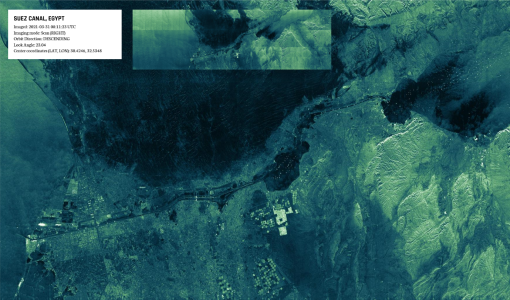
New life for Landsat historical data
45 years of data, more than 1.8 million images, these are the numbers of an adventure started 48 years ago with the launch of the first Landsat satellite.
Mission - Heritage Missions

Landsat Series
The Landsat Series is the world's longest running system of satellites for moderate-resolution optical remote sensing for land, coastal areas and shallow waters.