- News & Events
- New Landsat RBV data collectio...
New Landsat RBV data collection opened to users
07 Feb 2023
ESA is pleased to announce that the Landsat RBV data collection has been opened to users. The Landsat programme is a joint USGS and NASA-led enterprise for Earth observation that represents the world's longest-running system of satellites for moderate-resolution optical remote sensing for land, coastal areas, and shallow waters. Landsat data over Europe are acquired in the frame of ESA's Earthnet Third Party Missions Programme, in which ESA has an agreement to distribute data products from the missions.
Landsat-1 to 7 heritage missions data management activities have been gradually moved to ESA’s Heritage Space Programme, which will ensure preservation, access and curation of these assets for the long term.
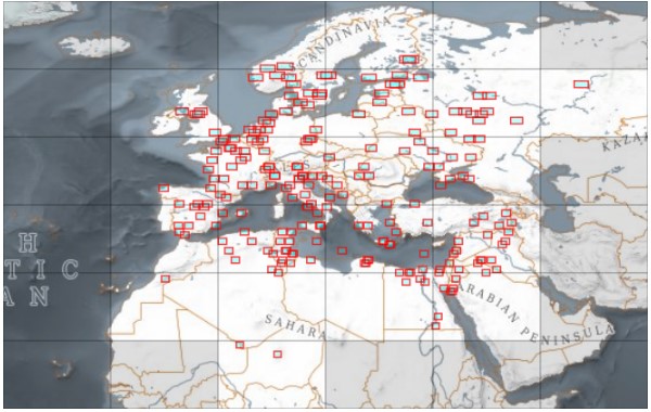
This dataset contains Landsat 3 Return Beam Vidicon (RBV) products acquired by ESA at the Fucino ground station over its visibility mask. The data (673 scenes) are the result of the digitalization of the original 70-millimetre (mm) black and white film rolls.
The RBV system was redesigned for Landsat 3 to use two cameras operating in one broad spectral band (green to near-infrared; 0.505–0.750 µm), mounted side-by-side, with a panchromatic spectral response and higher spatial resolution than on Landsat 1 and Landsat 2. Each of the cameras produced a swath of about 90 km (for a total swath of 180 km) with a spatial resolution of 40 m.
To learn more details on the data set specifications, please visit the Landsat RBV data collection page. Products can be downloaded after a fast registration process through ESA’s dissemination system: