- News
- Space data support Earth’s eco...
Space data support Earth’s ecosystems
30 Jan 2024
Deserts, coral reefs, rainforests and mountains: Earth is rich with different ecosystems. Remote sensing measurements from ESA’s many Earth observation satellites are powerful in providing information about the fascinating complexity and abundance of ecosystems.
ESA’s Earth observation (EO) missions are making a critical contribution to monitoring transformations in our planet’s ecosystems, helping track changes in the vegetation, soil, and ocean that affect these systems.
ESA’s Heritage Mission programme supports environmental research by ensuring availability of over 40 years of EO data from missions that are no longer operational.
One such Heritage mission, Envisat, made a significant contribution to land and ocean monitoring since its launch in 2002. Among its 10 powerful instruments, the Medium Resolution Imaging Spectrometer (MERIS) onboard Envisat, helped monitor coral bleaching and phytoplankton bloom, as well as tracking deforestation of tropical rain forest in Brazil [1].
Another instrument onboard Envisat was the Advanced Synthetic Aperture Radar (ASAR). This instrument was adept at monitoring oil floating on water’s surface. Between 2002 and 2012, ASAR identified more than 18,000 human-induced and naturally occurring oil slicks in the Gulf of Guinea.
The method used to analyse Envisat data allowed researchers to distinguish between human-induced oil pollution and the natural slicks that result from seepage of hydrocarbons through the seabed. This analysis could help develop mitigation strategies against oil pollution, conserving the oceans and marine environment.
Tracking wildfires that impact local ecosystems
ICEYE is a constellation of satellites designed to detect and track rapid changes on Earth’s surface. ICEYE data – available for research and application development purposes through ESA’s Third Party Missions (TPM) programme - are used to track wildfires, which can heavily alter an ecosystem by reducing nutrient availability in soil.
Very high resolution optical imagery is useful for tracking wildfires, however ICEYE uses Synthetic Aperture Radar (SAR) technology, to monitor wildfires in near real-time, delivering insights on burned areas.
Clément Albergel of ESA’s Climate Change Initiative (CCI), says: “Satellites are extremely useful for fire monitoring, permitting the monitoring of different fire characteristics: areas that are dry and prone to wildfire outbreak, actively flaming and smouldering fires, burned area, as well as smoke and trace gas emissions.”
According to Albergel, the detection of fire from space is based on two physical principles. One is related to the thermal anomaly that occurs when vegetation burns, implying a notable increase of temperature over the surrounding areas. This signal is quite easy to detect but lasts only a matter of hours. The second possibility is to monitor changes in surface reflectance (the light emitted by Earth) due to scorching or char of burned vegetation.
Another TPM is WorldView-3, an imaging and environment-monitoring satellite with high spatial and temporal resolution.
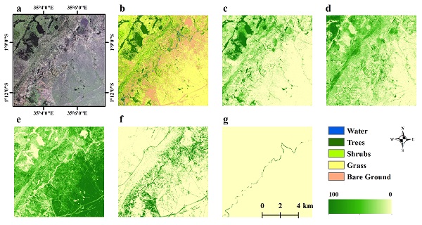
Researchers have used high resolution imagery of WorldView-3 to map vegetation in the Greater Maasai Mara savannah, a global hotspot for biodiversity in Kenya. The data revealed impressive changes to wooded areas that could have wide-spread impacts on local ecosystems.
ESA’s family of research missions, the Earth Explorers, provide essential information about cryosphere, hydrosphere, atmosphere, ionosphere and land surface, as well as Earth’s interior. Data from Earth Explorers help researchers better understand climate change and the complex interactions of ecosystems.
Launched in 2009, the Soil Moisture and Ocean Salinity (SMOS) mission has provided critical data about global vegetation, using a microwave L-band sensor. Researchers analysed global vegetation spanning from 2010 to 2020, and one key result of the study was that ecosystems with higher forest cover show stronger resistance to droughts than cropland.
Mapping how forests are changing
The upcoming Biomass, ESA’s seventh Earth Explorer mission, will provide further fruitful information to determine the global distribution of forests and how they are changing. Biomass will also investigate carbon stock and fluxes associated with terrestrial biosphere.
Monitoring photosynthetic activity can help shed light on the functioning of Earth’s vegetation. Currently, it is not possible to measure photosynthetic activity from space, but the forthcoming FLuorescence EXplorer (FLEX) mission will be capable of achieving this, furthering our understanding of Earth’s ecosystems.
By quantifying vegetation fluorescence, the photochemical reflectance index, and surface temperature, FLEX will provide innovative and unique measurements to increase our understanding of actual photosynthetic efficiency, and the status of vegetation health and stress, giving critical inputs for a global mapping of ecosystem dynamics [2].
Ecological studies rely on a wide range of data and remote sensing is a powerful tool for obtaining a deep understanding of ecosystems. ESA’s Earth observation activities, as well as its portfolio of TPM missions, have a huge number of applications in this field, furthering our understanding of the rich and diverse nature of our planet.
References
- [1] D. Blondeau-Patissier, et al., "ESA-MERIS 10-year mission reveals contrasting phytoplankton bloom dynamics in two tropical regions of Northern Australia", Remote Sensing 6, n.4, pp. 2963-2988, 2014, DOI: https://doi.org/10.3390/rs6042963.
- [2] J. F. Moreno, et al. "Very high spectral resolution imaging spectroscopy: The Fluorescence Explorer (FLEX) mission." 2016 IEEE International Geoscience and Remote Sensing Symposium (IGARSS), Beijing, China, pp. 264-267, 2016.