- All Categories (25827)
- Data (119)
- News (187)
- Missions (50)
- Events (64)
- Tools (28)
- Activities (24)
- Campaigns (16)
- Documents (25339)
DATA
Discover and download the Earth observation data you need from the broad catalogue of missions the European Space Agency operate and support.
Data - External Data (Restrained)

ADAM Surface Reflectance Database v4.0
ADAM enables generating typical monthly variations of the global Earth surface reflectance at 0.1° spatial resolution (Plate Carree projection) and over the spectral range 240-4000 nm. The ADAM product is made of gridded monthly mean climatologies over land and ocean surfaces, and of a companion API toolkit that enables the calculation of hyperspectral (at 1 nm resolution over the whole 240-4000 nm spectral range) and multidirectional reflectances (i.e. in any illumination/viewing geometry) depending on user choices. The ADAM climatologies that feed the ADAM calculation tools are: For ocean: Monthly chlorophyll concentration derived from SeaWiFS-OrbView-2 (1999-2009); it is used to compute the water column reflectance (which shows large spectral variations in the visible, but is insignificant in the near and mid infrared). Monthly wind speed derived from SeaWinds-QuikSCAT-(1999-2009); it is used to calculate the ocean glint reflectance. For land: Monthly normalized surface reflectances in the 7 MODIS narrow spectral bands derived from FondsdeSol processing chain of MOD09A1 products (derived from Aqua and Terra observations), on which relies the modelling of the hyperspectral/multidirectional surface (soil/vegetation/snow) reflectance. Uncertainty variance-covariance matrix for the 7 spectral bands associated to the normalized surface reflectance. For sea-ice: Sea ice pixels (masked in the original MOD09A1 products) have been accounted for by a gap-filling approach relying on the spatial-temporal distribution of sea ice coverage provided by the CryoClim climatology for year 2005.
Data - EO Sign In Authentication (Open)
ALOS African Coverage ESA archive
ALOS Africa is a dataset of the best available (cloud minimal, below 10%) African coverage acquired by AVNIR-2 in OBS mode and PRISM in OB1 mode (all Backward, Nadir and Forward views, in separated products), two different collections one for each instrument. The processing level for both AVNIR-2 and PRISM products is L1B. This dataset is a subset of the main ALOS AVNIR-2 and ALOS PRISM ESA collections. ALOS AVNIR-2: https://doi.org/10.5270/AL1-d9cfa6d ALOS PRISM: https://doi.org/10.5270/AL1-5e400fd.
Data - Fast Registration with approval (Restrained)
ALOS AVNIR-2 L1C
This collection provides access to the ALOS-1 AVNIR-2 (Advanced Visible and Near Infrared Radiometer type 2) L1C data acquired by ESA stations in the ADEN zone plus some worldwide data requested by European scientists. The ADEN zone was the area belonging to the European Data node and covered both the European and African continents, a large part of Greenland and the Middle East. The full mission archive is included in this collection, though with gaps in spatial coverage Time window: from 2006-04-28 to 2011-04-20 Orbits: from 1375 to 27898 Path (corresponds to JAXA track number): from 1 to 670 Row (corresponds to JAXA scene centre frame number): from 370 to 5230. One single Level 1C product type is offered for the OBS instrument mode: AV2_OBS_1C. The Level 1C product is a multispectral image (three bands in VIS and one in NIR) in GEOTIFF format with 10 m resolution.
Data - Fast Registration with approval (Restrained)
ALOS PRISM L1B
This collection provides access to the ALOS-1 PRISM (Panchromatic Remote-sensing Instrument for Stereo Mapping) L1b data acquired by ESA stations in the ADEN zone, in addition to worldwide data requested by European scientists. The ADEN zone was the area belonging to the European Data node and covered both the European and African continents, a large part of Greenland and the Middle East. The full mission archive is included in this collection, though with gaps in spatial coverage outside of the ADEN zone. The full mission is covered, though with gaps outside of the ADEN zone: Time window: from 2006-07-09 to 2011-03-31 Orbits: from 2425 to 24189 Path (corresponds to JAXA track number): from 1 to 668 Row (corresponds to JAXA scene centre frame number): from 55 to 7185. Two different Level 1B product types (Panchromatic images in VIS-NIR bands, 2.5 m resolution at nadir) are offered, one for each available sensor mode: PSM_OB1_11 -> Composed of up to three views; Nadir, Forward and Backward at 35 km swath PSM_OB2_11 -> Composed of up to two views; Nadir view at 70 km width and Backward view at 35 km width. All ALOS PRISM EO-SIP products have, at least, the Nadir view which is used for the frame number identification. All views are packaged together; each view, in CEOS format, is stored in a directory named according to the view ID according to the JAXA naming convention.
Data - Fast Registration with approval (Restrained)
ALOS PRISM L1C
This collection provides access to the ALOS-1 PRISM (Panchromatic Remote-sensing Instrument for Stereo Mapping) OB1 L1C data acquired by ESA stations (Kiruna, Maspalomas, Matera, Tromsoe) in the ADEN zone, in addition to worldwide data requested by European scientists. The ADEN zone was the area belonging to the European Data node and covered both the European and African continents, a large part of Greenland and the Middle East. The full mission archive is included in this collection, though with gaps in spatial coverage outside of the ADEN zone. With respect to the L1B collection, only scenes acquired in sensor mode with a Cloud Coverage score lower than 70% and a sea percentage lower than 80% are published: Orbits: from 2768 to 27604 Path (corresponds to JAXA track number): from 1 to 665 Row (corresponds to JAXA scene centre frame number): from 310 to 6790. The L1C processing strongly improve accuracy compared to L1B1 from several tenths of metres in L1B1 (~40 m of northing geolocation error for Forward views and ~10-20 m for easting errors) to some metres in L1C scenes (< 10 m both in north and easting errors). The collection contains only the PSM_OB1_1C EO-SIP product type, using data from PRISM operating in OB1 mode with three views (Nadir, Forward, and Backward) at 35 km wide. Most of the products contain all three views, but the Nadir view is always available and is used for the frame number identification. All views are packaged together; each view, in CEOS format, is stored in a directory named according to the JAXA view ID naming convention.
Data - Fast Registration with approval (Restrained)
ALOS PRISM L1C European Coverage Cloud Free
This collection is composed of a subset of ALOS-1 PRISM (Panchromatic Remote-sensing Instrument for Stereo Mapping) OB1 L1C products from the ALOS PRISM L1C collection (DOI: 10.57780/AL1-ff3877f) which have been chosen so as to provide a cloud-free coverage over Europe. 70% of the scenes contained within the collection have a cloud cover percentage of 0%, while the remaining 30% of the scenes have a cloud cover percentage of no more than 20%. The collection is composed of PSM_OB1_1C EO-SIP products, with the PRISM sensor operating in OB1 mode with three views (Nadir, Forward and Backward) at 35 km width.
Data - Announcement of Opportunity (Restrained)

Announcement of Opportunity for G-POD
ESA is offering all scientists the possibility to perform bulk processing and/or validation of their own algorithms exploiting the large ESA Earth-observation archive.
Data - Announcement of Opportunity (Restrained)

Announcement of Opportunity for S3VT (Sentinel-3 Validation Team)
In the framework of a Copernicus collaborative agreement ESA and EUMETSAT invite interested groups and individuals to support the Sentinel-3 Validation Team (S3VT).
Data - EO Sign In Authentication (Open)
Atmospheric Thematic Data Product [MWR_TDPATM]
This is the Atmospheric Thematic Data Product (TDP) V1 resulting from the ESA FDR4ALT project and containing Total Column Water Vapour (TCWV), Cloud Liquid Water Path (LWP), Atmospheric Attenuation of the altimeter backscattering coefficient at Ku-band (AttKu), and Wet Tropospheric Correction (WTC), retrieved from observations of the Microwave Radiometer (MWR) instruments flown on-board the ERS-1, and ERS-2, and Envisat satellites. Compared to existing datasets, the Atmospheric TDP demonstrates notable improvements in several aspects: Improved temporal coverage, especially for ERS-2 Improved L0 -> 1 processing Two different corrections are provided based on a neural network retrieval or on a 1D-VAR approach The FDR4ALT products are available in NetCDF format. Free standard tools for reading NetCDF data can be used. Information for expert altimetry users is also available in a dedicated NetCDF group within the products. Please consult the FDR4ALT Product User Guide before using the data. The FDR4ALT datasets represent the new reference data for the ERS/Envisat altimetry missions, superseding any previous mission data. Users are strongly encouraged to make use of these datasets for optimal results.
Data - External Data (Restrained)
Aura OMI complete NASA dataset
The OMI observations provide the following capabilities and features: A mapping of ozone columns at 13 km x 24 km and profiles at 13 km x 48 km A measurement of key air quality components: NO2, SO2, BrO, HCHO, and aerosol The ability to distinguish between aerosol types, such as smoke, dust and sulfates The ability to measure aerosol absorption capacity in terms of aerosol absorption optical depth or single scattering albedo A measurement of cloud pressure and coverage A mapping of the global distribution and trends in UV-B radiation. The OMI data are available in the following four levels: Level 0, Level 1B, Level 2, and Level 3. Level 0 products are raw sensor counts. Level 0 data are packaged into two-hour "chunks" of observations in the life of the spacecraft (and the OMI aboard it) irrespective of orbital boundaries. They contain orbital swath data. Level 1B processing takes Level 0 data and calibrates, geo-locates and packages the data into orbits. They contain orbital swath data. Level 2 products contain orbital swath data. Level 3 products contain global data that are composited over time (daily or monthly) or over space for small equal angle (latitude longitude) grids covering the whole globe.
Data - EO Sign In Authentication (Open)
AVHRR Level-1B Local Area Coverage Imagery
This collection is composed of AVHRR L1B products (1.1 km) reprocessed from the NOAA POES and Metop AVHRR sensors data acquired at the University of Dundee and University of Bern ground stations and from the ESA and University of Bern data historical archive. The product format is the NOAA AVHRR Level 1B that combines the AVHRR data from the HRPT stream with ancillary information like Earth location and calibration data which can be applied by the user. Other appended parameters are time codes, quality indicators, solar and satellite angles and telemetry. Two data collections cover Europe and the neighbouring regions in the period of 1 January 1981 to 31 December 2020 and the acquired data in the context of the 1-KM project in the ‘90s. During the early 1990’s various groups, including the International Geosphere-Biosphere Programme (IGBP), the Commission of the European Communities (CEC), the Moderate Resolution Imaging Spectrometer (MODIS) Science Team and ESA concluded that a global land 1 KM AVHRR data set would have been crucial to study and develop algorithms for several land products for the Earth Observing System. USGS, NOAA, ESA and other non-U.S. AVHRR receiving stations endorsed the initiative to collect a global land 1-km multi-temporal AVHRR data set over all land surfaces using NOAA's TIROS "afternoon" polar-orbiting satellite. On 1 April 1992, the project officially began up to the end of 1999 with the utilisation of 23 stations worldwide plus the NOAA local area coverage (LAC) on-board recorders. The global land 1-km AVHRR dataset is composed of 5 channels, raw AVHRR dataset at 1.1 km resolution from the NOAA-11 and NOAA-14 satellites covering land surfaces, inland water and coastal areas. Global Land 1 km AVHRR Data Set Project HRPT Ground Station Network (as of 1 April 1992) and Acquisition Areas for LAC Recorded Data Spatial coverage: Check the spatial coverage of the collection on a map available on the Third Party Missions Dissemination Service: AVHRR L1B 1.1 KM AVHRR L1B LAC Out-of-Europe.
Data - Announcement of Opportunity (Restrained)
CLOSED - Announcement of Opportunity for S5PVT (Sentinel-5 Precursor Calibration and Validation Team)
In the framework of the Copernicus programme, ESA offered an announcement of opportunity to support the Sentinel-5 Precursor Calibration and Validation Team Call.
Data - Announcement of Opportunity (Restrained)

CLOSED - Announcement of Opportunity for Spire data
An opportunity for scientists and researchers to access Spire data.
Data - Announcement of Opportunity (Restrained)

CLOSED - EarthCARE Calibration and Validation Announcement of Opportunity
ESA offered an announcement of opportunity to support the calibration and validation of EarthCARE products. This opportunity closed in 2017.
Data - Announcement of Opportunity (Restrained)

Closed ESA announcement of opportunities
Find out about closed ESA announcement of opportunities and what these opportunities involved, for historical reference.
Data - Campaigns (Open)
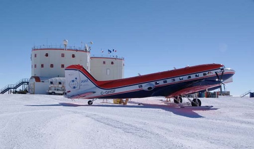
DOMECair (GOCE)
The airborne survey DOMECair 2013 and its instrumentation was designed to obtain calibration and validation data for two different satellite missions of ESA’s Earth Explorer mission, for satellites SMOS and GOCE.
Data - Campaigns (Open)
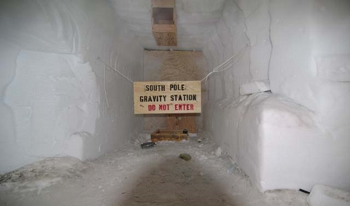
DOMECair (SMOS)
The purpose of this campaign was to assess the merits of the East Antarctic Plateau around Dome C with the Concordia station as a candidate for an Earthly calibration site. It was an airborne campaign in Antarctica supporting SMOS calibration.
Data - Data Description
Envisat AATSR L1B Brightness Temperature/Radiance [ENV_AT_1_RBT]
- AATSR Full Resolution land and ocean cover image of the Iberian Peninsula from 28 October 2006 AATSR Full Resolution land cover image of the Iberian Peninsula from 28 October 2006. The Envisat AATSR Level 1B Brightness Temperature/Radiance product (RBT) contains top of atmosphere (TOA) brightness temperature (BT) values for the infra-red channels and radiance values for the visible channels, on a 1-km pixel grid. Values for each channel and for the nadir and oblique views occupy separate NetCDF files within the Sentinel-SAFE format, along with associated uncertainty estimates. Additional files contain cloud flags, land and water masks, and confidence flags for each image pixel, as well as instrument and ancillary meteorological information. This AATSR product [ENV_AT_1_RBT] in NetCDF format stemming from the 4th AATSR reprocessing, is a continuation of ERS ATSR data and a precursor of Sentinel-3 SLSTR data. It has replaced the former L1B product [ATS_TOA_1P] in Envisat format from the 3rd reprocessing. Users with Envisat-format products are recommended to move to the new Sentinel-SAFE like/NetCDF format products. The 4th reprocessing of Envisat AATSR data was completed in 2022; the processing updates that have been put in place and the expected scientific improvements have been outlined in full in the User Documentation for (A)ATSR 4th Reprocessing Products.
Data - Fast Registration with immediate access (Open)

Envisat GOMOS Geolocated Calibrated Transmission Spectra and Photometer Fluxes [GOM_TRA_1P]
This data product describes the geolocated and calibrated transmission spectra products, containing the full transmission and the covariance spectra needed for Level 2 processing. Coverage is as follows: Elevation range: +62 deg to +68 deg Azimuth range: +90 deg to +190 deg (with respect to the flight direction). The file size is 1 MB per occultation, depending on the duration of the occultation.
Data - Fast Registration with immediate access (Open)

Envisat GOMOS Level 1b - Limb spectra [GOM_LIM_1P]
This data product describes localised calibrated upper and lower background limb spectra (flat-field corrected, with and without stray light). Coverage is as follows: Elevation range: C25+62 deg to +68 deg Azimuth range: +90 deg to +190 deg (with respect to the flight direction). The file size is Mbytes per occultation, depending on the duration of the occultation.