- Campaigns
- DOMECair (GOCE)
DOMECair (GOCE)
Overview
What was the purpose of DOMECair (GOCE)?
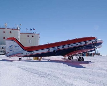
The airborne survey DOMECair 2013 and its instrumentation was designed to obtain calibration and validation data for two different satellite missions of ESA’s Earth Explorer mission, for satellites SMOS and GOCE.
What was the outcome of DOMECair (GOCE)?
The Dome C gravity survey was successful, and covered a hitherto unsurveyed and logistically very difficult region of Antarctica.
The survey has provided a consistent gravity data set with a reasonably small bias of 3 mGal compared to GOCE, and an estimated track r.m.s. noise of 8 mGal. This data set is therefore sufficient for an upward continuation and gradient estimation process to the GOCE altitude, as this process will damp the noise in the airborne data.
Download the DOMECair (GOCE) Final Report
| Data Coverage (Year) | 2013 |
| Release Date | January 2018 |
| Geographic Site | DOME C, Antarctica |
| Field of Application | Airborne gravity data |
| Data Size | 0.12 GB |
Digital Object Identifier: https://doi.org/10.5270/esa-hv4o79h - DOMECair (GOCE): "Dome-C airborne gravity measurements and comparison to GOCE gradient data"
Data
The campaign data is available online via FTPS upon submission of a data access request. An active EO Sign In account is required to submit the request.
The data can be downloaded via an FTP client (e.g., FileZilla or WinSCP) using the option "Implicit FTP over TLS".
For further information about the EO Sign In Service you can visit TellUs
Should you need support please contact EOHelp