- All Categories (221)
- Data (77)
- News (62)
- Missions (8)
- Events (27)
- Tools (1)
- Activities (1)
- Campaigns (19)
- Documents (26)
DATA
Discover and download the Earth observation data you need from the broad catalogue of missions the European Space Agency operate and support.
Data - Campaigns (Open)
SARSimHT
The main objective of “SARSimHT – Airborne SAR experiment to simulate Hydroterra data” was to demonstrate the image formation process of Hydroterra through the exploitation of a repeat-pass hyper-temporal airborne SAR image stack acquired over short time intervals representative of the Hydroterra mission.
Data - Campaigns (Open)

ROVE (1975-1981)
The Dutch research team ROVE (Radar Observation on Vegetation), funded by the remote sensing organization NIWARS, started in 1974 to investigate the scattering of microwaves by crops and soils, in order to help interpretation of radar imagery.
Data - Campaigns (Open)
PremierEX
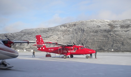
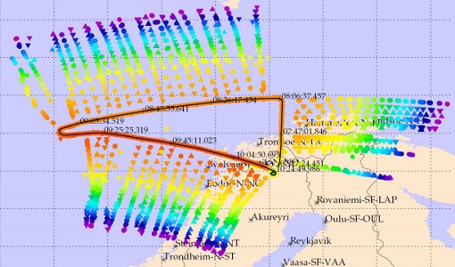
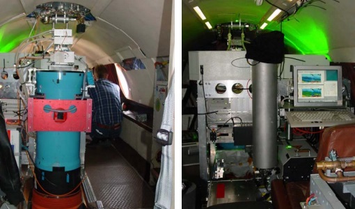
The campaign was based in the Arena Arctica in Kiruna (Sweden). The science campaign has addressed the science objectives and was part of the airborne campaign of the EU project RECONCILE.
Data - Campaigns (Open)
PhotoProxy 2019
The Photosynthetic-Proxy Experiment campaign address relevant open aspects that are related to the quantitative assessment of vegetation photosynthesis and vegetation stress from space.
Data - Campaigns (Open)

HYFLEX
This HYFLEX campaign aimed to deliver maps of sun-induced fluorescence recorded from airborne measurements using the approaches of the spaceborne FLEX mission.
Data - Campaigns (Open)
FLEXSense 2019
The FLEXSense 2019 campaign activities were undertaken in Germany and Italy with the goal of providing a complete set of high-resolution experimental data, including all relevant elements required for the preparation of the FLEX satellite mission.
Data - Campaigns (Open)
FLEXSense 2018
The 2018 Fluorescence Explorer Sense (FLEXSense) campaign combined various field activities in preparation for the FLEX satellite mission.
Data - Campaigns (Open)

FLEX-US
The primary goal of the 2013 joint ESA/NASA airborne campaign was to record an unprecedented FLEX-like dataset containing maps of sun-induced fluorescence, hyperspectral reflectance, surface temperature, and canopy structure.
Data - Campaigns (Open)

FLEX EU 2014
The FLEX-EU Campaign was carried out in 2014 over an agricultural area around Jülich, Germany, Latisana, Italy and forest sites in Czech Republic
Data - Campaigns (Open)

BelSAR 2018
The BelSAR project intended to carry out an airborne campaign for SAR bistatic interferometric measurements at L-band and full polarisation, over a test site in Belgium.
Data - Campaigns (Open)
WALEX
The objective of (WALEX) was to collect valuable data to provide representative lidar measurements of water vapour and aerosol properties in different climatic zones.
Data - Campaigns (Open)

AGRISAR 2006
The AGRISAR 2006 campaign, carried out between 18 April and 2 August 2006, was established to address important specific programmatic needs of Sentinel-1 and -2.
Data - Campaigns (Open)

AgriSAR 2009
The AgriSAR 2009 campaign was defined to leverage the RADARSAT-2 mission to better understand and demonstrate the potential for GMES land monitoring user services, particularly in agriculture.
Data - Campaigns (Open)

AquiferEx
The AquiferEx Optical and Radar Campaign was in support of information product generation based on satellite data, harmonisation of satellite data acquisition performed among Aquifer and AquiferEx project partners.
Data - Fast Registration with approval (Restrained)
ERS-1/2 ATSR Averaged Surface Temperature [AT1/AT2_AR__2P]
The Averaged Surface Temperature Product (AST) contains averaged geophysical data at two different resolutions, and with respect to two different averaging schemes: measurement data sets at resolutions of 0.5 by 0.5 degrees and 10 by 10 arcmin with respect to a latitude/longitude grid; other data sets contain data averaged over equal area cells of 50 by 50 km and 17 by 17 km aligned with the satellite ground track. Both top-of-atmosphere and surface data sets are provided. The surface temperature data sets provide, for sea cells, nadir and dual view sea surface temperatures, and for land cells, land surface temperature (currently 11 micron BT) and NDVI. Cloud data is also included. No ADS are included in the AST product; auxiliary data is contained within the MDS. The data sets of the AST product are arranged by surface type and resolution. The 3rd reprocessing of ATSR data was performed in 2013; the processing updates that have been put in place and the scientific improvements are outlined in full in the User Summary Note for the Third ERS ATSR Reprocessing.
Data - Project Proposal (Restrained)
COSMO-SkyMed full archive and tasking
The archive and new tasking X-band SAR products are available from COSMO-Skymed (CSK) and COSMO-SkyMed Second Generation (CSG) missions in ScanSAR and Stripmap modes, right and left looking acquisition (20 to 60° incidence angle). COSMO-SkyMed modes: Acquisition Mode Single look Resolution [Az. X. Rg, SCS] (m) Scene size [Az. X. Rg] (km) Polarisation Scene duration (seconds) Number of looks Multilook resolution (m) Geolocation accuracy ±3 s (m) [DGM, GEC, GTC] Stripmap Himage 2.6 x 3 40 x 40 Single: HH, HV, VH, VV 7 3 5 25 Stripmap PingPong 9.7 x 11 30 x 30 Alternate: HH/VV, HH/HV, VV/VH 6 3 20 25 ScanSAR Wide 23 x 13.5 100 x 100 Single: HH, HV, VH, VV 15 4 - 9 30 30 ScanSAR Huge 38 x 13.5 200 x 200 Single: HH, HV, VH, VV 30 25 - 66 100 100 COSMO-Skymed Second Generation Modes: Acquisition Mode Single look Resolution [Az. X. Rg, SCS] (m) Scene size [Az. X. Rg] (km) Polarisation Scene duration (seconds) Number of looks Multilook resolution (m) Geolocation accuracy ±3σ (m) [DGM, GEC, GTC] Stripmap 3 x 3 40 x 40 Single (HH, VV, HV, VH) or Dual (HH+HV, VV+VH) 7 2 x 2 4 x 4 6 x 7 11 x 14 3.75 Stripmap PingPong 12 x 5 30 x 30 Alternate (HH/VV, HH/HV+VV/VH) 6 1 x 2 2 x 5 12 x 10 23 x 26 12 QuadPol 3 x 3 40 x 15 Quad (HH+HV+VV+VH) N/A 2 x 2 4 x 4 6 x 7 11 x 14 3.75 ScanSAR 1 20 x 4 100 x 100 Single (HH, VV, HV, VH) or Dual (HH+HV, VV+VH) 15 1 x 3 1 x 5 2 x 8 20 x 14 23 x 27 35 x 40 12 ScanSAR 2 40 x 6 200 x 200 Single (HH, VV, HV, VH) or Dual (HH+HV, VV+VH) 30 1 x 4 1 x 7 3 x 16 40 x 27 47 x 54 115 x 135 12 Following Processing Levels are available, for both CSK and CSG: SCS (Level 1A, Single-look Complex Slant): Data in complex format, in slant range projection (the sensor's natural acquisition projection) and zero doppler projection, weighted and radiometrically equalised; the coverage corresponds to the full resolution area illuminated by the SAR instrument DGM (Level 1B, Detected Ground Multi-look): Product obtained detecting, multi-looking and projecting the Single-look Complex Slant data onto a grid regular in ground: it contains focused data, amplitude detected, optionally despeckled by multi-looking approach, radiometrically equalised and represented in ground/azimuth projection GEC (Level 1C, Geocoded Ellipsoid Corrected): Focused data, amplitude detected, optionally despeckled by multi-looking approach, geolocated on the reference ellipsoid and represented in a uniform preselected cartographic presentation. Any geometric correction derived by usage of terrain model isn't applied to this product by default GTC (Level 1D, Geocoded Terrain Corrected): Focused data, fully calibrated with the usage of terrain model, amplitude detected, optionally despeckled by multi-looking approach, geolocated on a DEM and represented in a uniform preselected cartographic presentation. The image scene is located and accurately rectified onto a map projection, through the use of Ground Control Points (GCPs) and Digital Elevation Model (DEM); it differs from GEC for the use of the DEM (instead of reference ellipsoid) for the accurate conversion from slant to ground range and to approximate the real earth surface. The list of available data can be retrieved using the CLEOS COSMO-SkyMed products catalogue. User registration is required to use the catalogue. As per ESA policy, very high-resolution data over conflict areas cannot be provided.
Data - Project Proposal (Restrained)
COSMO-SkyMed ESA archive
The COSMO-SkyMed archive collection consists of COSMO-SkyMed products requested by ESA supported projects over their areas of interest around the world. The dataset regularly grows as ESA collects new products over the years. The following list delineates the characteristics of the SAR measurement modes that are disseminated under ESA Third Party Missions (TPM). STRIPMAP HIMAGE (HIM): Achieving medium resolution (3 m x 3 m single look), wide swath imaging (swath extension ≥40 km). STRIPMAP PINGPONG (SPP): Achieving medium resolution (15 m), medium swath imaging (swath ≥30 km) with two radar polarization's selectable among HH, HV, VH and VV. SCANSAR WIDE (SCW): Achieving radar imaging with swath extension of 100 x 100 km2 and a spatial resolution of 30 x 30 m2. SCANSAR HUGE (SCH): Achieving radar imaging with swath extension of 200 x 200 km2 and a spatial resolution selectable of 100 x 100 m2. Processing Levels: Level 1A - Single-look Complex Slant - (SCSB and SCSU): RAW data focused in slant range-azimuth projection, that is the sensor natural acquisition projection; product contains In-Phase and Quadrature of the focused data, weighted and radiometrically equalised.The processing of the 1A_SCSU product differs from that of the 1A_SCSB product for the following features:a non-weighted processing is performed, which means that windowing isn't applied on the processed bandwidth; radiometric equalisation (in terms of compensation of the range antenna pattern and incidence angle) is not performed; hence only compensation of the antenna transmitter gain and receiver attenuation and range spreading loss is applied. Level 1B - Detected Ground Multi-look (DGM): Product obtained detecting, multi-looking and projecting the Single-look Complex Slant data onto a grid regular in ground. Spotlight Mode products are not multi-looked. Level 1C - Geocoded Ellipsoid Corrected (GEC) and Level 1D - Geocoded Terrain Corrected (GTC): Obtained projecting the Level 1A product onto a regular grid in a chosen cartographic reference system. In case of Lev 1C the surface is the earth ellipsoid while for the Lev 1D a DEM (Digital Elevation Model) is used to approximate the real earth surface. Spatial coverage: Check the spatial coverage of the collection on a map available on the Third Party Missions Dissemination Service. As per ESA policy, very high-resolution data over conflict areas cannot be provided.
Data - EO Sign In Authentication (Open)
Envisat MERIS Full Resolution - Level 2 [MER_FRS_2P/ME_2_FRG]
MERIS FR Level 2 is a Full-Resolution Geophysical product for Ocean, Land and Atmosphere. Each MERIS Level 2 geophysical product is derived from a MERIS Level 1 product and auxiliary parameter files specific to the MERIS Level 2 processing. The MERIS FR Level 2 product has Sentinel 3-like format starting from the 4th reprocessing data released to users in July 2020. The data package is composed of NetCDF 4 files containing instrumental and scientific measurements, and a Manifest file which contains metadata information related to the description of the product. A Level 2 product is composed of 64 measurement files containing: 13 files containing Water-leaving reflectance, 13 files containing Land surface reflectance and 13 files containing the TOA reflectance (for all bands except those dedicated to measurement of atmospheric gas - M11 and M15), and several files containing additional measurements on Ocean, Land and Atmospheric parameters and annotation. The Auxiliary data used are listed in the Manifest file associated to each product. The Level 2 FR product covers the complete instrument swath. The product duration is not fixed and it can span up to the time interval of the input Level 0/Level 1. Thus the estimated size of the Level 2 FR is dependent on the start/stop time of the acquired segment. During the Envisat mission, acquisition of MERIS Full Resolution data was subject to dedicated planning based on on-demand ordering and coverage of specific areas according to operational recommendations and considerations. See yearly and global density maps to get a better overview of the MERIS FR coverage.
Data - Fast Registration with approval (Restrained)
ERS-1/2 ATSR Gridded Brightness Temperature/Reflectance [AT1/AT2_TOA_1P]
The Gridded Brightness Temperature/Reflectance (GBTR) product contains top of atmosphere (TOA) brightness temperature (BT) values for the infra-red channels and reflectance values for the visible channels. Values for each channel and for the nadir and forward views occupy separate measurement data sets. Additional MDS contain cloud and land/sea flags and confidence flags for each image pixel. The 3rd reprocessing of ATSR data was performed in 2013; the processing updates that have been put in place and the scientific improvements are outlined in full in the User Summary Note for the Third ERS ATSR Reprocessing.
Data - Fast Registration with approval (Restrained)
ERS-1/2 ATSR Gridded Surface Temperature [AT1/AT2_NR__2P]
The Gridded Surface Temperature (GST) Product is the Level 2 full resolution geophysical product. The product contains gridded sea-surface temperature images using both nadir and dual view retrieval algorithms. The product includes pixel latitude/longitude positions, X/Y offset and the results of the cloud-clearing/land-flagging. It contains a single measurement data set the content of which is switchable, that is to say, the content of each pixel field will depend on the surface type. Specifically, the contents of the data fields will depend on the setting of the forward and nadir cloud flags and the land flag. The 3rd reprocessing of ATSR data was performed in 2013; the processing updates that have been put in place and the scientific improvements are outlined in full in the User Summary Note for the Third ERS ATSR Reprocessing.