- All Categories (128)
- Data (20)
- News (49)
- Missions (3)
- Events (25)
- Tools (1)
- Activities (1)
- Campaigns (8)
- Documents (21)
DATA
Discover and download the Earth observation data you need from the broad catalogue of missions the European Space Agency operate and support.
Data - Sample Data (Open)
IRS-P6 (ResourceSat-1) Sample Data
Download free IRS-P6 (ResourceSat-1) sample datasets to preview products available for this mission.
Data - Announcement of Opportunity (Restrained)
Announcement of Opportunity for NovaSAR-1
ESA is launching an Announcement of Opportunity for the international scientific community to access data from the NovaSAR-1 mission for science and EO-based applications development.
Data - Project Proposal (Restrained)
NovaSAR-1 new tasking
NovaSAR-1 new acquisition data are available in two baseline acquisition modes: Stripmap – provides the highest resolution of 6 metres with up to 20 km swath selected from a 150 km field of regard, available in single polarisation. ScanSAR – has a 20 - 30 metre resolution and up to 150 km swath. Available in single polarisation. Within each of the baseline modes there are a variety of mode options that vary according to ground range resolution, incidence angles, swath width and the number of looks: Acquisition Mode Polarisation Resolution (m) Swath Width (km) Incidence Angles Number of Looks Stripmap Single: HH 6 20 16.0 – 25.38° 3 (1 range, 3 azimuth) 13 – 20 21.29 – 31.2° Single: VV 6 20 16.0 – 25.38° 3 (1 range, 3 azimuth) 13 – 20 21.29 – 31.2° ScanSAR Single: HH 20 100 15.0 - 24.66° 4 (2 range, 2 azimuth) 50 24.51 - 28.94° Single: VV 20 100 15.0 – 24.66° 4 (2 range, 2 azimuth) 50 24.51 - 28.94° Single: HH 30 150 11.29 – 25.93° 4 (2 range, 2 azimuth) 55 27.35 - 32.01° Single: VV 30 150 11.29 – 25.93° 4 (2 range, 2 azimuth) 55 27.35 - 32.01° NovaSAR-1 data are provided as a Level 2 (ARD) product as standard, but the accompanying Level 1 data may also be requested. Level 1 – delivered as reconstructed, unprocessed instrument data at full resolution. Level 2 (ARD) – delivered as a processed product with applied radiometric and geometric corrections i.e. orthorectification and spatial registration: Geocoded Ellipsoid Corrected (GEC) – Maritime and ocean applications Geocoded Terrain Corrected (GTC) – Land applications and change detection Where available, associated automatic identification system (AIS) data may be requested alongside the NovaSAR-1 data products.
Data - Fast Registration with immediate access (Open)
FSSCat products
The FSSCat collection provides hyperspectral data coverage over a number of locations around the world, as measured by the HyperScout 2 sensor. The FSSCat hyperspectral data products are comprised of 50 spectral bands, covering a spectral range of 450 – 950 nm with a spectral resolution of 18 nm (at FWHM). Imagery is available with an along-track ground sampling distance (GSD) of 75 m. To ensure a high degree of radiometric accuracy, HyperScout 2 data are validated through comparison with Sentinel-2 data products. The processing level of the data is L1C – calibrated top-of-atmosphere radiance, reflectance or brightness temperature. The raster type of the L1C data product is a GRID – a 2D or 3D raster where the (geo)location of the data is uniquely defined by the upper left pixel location of the raster and the pixel size of the raster, and the projection parameters of the raster (if georeferenced). The third dimension can e.g. be a spectral or third spatial dimension. The L-1C VNIR data product includes a hyperspectral cube of TOA reflectance in the VNIR range, as well as relevant meta-data that adheres to EDAP's best practice guidelines. This product consists of georeferenced and ortho-rectified image tiles that contain spectral reflectance data at the top-of-the-atmosphere. Each image tile contains radiometrically corrected and ortho-rectified band images that are projected onto a map, as well as geolocation information and the coordinate system used. Additionally, each image pixel provides TOA spectral reflectance data in scaled integers, conversion coefficients for spectral radiance units, viewing and solar zenith and azimuth angles, and quality flags.
Data - Fast Registration with approval (Restrained)
European Cities: Cartosat-1 Euro-Maps 3D
A large number of European cities are covered by this dataset; for each city you can find one or more Cartosat-1 ortho image products and one or more Euro-Maps 3D DSM tiles clipped to the extent of the ortho coverage. The Euro-Maps 3D DSM is a homogeneous, 5 m spaced Digital Surface Model semi-automatically derived from 2.5 m Cartosat-1 in-flight stereo data with a vertical accuracy of 10 m. The very detailed and accurate representation of the surface is achieved by using a sophisticated and well adapted algorithm implemented on the basis of the Semi-Global Matching approach. The final product includes several pixel-based quality and traceability layers: The dsm layer (*_dsm.tif) contains the elevation heights as a geocoded raster file The source layer (*_src.tif) contains information about the data source for each height value/pixel The number layer (*_num.tif) contains for each height value/pixel the number of IRS-P5 Cartosat-1 stereo pairs used for the generation of the DEM The quality layer (*_qc.tif) is set to 1 for each height/pixel value derived from IRS-P5 Cartosat-1 data and which meets or exceeds the product specifications The accuracy vertical layer (*_acv.tif) contains the absolute vertical accuracy for each quality controlled height value/pixel. The ortho image is a Panchromatic image at 2.5 m resolution. The following table defines the offered product types. EO-SIP product type Description PAN_PAM_3O IRS-P5 Cartosat-1 ortho image DSM_DEM_3D IRS-P5 Cartosat-1 DSM
Data - EO Sign In Authentication (Open)
Aeolus L2A Aerosol/Cloud optical product
The Level 2A aerosol/cloud optical products of the Aeolus mission include: Geo-located consolidated backscatter and extinction profiles Backscatter-to-extinction coefficient LIDAR ratio, scene classification Heterogeneity index Attenuated backscatter signals. Resolution: Horizontal resolution of L2A optical properties at observation scale (~87 km); Exceptions are group properties (horizontal accumulation of measurements from ~3 km to ~87 km) and attenuated backscatters (~3 km). Note: The resolution of "groups" in the L2A can only go down to 5 measurements at the moment, i.e. ~15 km horizontal resolution. This could be configured to go to 1 measurement - Vertical resolution 250-2000 m (Defined by Range Bin Settings).
Data - Fast Registration with approval (Restrained)
ALOS PRISM L1B
This collection provides access to the ALOS-1 PRISM (Panchromatic Remote-sensing Instrument for Stereo Mapping) L1b data acquired by ESA stations in the ADEN zone, in addition to worldwide data requested by European scientists. The ADEN zone was the area belonging to the European Data node and covered both the European and African continents, a large part of Greenland and the Middle East. The full mission archive is included in this collection, though with gaps in spatial coverage outside of the ADEN zone. The full mission is covered, though with gaps outside of the ADEN zone: Time window: from 2006-07-09 to 2011-03-31 Orbits: from 2425 to 24189 Path (corresponds to JAXA track number): from 1 to 668 Row (corresponds to JAXA scene centre frame number): from 55 to 7185. Two different Level 1B product types (Panchromatic images in VIS-NIR bands, 2.5 m resolution at nadir) are offered, one for each available sensor mode: PSM_OB1_11 -> Composed of up to three views; Nadir, Forward and Backward at 35 km swath PSM_OB2_11 -> Composed of up to two views; Nadir view at 70 km width and Backward view at 35 km width. All ALOS PRISM EO-SIP products have, at least, the Nadir view which is used for the frame number identification. All views are packaged together; each view, in CEOS format, is stored in a directory named according to the view ID according to the JAXA naming convention.
Data - Announcement of Opportunity (Restrained)

Announcement of Opportunity for NoR
ESA invites submissions for the Network of Resources (NoR) call, which aims to support research, development and pre-commercial users to innovate their working practices, moving from a data download paradigm towards a 'bring the user to the data' paradigm.
Data - EO Sign In Authentication (Open)
AVHRR Level-1B Local Area Coverage Imagery
This collection is composed of AVHRR L1B products (1.1 km) reprocessed from the NOAA POES and Metop AVHRR sensors data acquired at the University of Dundee and University of Bern ground stations and from the ESA and University of Bern data historical archive. The product format is the NOAA AVHRR Level 1B that combines the AVHRR data from the HRPT stream with ancillary information like Earth location and calibration data which can be applied by the user. Other appended parameters are time codes, quality indicators, solar and satellite angles and telemetry. Two data collections cover Europe and the neighbouring regions in the period of 1 January 1981 to 31 December 2020 and the acquired data in the context of the 1-KM project in the ‘90s. During the early 1990’s various groups, including the International Geosphere-Biosphere Programme (IGBP), the Commission of the European Communities (CEC), the Moderate Resolution Imaging Spectrometer (MODIS) Science Team and ESA concluded that a global land 1 KM AVHRR data set would have been crucial to study and develop algorithms for several land products for the Earth Observing System. USGS, NOAA, ESA and other non-U.S. AVHRR receiving stations endorsed the initiative to collect a global land 1-km multi-temporal AVHRR data set over all land surfaces using NOAA's TIROS "afternoon" polar-orbiting satellite. On 1 April 1992, the project officially began up to the end of 1999 with the utilisation of 23 stations worldwide plus the NOAA local area coverage (LAC) on-board recorders. The global land 1-km AVHRR dataset is composed of 5 channels, raw AVHRR dataset at 1.1 km resolution from the NOAA-11 and NOAA-14 satellites covering land surfaces, inland water and coastal areas. Global Land 1 km AVHRR Data Set Project HRPT Ground Station Network (as of 1 April 1992) and Acquisition Areas for LAC Recorded Data Spatial coverage: Check the spatial coverage of the collection on a map available on the Third Party Missions Dissemination Service: AVHRR L1B 1.1 KM AVHRR L1B LAC Out-of-Europe.
Data - EO Sign In Authentication (Open)
PROBA-1 HRC
The HRC Level 1A product is an image with a pixel resolution of 8m. The data are grey scale images, an image contains 1026 x 1026 pixels and covers an area of 25 km2. HRC data is supplied in BMP format. All PROBA-1 passes are systematically acquired according to the current acquisition plan, HRC data are processed every day to Level 1A and made available to ESA users. Spatial coverage: Check the spatial coverage of the collection on a map available on the Third Party Missions Dissemination Service.
Data - EO Sign In Authentication (Open)
PROBA-1 CHRIS Level 1A
CHRIS acquired a set of up to five images of each target during each acquisition sequence, these images were acquired when PROBA-1 was pointing at distinct angles with respect to the target. CHRIS Level 1A products (supplied in HDF data files, version 4.1r3) include five formal CHRIS imaging modes, classified as modes 1 to 5: Mode Name Swath Spectral Bands/Ground Resolution Mode 1 Aerosols 13 km 62 at 34 m (773 nm / 1036 nm) Mode 2 Water bands 13 km 18 at 18 m Mode 3 Land channels 13 km 18 at 18 m Mode 4 Chlorophyll band set 13 km 18 at 18 m Mode 5 Land channels 6.5 km 37 at 18 m Spatial coverage: Check the spatial coverage of the collection on a map available on the Third Party Missions Dissemination Service.
Data - EO Sign In Authentication (Open)
OceanSat-2 data
ESA, in collaboration with GAF AG, acquired and processed every day OceanSat-2 passes over Neutrelitz reception station from January 2016 to November 2021. All passes were systematically processed to levels 1B, 2B and 2C, and available to users in NRT (< 3 hours). Products are available in: Level 1B: Geophysical Data containing Radiance Data for all 8 Bands of OCM-2 Level 2B: Geophysical Data L2B for given Geo physical parameter. Geo physical parameters: Chlorophyll, Aerosol Depth, Different Attenuation, Total Suspended Sediments Level 2C: Georeferenced Radiance Data for given geo physical parameter. Geo physical parameters: Chlorophyll, Aerosol Depth, Different Attenuation, Total Suspended Sediments. Spatial coverage: Check the spatial coverage of the collection on a map available on the Third Party Missions Dissemination Service.
Data - EO Sign In Authentication (Open)
Envisat MERIS Full Resolution - Level 1 [MER_FRS_1P/ME_1_FRG]
The MERIS Level 1 Full Resolution (FR) product contains the Top of Atmosphere (TOA) upwelling spectral radiance measurements. The in-band reference irradiances for the 15 MERIS bands are computed by averaging the in-band solar irradiance of each pixel. The in-band solar irradiance of each pixel is computed by integrating the reference solar spectrum with the band-pass of each pixel. The MERIS FR Level 1 product has Sentinel 3-like format starting from the 4th reprocessing data released to users in July 2020. Each measurement and annotation data file is in NetCDF 4. The Level 1 product is composed of 22 data files: 15 files containing radiances at each band (one band per file), accompanied by the associated error estimates, and 7 annotation data files. The 15 sun spectral flux values provided in the instrument data file of the Level 1 products are the in-band reference irradiances adjusted for the Earth-sun distance at the time of measurement. The band-pass of each pixel is derived from on-ground and in-flight characterisation via an instrument model. The values "Band wavelength" and "Bandwidth" provided in the Manifest file of the Level 1b products are the averaged band-pass of each pixel over the instrument field of view. Auxiliary data are also listed in the Manifest file associated to each product. The Level 1 FR product covers the complete instrument swath. The product duration is not fixed and it can span up to the time interval of the input Level 0 (for a maximum of 20 minutes). Thus the estimated size of the Level 1 FR is dependent on the start/stop time of the acquired segment. During the Envisat mission, acquisition of MERIS Full Resolution data was subject to dedicated planning based on on-demand ordering and coverage of specific areas according to operational recommendations and considerations. See yearly and global density maps to get a better overview of the MERIS FR coverage.
Data - Fast Registration with approval (Restrained)
ERS-1/2 ATSR Averaged Surface Temperature [AT1/AT2_AR__2P]
The Averaged Surface Temperature Product (AST) contains averaged geophysical data at two different resolutions, and with respect to two different averaging schemes: measurement data sets at resolutions of 0.5 by 0.5 degrees and 10 by 10 arcmin with respect to a latitude/longitude grid; other data sets contain data averaged over equal area cells of 50 by 50 km and 17 by 17 km aligned with the satellite ground track. Both top-of-atmosphere and surface data sets are provided. The surface temperature data sets provide, for sea cells, nadir and dual view sea surface temperatures, and for land cells, land surface temperature (currently 11 micron BT) and NDVI. Cloud data is also included. No ADS are included in the AST product; auxiliary data is contained within the MDS. The data sets of the AST product are arranged by surface type and resolution. The 3rd reprocessing of ATSR data was performed in 2013; the processing updates that have been put in place and the scientific improvements are outlined in full in the User Summary Note for the Third ERS ATSR Reprocessing.
Data - Fast Registration with approval (Restrained)
ERS-1/2 ATSR Gridded Brightness Temperature/Reflectance [AT1/AT2_TOA_1P]
The Gridded Brightness Temperature/Reflectance (GBTR) product contains top of atmosphere (TOA) brightness temperature (BT) values for the infra-red channels and reflectance values for the visible channels. Values for each channel and for the nadir and forward views occupy separate measurement data sets. Additional MDS contain cloud and land/sea flags and confidence flags for each image pixel. The 3rd reprocessing of ATSR data was performed in 2013; the processing updates that have been put in place and the scientific improvements are outlined in full in the User Summary Note for the Third ERS ATSR Reprocessing.
Data - Fast Registration with approval (Restrained)
ERS-1/2 ATSR Gridded Surface Temperature [AT1/AT2_NR__2P]
The Gridded Surface Temperature (GST) Product is the Level 2 full resolution geophysical product. The product contains gridded sea-surface temperature images using both nadir and dual view retrieval algorithms. The product includes pixel latitude/longitude positions, X/Y offset and the results of the cloud-clearing/land-flagging. It contains a single measurement data set the content of which is switchable, that is to say, the content of each pixel field will depend on the surface type. Specifically, the contents of the data fields will depend on the setting of the forward and nadir cloud flags and the land flag. The 3rd reprocessing of ATSR data was performed in 2013; the processing updates that have been put in place and the scientific improvements are outlined in full in the User Summary Note for the Third ERS ATSR Reprocessing.
Data - EO Sign In Authentication (Open)
Envisat MERIS Full Resolution - Level 2 [MER_FRS_2P/ME_2_FRG]
MERIS FR Level 2 is a Full-Resolution Geophysical product for Ocean, Land and Atmosphere. Each MERIS Level 2 geophysical product is derived from a MERIS Level 1 product and auxiliary parameter files specific to the MERIS Level 2 processing. The MERIS FR Level 2 product has Sentinel 3-like format starting from the 4th reprocessing data released to users in July 2020. The data package is composed of NetCDF 4 files containing instrumental and scientific measurements, and a Manifest file which contains metadata information related to the description of the product. A Level 2 product is composed of 64 measurement files containing: 13 files containing Water-leaving reflectance, 13 files containing Land surface reflectance and 13 files containing the TOA reflectance (for all bands except those dedicated to measurement of atmospheric gas - M11 and M15), and several files containing additional measurements on Ocean, Land and Atmospheric parameters and annotation. The Auxiliary data used are listed in the Manifest file associated to each product. The Level 2 FR product covers the complete instrument swath. The product duration is not fixed and it can span up to the time interval of the input Level 0/Level 1. Thus the estimated size of the Level 2 FR is dependent on the start/stop time of the acquired segment. During the Envisat mission, acquisition of MERIS Full Resolution data was subject to dedicated planning based on on-demand ordering and coverage of specific areas according to operational recommendations and considerations. See yearly and global density maps to get a better overview of the MERIS FR coverage.
Data - Campaigns (Open)
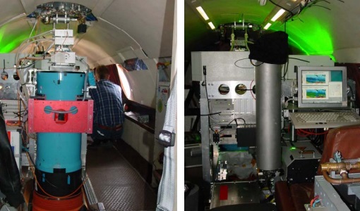
WALEX
The objective of (WALEX) was to collect valuable data to provide representative lidar measurements of water vapour and aerosol properties in different climatic zones.
Data - Campaigns (Open)
FLEXSense 2019
The FLEXSense 2019 campaign activities were undertaken in Germany and Italy with the goal of providing a complete set of high-resolution experimental data, including all relevant elements required for the preparation of the FLEX satellite mission.
Data - Campaigns (Open)
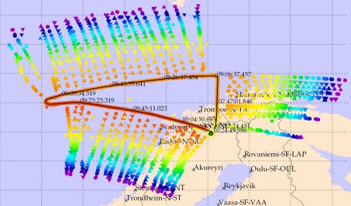
PremierEX
The campaign was based in the Arena Arctica in Kiruna (Sweden). The science campaign has addressed the science objectives and was part of the airborne campaign of the EU project RECONCILE.