- All Categories (2161)
- Data (12)
- News (19)
- Missions (16)
- Events (20)
- Tools (3)
- Activities (2)
- Documents (2089)
NEWS
Discover the latest news on the European Space Agency's Earth Observation activities. Learn all about new data availability and how ESA's missions are performing.
News - General News
 8 Apr 2024
ESA's improved Earth system data records: what is in store for the future?
Fundamental Data Records (FDRs) are instrumental in advancing our understanding of Earth systems and for addressing societal challenges effectively. These long-term records contain uncertainty-quantified, calibrated and geo-located multi-instrument/multi-platform satellite sensor data spanning several decades to support climate-related applications.
News - Data Release news
8 Mar 2024FDR4ALT - ESA unveils new cutting-edge ERS/Envisat Altimeter and Microwave Radiometer Datasets
The European Space Agency (ESA) has developed a comprehensive suite of innovative Earth system data records as part of the Fundamental Data Records for Altimetry project - FDR4ALT.
News - Operational News
 12 Feb 2024
Temporary interruption to Envisat AATSR dissemination service
A planned downtime will affect the access to the ftp dissemination server for the Envisat AATSR data during the period 13-15 February 2024.
News - Infographics
29 Jan 2024Learn more about Envisat MERIS Full Resolution Level-1 data
Learn more about the Envisat MERIS Level 1 products in our latest infographic.
News - Data Release news
5 Dec 2023MOS-1/1B MESSR and VTIR data products now available
MOS-1/1B MESSR (Multi-spectral Electronic Self-Scanning Radiometer) and VTIR (Visible and Thermal Infrared Radiometer) level 1 data products are now available via the ESA Heritage Missions Dissemination System.
News - Success Stories
 17 Jan 2023
Pléiades unlocks information about rock glaciers in central Himalaya
As climate change accelerates the melting of glacial ice, remote sensing scientists are tapping into the potential of Pléiades data to help vulnerable mountainous communities.
News - Thematic area articles
9 Dec 2022Global understanding of Earth's land surfaces greatly boosted by satellite data
ESA perform land surface monitoring with a range of instruments onboard satellites acquiring optical and radar data. Collections of data from these missions are freely available for research purposes.
News - Success Stories
 25 Aug 2022
Tracking mountainous glaciers using TanDEM-X
Ice melting from mountain glaciers is one of the largest contributors to sea-level rise outside the large ice sheets of Antarctica and Greenland. New research leveraging the vast data from the TanDEM-X mission, has successfully mapped glacial elevation change over multiple mountainous regions of the world.
News - Thematic area articles
 21 July 2022
Space helps monitor Earth’s changing biosphere
Earth’s biosphere is continually changing. Through its pioneering Earth observation missions, ESA is making critical contributions to monitor these changes and their impacts on Earth’s water and carbon cycles.
News - Thematic area articles
 30 June 2022
Transforming space data into climate action
ESA’s Earth observation activities are playing a key role in the revitalised global drive to combat climate change.
News - Events and Proceedings
 26 May 2022
Data preservation takes centre stage at Living Planet Symposium
Against the backdrop of the famed Rhine River, world-class scientists and Earth observation data-users are gathered this week in the historical city of Bonn, at the Living Planet Symposium (LPS).
News - Spotlight on EO community
 4 Mar 2022
Introducing Mirko Albani
In this short introduction, ESA's Heritage Missions Programme Manager describes what he likes most about ESA's long term archive of satellite mission data and his role in the programme.
News - Success Stories
 1 Mar 2022
How Envisat helped to shape global understanding of Earth’s systems
Twenty years have passed since a ground-breaking European spacecraft designed to deliver unprecedented insight into the planet’s changing environment was lofted into orbit.
News - Success Stories
 17 Dec 2021
Pléiades celebrates 10 years and extends satellite fleet with Pléiades Neo
ESA is proud to mark the 10-year milestone of the Pléiades programme, a forerunner in providing very high resolution (VHR) commercial satellite imagery ideal for precision mapping and in-depth intelligence.
News - Success Stories
 25 Nov 2021
COP26 fuels interest in satellite data
As COP26 stimulates action to reduce global warming, the essential role of satellite data in understanding and monitoring climate change is apparent.
News - Data Release news
 3 Aug 2021
New SMOS Level 1 Near Real Time processing baseline released
A new version of the SMOS level 1 Near Real Time processor - version 724 - was deployed in the operational ground segment on 2 August 2021.
News - Data Release news
 3 Aug 2021
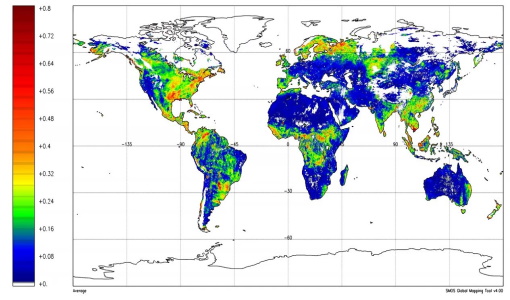
New SMOS Level 2 Near Real Time Neural Network Soil Moisture baseline is released
A new version of the SMOS level 2 Near Real Time processor - version 300 - was deployed in the operational ground segment on 2 August 2021.
News - Infographics
 3 Dec 2020
Envisat - ESA's versatile Earth observation satellite
Learn more about ESA's Envisat mission - the largest Earth observation satellite ever built - in a new infographic.
News - Success Stories
 19 May 2020
Forty years of heritage data highlight warming European lakes
In the last decade, climate change has taken centre stage in both the public and scientific arenas, as increasingly extreme weather and human impact on the environment have become more apparent.