- News & Events
- Data preservation takes centre...
Data preservation takes centre stage at Living Planet Symposium
26 May 2022
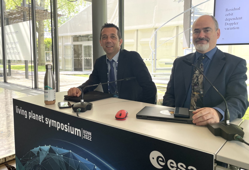
Against the backdrop of the famed Rhine River, world-class scientists and Earth observation data-users are gathered this week in the historical city of Bonn, at the Living Planet Symposium (LPS).
The vital role of long-term information on Earth’s environment was highlighted with a full day programme on Tuesday 24 May, centred on ESA’s Heritage Missions and long-term archives. The Rhinelobby room was well attended when Mirko Albani, ESA’s Heritage Missions Programme Manager, chaired a session on data archival in the Earth observation data lifecycle and three sessions exploring in detail the agency’s heritage missions data holdings and their long-term timeseries data.
Mirko Albani, says, “Heritage data are extremely important as they provide the unique capability to look back in time and understand the changes affecting our planet. ESA holds one of the largest Earth observation space data archive in the world and the Heritage Space Programme ensures that these data assets are preserved, continuously improved and kept accessible to meet evolving user needs.
“The Living Planet Symposium is an excellent forum to present the latest achievements in terms of heritage data, long-term timeseries data improvement, and their exploitation for research and operational applications.”
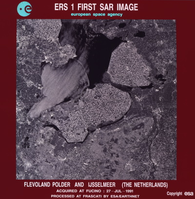
ESA’s Heritage Missions consist of remote sensing missions, which are no longer operational, such as the European Remote Sensing Satellites (ERS-1 and ERS-2), Envisat, and ESA's Gravity field and Ocean Circulation Explorer (GOCE). The preservation and delivery of data from these missions is ensured through ESA’s Heritage Space Programme, which helps meet the growing demand for long-term information on Earth.
Moreover, the programme covers ESA’s heritage data holdings acquired over Europe since the mid 70’s, from more than 40 Third Party Missions, including among others Landsat, ALOS and NOAA POES AVHRR.
The Envisat mission was launched in 2002 and remained operational for 10 years. The value and quality of the data acquired from all Envisat instruments are today continuously improved. Valorisation activities in the atmospheric domain are supported by the Envisat Validation Data Centre (EVDC). At LPS, the recent modernisation of EVDC was shared, such as the addition of a large set of new functionalities and a set of video tutorials guiding users on new tools.
Envisat and ERS were also in the fore during a talk on radar altimeter and microwave radiometer data reprocessing and fundamental data records generation. The talk shared these outcomes of the Heritage Space Programme, which will lead to the availability of improved and additional data products. Scientists applying the Doppler effect to Envisat imagery also presented their results.
The role of heritage data in facilitating cutting-edge climate-related research was also evident in many of Tuesday’s sessions. Climate Data Records (CDRs) from Earth observation are in fact generated using data from multiple satellite instruments and need to be of sufficient length to determine climate variability. Long-term stability in CDRs is essential for detecting environmental changes that demonstrate how climate is changing.
One session examined cloud detection approaches for the construction of the Land Surface Temperature Climate Change Initiative single-sensor CDR, which is comprised of data from many radiometer instruments.
Surface reflectance is one of the key products used in developing several land Essential Climate Variables, such as vegetation indices and albedo. Another presentation explored how to build consistent long-term surface reflectance data records of climate quality by combining data from different instruments on polar orbiting Earth observation satellites.
The ESA Heritage data holdings are accessible free of charge to a range of stakeholders and several types of data are available to users including, synthetic aperture radar (SAR), optical imagery, and atmospheric chemistry data.
The diversity in the Heritage Space Programme was also highlighted in the symposium sessions, such as one about ground deformation monitoring using multi-decadal SAR imagery archives and another about the unique ESA archive of 40 years old Advanced Very High Resolution Radiometer (AVHRR) data.
The symposium was also an opportunity to showcase how the agency is using state-of-the-art technologies to improve alignment of data from heritage archives with data from more recent missions, and to make these data more easily and efficiently accessible and exploitable by end users.
Learn more about Heritage Missions at ESA
Data access and user services survey
ESA is taking the opportunity of the Symposium to invite feedback on its data access and services through an online survey. Take 10 minutes to share your experience in using data, which will help improve the range and quality of the data and services offered.