- Learn & Discover
- Transforming space data into c...
Transforming space data into climate action
30 Jun 2022
ESA’s Earth observation activities are playing a key role in the revitalised global drive to combat climate change.
A growing number of scientists from around the world are using freely available data from the agency’s remote sensing archives to improve their understanding of Earth’s evolving environment.
This information is helping businesses, governments and communities to shape a greener, more sustainable future.
ESA has been helping the global community track the changes impacting the planet for decades, thanks to a succession of state-of-the-art remote sensing missions.
How is climate change monitored from space?
For decades, Earth observing satellites have been collecting data on different aspects of Earth’s system through a variety of instruments, obtaining observations that cannot be acquired from the ground.
By analysing and processing these data, scientists can reveal how Earth’s environment is evolving over long time-periods, delivering insight into the impacts and drivers of climate change.
Continuous data

These include several non-operational Heritage Missions, such as ESA’s European Remote Sensing (ERS) satellite programme.
The programme consisted of two satellites, ERS-1 and ERS-2, which were launched into the same orbit in 1991 and 1995, respectively.
ERS – the first ESA Earth observation programme dedicated to microwave spectrum-based environmental monitoring – hosted a range of instruments that delivered coverage of the land, oceans and atmosphere. ERS-1 remained active until 2000, with ERS-2 continuing to collect observations until 2011.
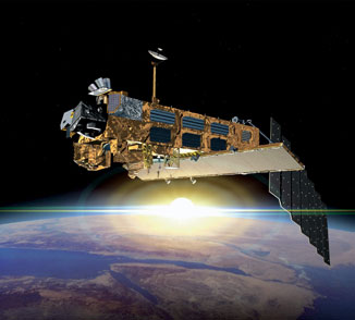
ERS was succeeded by ESA’s Envisat satellite, which became operational in 2002 and delivered 10 years of data detailing different aspects of Earth’s environment.
Envisat and ERS are contributing to global assessments completed by the Intergovernmental Panel on Climate Change (IPCC).
Last year, the IPCC published a report that detailed the intensifying impacts of climate change, including melting of the ice sheets, sea level rise, ocean warming and acidification.
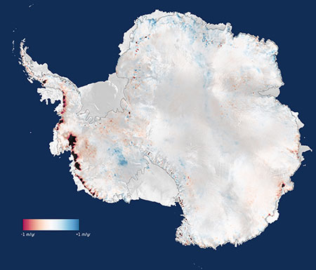
Observations from ERS and Envisat have proven critical for monitoring changes to the ice sheets, which together with glacier mass loss, are now the dominant contributors to global sea level rise.
In addition, these missions have helped to monitor many other indicators and causes of climate change, such as greenhouse gas emissions, sea surface temperature and many more.
Through ESA’s Heritage Space Programme, Heritage data are maintained, made accessible, and continuously improved, so that they can be combined with information from active missions to build continuous pictures of the environment.
How long have satellites been monitoring the environment?
Space-borne technology has now been monitoring Earth’s surface for more than 60 years, with the first satellite dedicated to gathering information on the planet’s environment launched in 1959. Since then, the Earth observation industry has grown rapidly and there are now some 1000 remote sensing satellites in orbit.
By combining high-quality data from both current and previous missions, scientists are improving their understanding of the long-term changes impacting the planet, for the benefit of society and the environment.
Exploring the climate
ESA is continuing to advance understanding of climate change through its Earth Explorers programme, which is a group of missions that investigate the complex interactions between Earth’s systems.
Launched in 2010, CryoSat was the first Earth Explorer to be selected for development.
The mission uses its SAR/Interferometric Radar Altimeter (SIRAL) to measure the thickness of polar sea ice and monitor changes in the ice sheets that blanket Greenland and Antarctica, as well as glaciers around the world.
Thanks to its novel instrument design and to its near-polar orbit, the satellite can survey regions of Antarctica that were beyond the reach of previous altimeter missions. Using these data, scientists have delivered new insight into the ice losses impacting the continent.
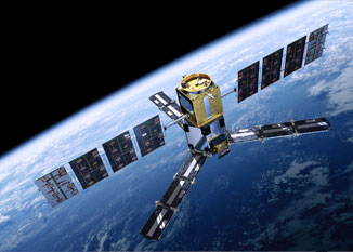
In 2009, the Soil Moisture and Ocean Salinity (SMOS) mission was launched, marking the beginning of a mission that would go well beyond its planned lifespan.
SMOS is the first satellite to use microwave L-band measurements to deliver global observations of variability in soil moisture and sea surface salinity, caused by the continuous exchange in Earth's water cycle between the oceans, the atmosphere and the land. These key geophysical parameters are vital for the development of climate change models.
International partner missions
ESA is further increasing scientists’ understanding of the climate by disseminating data collected by a number of international partner missions, through the agency’s Third Party Missions (TPM) programme.
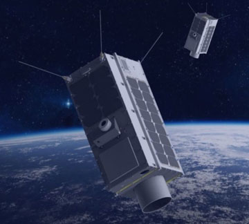
Canadian remote sensing constellation GHGSat – which became a TPM during last month’s Living Planet Symposium – can detect and quantify emissions of planet-warming emissions from point sources as small as individual oil and gas wells.
This has the potential to increase understanding of how emissions from industrial facilities contribute to climate change, as well as helping industry act to reduce these emissions.
Other greenhouse gas-monitoring missions covered by ESA’s TPM programme include SciSat-1, Odin and the GOSAT series.