- All Categories (19604)
- Data (74)
- News (75)
- Missions (47)
- Events (44)
- Tools (6)
- Activities (4)
- Campaigns (5)
- Documents (19349)
News - Success Stories

1 km resolution aerosol optical thickness retrieved from PROBA-V
The ESA SPAR@MEP project aims to deliver a long-term data record (LTDR) of aerosol optical properties and surface reflectance from SPOT-VGT and PROBA-V observations.
News - Success Stories

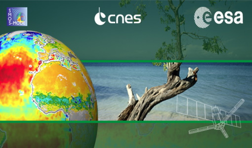
10 years of Envisat data help to illuminate ocean processes
A decade after Envisat beamed its final image to the planet, the pioneering ESA mission is continuing to foster improved understanding of Earth’s systems.
News - Data Release news

15 cm HD and 30 cm HD products added to EUSI ESA archive collections
Two new products, 15 cm HD and 30 cm HD, have been added to the collections from GeoEye-1, QuickBird-2, and WorldView (1 – 4).
Document - Proceedings

2004 Envisat and ERS Symposium
The 2004 Envisat and ERS Symposium was held in Salzburg - Austria from 6 to 10 September 2004. The 2004 Envisat and ERS Symposium provided a forum for investigators to present results of ongoing research project activities and assess the development of applications and services.
Event - Meeting

20th GHRSST Science Team Meeting
The 20th GHRSST International Science Team meeting in 2019 brought together sea surface temperature experts to look at future innovations.
Event - Training

2nd Advanced Training Course on Land Remote Sensing 2009
This 2009 advanced ESA training course focused on land remote sensing theory and applications.
Event - Training
2nd Advanced Training Course on Ocean Remote Sensing 2009
This advanced training course focused on ocean remote sensing theory and applications.
Event - Workshop

2nd CHRIS PROBA Workshop
This 2004 workshop was on the treatment of Compact High Resolution Images Spectrometer (CHRIS) data.
Event - Conference
2nd SMOS Science Conference
The conference focused on the applications of SMOS data, including operational services, the development of novel data products, the synergistic use of SMOS data with other data sources and the potential of SMOS data for the generation of long-term data sets.
Event - Training
3rd Advanced Training Course on Land Remote Sensing 2011
This 2011 advanced ESA training course focused on land remote sensing theory and applications.
Event - Conference

3rd ERS Symposium
The ESA Directorate for Observation of the Earth and its Environment held the 3rd ERS Symposium, in 1997, where many of the results from the ERS-1 and ERS-2 missions were presented and discussed by the scientific community.
Event - Meeting
3rd Sentinel-2 Validation Team Meeting
This Sentinel-2 Validation Team (S2VT) meeting was the third edition of a meeting series, initiated in 2016. The S2VT is organised under the auspices of ESA, CNES, and ENSEEIHT.
Event - Workshop
4th CHRIS PROBA Workshop
Workshop on the treatment of Compact High Resolution Images Spectrometer (CHRIS) data.
Event - Training
4th ESA EARSEL CNR School - Remote Sensing for Forest Fires
This course was to disseminate and discuss research methods and technologies of active and passive Earth Observation for applications related to forest fires.
Event - Training

9th Advanced Training Course on Land Remote Sensing
ESA organised the 9th Advanced Training Course on Land Remote Sensing with a focus on Agriculture. It took place from 16 to 20 September 2019.
Document - Technical Note

AATSR-Latitude-Dependent-Bias-Correction.pdf
This document contains calibration information for the Sea Surface Temperature readings from the AATSR instrument on Envisat.
Event - Training
Advanced Training Course in Land Remote Sensing 2012
The 2012 advanced training course focused on land remote sensing theory and applications.
Event - Training
Advanced Training Course on Ocean Remote Sensing 2006
The objective of the course was to provide first-hand information on a broad range of ocean research topics including key principles of SAR, Radar Altimetry, Ocean Colour and Sea Surface Temperature measurements, processing algorithms, data products and their use in oceanographic applications.
Event - Conference
ALOS 2008 Symposium
The 2008 Joint PI Symposium of the ALOS Data Nodesa was a forum to exchange views on technical and scientific issues on the data exploitation.
Data - EO Sign In Authentication (Open)
ALOS African Coverage ESA archive
ALOS Africa is a dataset of the best available (cloud minimal, below 10%) African coverage acquired by AVNIR-2 in OBS mode and PRISM in OB1 mode (all Backward, Nadir and Forward views, in separated products), two different collections one for each instrument. The processing level for both AVNIR-2 and PRISM products is L1B. This dataset is a subset of the main ALOS AVNIR-2 and ALOS PRISM ESA collections. ALOS AVNIR-2: https://doi.org/10.5270/AL1-d9cfa6d ALOS PRISM: https://doi.org/10.5270/AL1-5e400fd.