- Learn & Discover
- 10 years of Envisat data help ...
10 years of Envisat data help to illuminate ocean processes
09 Mar 2022
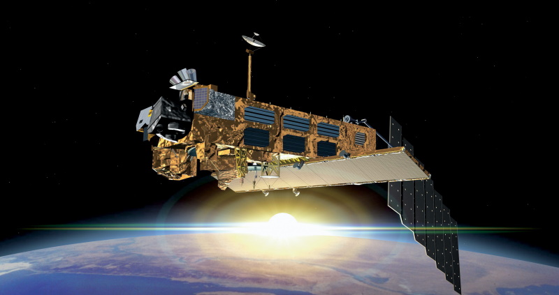
A decade after Envisat beamed its final image to the planet, the pioneering ESA mission is continuing to foster improved understanding of Earth’s systems.
European scientists are applying a phenomenon of physics called the Doppler effect to Envisat imagery with the aim of revealing sea surface wind velocity, wave intensity and the movement of ocean currents in exquisite new detail.
These high-resolution insights could support ground-breaking science in the areas of meteorology, oceanography and climatology.
Discovered some 180 years ago, the Doppler effect describes the shift in frequency of a light or sound wave, in relation to an observer that is moving relative to its source.
The phenomenon has long been used by remote sensing experts to elucidate the behaviour of the oceans [1] – and now a team of scientists at the Norwegian Meteorological Institute are building on this work by using Envisat synthetic aperture radar data (SAR) to test and develop an improved Doppler shift processing method.
SAR uses a moving antenna that beams out radio waves to create high resolution images of Earth’s surface.
When a space-borne antenna emits this radiation, an area of the planet is illuminated called the radar footprint. In theory, if Earth’s surface is static, the Doppler shift at the centre of the footprint should be zero.
However, movement of the surface results in changes to the Doppler shift – and it is this information that helps scientists generate insights about ocean processes.
Due to the lack of precise information on antenna pointing, these Doppler measurements need to be calibrated. Thanks to Envisat’s stable orbit and attitude, the scientists are using land coverage data in the SAR acquisitions to calibrate the initial Doppler shift derived from the spacecraft’s best-known position, as well as the orientation of its antenna.
The team has already made progress in enhancing the accuracy and resolution of the improved reprocessing method.
As part of the next phase of the research, scientists will further optimise the method so that it can distinguish between ocean currents and waves. These data, in turn, could then be used to derive high-resolution information about ocean surface wind speeds.
Once refined, the new reprocessing system could be applied to data from other Earth observation missions – including the Copernicus Sentinels – resulting in the development of a global time-series of ocean processes that meets the needs of the user community.
There are numerous possible applications for research, including studies on mesoscale ocean circulation, high-resolution wind retrieval and ocean circulation climatologies – and this potential has been demonstrated in several previous studies.
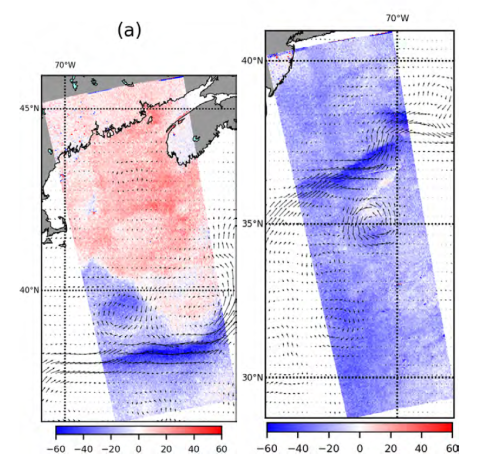
In 2014, for example, a team of French, Norwegian and South African researchers used Doppler-derived ocean surface velocities to monitor the Agulhas Current, a surface oceanic current that forms the western boundary current of the southern Indian Ocean [2].
The project yielded promising results; highlighting the potential, that Doppler-based ocean surface velocity retrieval has for improving understanding of ocean systems.
Morten Hansen, Senior Scientist at the Norwegian Meteorological Institute, says, “We aim to process 10 years of global range Doppler velocity estimates from Envisat ASAR and make the results openly available to the user community. The uncertainties of our new data retrievals are about half that of the previous results from Envisat.
“This helps to provide an even better potential for reuse and application than the previous more limited dataset from 2007-2012, and not least it will provide a significant contribution to a long-term timeseries of surface velocity estimates from SAR.”
Mirko Albani, Heritage Missions Manager at ESA, says, “This exciting activity is another great example of how non-operational heritage missions can facilitate cutting-edge research – and I look forward to seeing results of the project.
“Envisat data are maintained, made accessible, and continuously improved as part of ESA’s Heritage Space Programme with the goal of maximising the usability of the agency’s heritage data archives to enable ground-breaking science, benefiting society and the environment.”
References
[1] A. A. Mouche et al., "On the Use of Doppler Shift for Sea Surface Wind Retrieval From SAR," in IEEE Transactions on Geoscience and Remote Sensing, vol. 50, no. 7, pp. 2901-2909, July 2012, doi: 10.1109/TGRS.2011.2174998.
[2] Johannessen J., Chapron B., Collard F., Backeberg B. (2014) Use of SAR data to Monitor the Greater Agulhas Current. In: Barale V., Gade M. (eds) Remote Sensing of the African Seas. Springer, Dordrecht