- All Categories (213)
- Data (1)
- News (13)
- Missions (1)
- Events (6)
- Tools (3)
- Activities (1)
- Campaigns (3)
- Documents (185)
News - Operational News
Transition from FTP to FTPS for SMOS, Aeolus and Campaign data dissemination systems
As of 15 April 2024 access to the SMOS, Aeolus and Campaign data will be changed from simple FTP to FTPS.
News - Thematic area articles
Space data support Earth’s ecosystems
ESA’s Earth observation (EO) missions are making a critical contribution to monitoring transformations in our planet’s ecosystems, helping track changes in the vegetation, soil, and ocean that affect these systems.
News - Spotlight on EO community
Introducing the Biomass and SMOS Mission Manager
In this video, Klaus Scipal describes his role as Mission Manager of Biomass and SMOS, and what he enjoys about his involvement with these dedicated science missions.
News - General News
ESA's excellent Earth Explorer missions extended to 2025
Since 2009, ESA’s Earth Explorer missions have pioneered breakthrough technologies and transformed our understanding of Earth’s system, from its core to the outer stretches of the atmosphere.
News - Data Release news
New version of the SMOS-CryoSat level 4 sea ice thickness product is now available
The new version 205 of the merged SMOS-CryoSat level 4 sea ice thickness product is now available on the SMOS dissemination service
News - Thematic area articles
Global understanding of Earth's land surfaces greatly boosted by satellite data
ESA perform land surface monitoring with a range of instruments onboard satellites acquiring optical and radar data. Collections of data from these missions are freely available for research purposes.
News - Thematic area articles

Satellites reveal changes to Earth’s icy zones
ESA’s Earth observation activities are helping scientists investigate the influence of climate change on widespread ice-losses across the planet.
Event - Training

EO Summer School 4
ESA's series of summer schools, on Monitoring of the Earth System, aims to promote the exploitation of Earth observation data.
Event - Training
EO Summer School 3
ESA's series of summer schools, on Monitoring of the Earth System, aims to promote the exploitation of Earth observation data.
News - Thematic area articles

Transforming space data into climate action
ESA’s Earth observation activities are playing a key role in the revitalised global drive to combat climate change.
News - Thematic area articles

Satellite data central to ocean monitoring
Over 95% of Earth’s water is found in our oceans, and yet sadly, oceans are under stress from climate change and pollution. Monitoring our oceans is vital for Earth’s survival and satellites are the primary means of long-term and independent observation of our vast ocean bodies and their associated coastal zones.
News - Data Release news

SMOS L2 Sea Surface Salinity products documentation updates
SMOS L2 Sea Surface Salinity product validation report is now available.
News - General News

Updated SMOS documentation available
Updated versions of several SMOS data documents are now available.
Activity - Projects
Dragon 2 Cooperation Programme
The Dragon 2 Programme focussed on the exploitation of ESA, ESA's Third Party Missions and Chinese Earth observation data for science and applications development in land, ocean and atmospheric applications.
Tools - Other

Polar TEP
The Polar Thematic Exploitation Platform (TEP) enables access, processing, uploading, visualisation, manipulation and comparison of data over the polar regions.
Event - Training

3rd Advanced Training Course on Ocean Remote Sensing 2013
The 3rd Advanced Training Course on Ocean Remote Sensing was held from 23 to 27 September 2013 in Cork, at the National Maritime College of Ireland.
Mission - Earth Explorers

SMOS
The Soil Moisture and Ocean Salinity (SMOS) mission is dedicated to making global observations of soil moisture over land and salinity over oceans.
Data - Campaigns (Open)
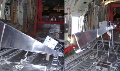
LOSAC
The L-band Ocean Salinity Airborne Campaign (LOSAC) objective is to understand the nature of the wind driven signatures in order to evaluate if corrections are necessary prior to salinity estimations based on the radiometer signals.
Campaign

DOMEX-1
The purpose of the DOMEX experiment was to acquire the first combined, in-situ microwave emission measurements using C- and L-band radiometers.
Campaign
LOSAC
The L-band Ocean Salinity Airborne Campaign (LOSAC) objective is to understand the nature of the wind driven signatures in order to evaluate if corrections are necessary prior to salinity estimations based on the radiometer signals.