- All Categories (63)
- Data (22)
- News (14)
- Missions (3)
- Events (11)
- Tools (2)
- Activities (5)
- Campaigns (4)
- Documents (2)
Event - Conference

3rd ERS Symposium
The ESA Directorate for Observation of the Earth and its Environment held the 3rd ERS Symposium, in 1997, where many of the results from the ERS-1 and ERS-2 missions were presented and discussed by the scientific community.
Event - Workshop

Applications of the ERS Along Track Scanning Radiometer Workshop 1999
The workshop on ERS mission's Along Track Scanning Radiometer (ATSR) instrument gathered researchers and specialists working on different applications of the mission.
Event - Workshop
CEOS-IVOS Workshop on Inter-comparison of Large Scale Optical and Infrared Sensors
The 2004 workshop was an opportunity to present and exchange experiences and knowledge from work on inter-comparing large scale optical sensors at different product levels.
Event - Conference
15 Years of Progress in Radar Altimetry Symposium
A Symposium on "15 Years of Progress in Radar Altimetry" and the annual meeting of the Ocean Surface Topography Science Team, the International Doris Service Workshop and the ARGO Workshop.
Event - Training

Advanced Training Course on Ocean Remote Sensing 2006
The objective of the course was to provide first-hand information on a broad range of ocean research topics including key principles of SAR, Radar Altimetry, Ocean Colour and Sea Surface Temperature measurements, processing algorithms, data products and their use in oceanographic applications.
News - General News

Satellite Radar Altimetry: past and future
Satellite radar altimetry measurements yield a wealth of information that can be used for a wide range of applications.
Campaign
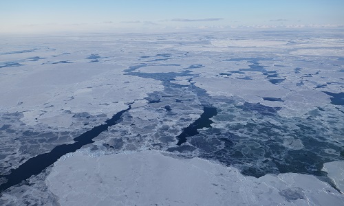
CIMREx
CIMREx airborne campaign aimed to sample the sea ice microwave emissions from various sea ice regimes around Svalbard and Greenland.
Campaign

AirScatterGNSS
In this project an Airborne Wind Vector Scatterometer (AWVS) system was designed and built for measurements of sea surface backscattering from an aircraft.
Campaign
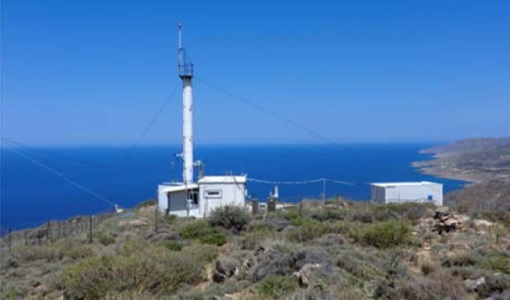
CHARADMexp
The ESA CHARADMExp campaign focuses on marine and marine-dust aerosol mixture characterisation.
Campaign
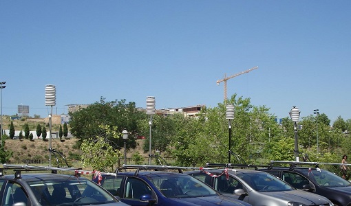
DESIREX 2008
DESIREX 2008 (Dual-use European Security IR Experiment 2008) was conceived as an experimental campaign in the city of Madrid (Spain).
Data - Campaigns (Open)
AirScatterGNSS
In this project an Airborne Wind Vector Scatterometer (AWVS) system was designed and built for measurements of sea surface backscattering from an aircraft.
Mission - Heritage Missions

Envisat
Envisat was ESA's successor to ERS. Envisat carried ten instruments aboard for a wide range of Earth observing fields. The mission was operational from 2002 to 2012.
Mission - Earth Explorers

Aeolus
The Aeolus mission which was launched into space on 22 August 2018 and was retired on 30 April 2023, provided global observations of wind profiles from space to improve the quality of weather forecasts, and to advance our understanding of atmospheric dynamics and climate processes.
Data - EO Sign In Authentication (Open)
Envisat ASAR WS Single Look Complex L1 [ASA_WSS_1P]
The Level-1B data product offered by ESA from the ASAR Wide-Swath Mode (WS) is a multi-look detected product, ASA_WSM_1P, intended to support applications that exploit intensity data. In order to support the development of new applications with the ASAR ScanSAR data, a WSM product providing phase information has been developed and implemented in the ESA ASAR processor - the Wide-Swath Single-Look complex product (ASA_WSS_1P). This product is mainly used for INSAR applications based either on wide-swath/wide-swath pairs or wide-swath/image mode pairs, applications of ocean current mapping, large-area ocean wave retrievals and atmospheric water vapour characterisation. It is important to mention that the standard ESA WSS product is based on the prototype WSS processor developed by Polimi/Poliba, which has also been used to generate prototype products for testing potential and preparing the exploitation of the WSS product. The ESA ASA_WSS_1P product is available as a standard Envisat ASAR product. The ASA_WSS_1P product format is slightly different from other ASAR products since: There are 5 different MDSs, one per sub-swath A "Doppler Grid" ADS has been included to support ocean current mapping applications There are 5 records in the MPP ADS, one per sub-swath There are 5 records in the SQ ADS, one per sub-swath. Other key characteristics of the ASA_WSS_1P product are summarised below: Processing is fully phase preserving Data in the MDSs is sampled in a common grid both in range and in azimuth Standard product is 60 sec long with 80 m az. pixel spacing Auxiliary timeline information has been added in the Main Processing Parameters ADS Elevation antenna pattern correction is applied by default (although the product is a single-look complex). Spatial Resolution: Approximately 8 m slant range x 80 m azimuth.
Data - Fast Registration with immediate access (Open)
GOME Total Column Water Vapour Climate product
The GOME Total Column Water Vapour (TCWV) Climate product was generated by the Max Planck Institute for Chemistry (MPIC), and the German Aerospace Center (DLR) within the ESA GOME-Evolution project. It is a Level 3 type product containing homogenized time-series of the global distribution of TCWV spanning over more than two decades (1995-2015). The data is provided as single netCDF file, containing monthly mean TCWV (units kg/m2) with 1-degree resolution, and is based on measurements from the satellite instruments ERS-2 GOME, Envisat SCIAMACHY, and MetOp-A GOME-2. Details are available in the paper by Beirle et al, 2018. Please also consult the GOME TCWV Product Quality Readme file before using the data.
Data - Fast Registration with immediate access (Open)
ERS-2 GOME Total Column Amount of Trace Gases Product
GOME Level 2 products were generated by DLR on behalf of the European Space Agency, and are the end result of the Level 1 to 2 reprocessing campaign of GOME Level 1 version 4 data with Level 2 GOME Data Processor (GDP) version 5.0 (HDF-5 format). The GOME Level 2 data product comprises the product header, total column densities of ozone and nitrogen dioxide and their associated errors, cloud properties and selected geo-location information, diagnostics from the Level 1 to 2 algorithms and a small amount of statistical information.
Data - Fast Registration with immediate access (Open)
Envisat ASAR Wave Imagette Cross Spectra L1 [ASA_WVS_1P]
The ASAR Wave product is extracted from the combined SLC and Cross Spectra product, ASA_WVI_1P, which is generated from data collected when the instrument was in Wave Mode using the Cross Spectra methodology. The product is meant for Meteo users. The spatial coverage is up to 20 spectra acquired every 100 km, with a minimum coverage of 5km x 5km. The file size has a maximum of 0.2 Mbytes. Auxiliary data include Orbit state vector, Time correlation parameters, Wave Processing parameters ADS, Wave Geolocation ADS, SQ ADS. The product provides a continuation of the ERS-SAR wave mode data. Output: Wavelength range from 20 to 1000 m in 24 logarithmic steps.
Data - Fast Registration with immediate access (Open)
ERS-2 GOME Spectral Product L1
GOME Level 1 products contain Earthshine radiance at the Top of the Atmosphere and solar irradiance spectra. They were generated by DLR on behalf of the European Space Agency with Level 1 GOME Data Processor (GDP-L1) starting from the Extracted GOME Calibration (EGOC) Level 0 data files. Originally raw detector signals (binary Analog to Digital Converted units) of the science measurements plus calibration constants were provided (dataset version 4 and lower), but following the end of the operational phase of the ERS-2 mission (2 July 2011), as part of ESA's post-operational algorithm improvement activities (Coldewey-Egbers et al., 2018), the GOME Level 1 data type was entirely revised and a dataset of fully calibrated and ready to use data was generated with GOME processor version 5.1. The version 5.1 data bring relevant quality improvements for the revised calibration approach, compensating aging and instrument degradation, and provide enhanced accessibility. The version 5.1 data are in NetCDF format and differ fundamentally from the previous GOME Level 1 data, having the Envisat proprietary format and basically containing Level 1a data where a dedicated extraction software tool had to be applied by end user to obtain spectrally and radiometrically calibrated radiances (including the correction for polarisation, leakage current and stray light). Such calibrations are now applied to the version 5.1 L1b data product in the standard processing. Users of GOME Level 1 products are strongly recommended to migrate to the latest reprocessed dataset. Please consult the GOME Product Quality Readme file before using the data.
Data - Project Proposal (Restrained)
IRS-1C/1D Full archive
The following products are available: PAN: Panchromatic, resolution 5 m, Coverage 70 km x 70 km, radiometrically and ortho (DN) corrected, LISS-III: Multi-spectral, resolution 25 m, Coverage 140 km x 140 km, radiometrically and ortho (DN) corrected (ortho delivered without Band 5) WiFS: Multi-spectral, resolution 180 m, Coverage 800 km x 800 km, radiometrically and ortho (DN) corrected. Sensor Type Resolution (m) Coverage (km x km) System or radiometrically corrected Ortho corrected (DN) Global archive PAN Panchromatic 5 70 x 70 X X 1996 – 2007 (IRS-1C) 1998 – 2009 (IRS-1D) LISS-III Multi-spectral 25 140 x 140 X X (without band 5) WiFS Multi-spectral 180 800 km x 800 km X X Note: Whether system corrected or radiometrically corrected products are available depends on sensor and processing centre For PAN and LISS-III ortho corrected: If unavailable, user has to supply ground control information and DEM in suitable quality For WiFS ortho corrected: service based on in house available ground control information and DEM.
Data - EO Sign In Authentication (Open)
IRS-1C/1D European coverage
IRS-1C/1D dataset is composed of products generated by the Indian Remote Sensing (IRS) Satellites 1C/1D PAN sensor. The products, acquired from 1996 to 2004 over Europe, are radiometrically and ortho corrected level 1 black and white images at 5 metre resolution and cover an area of up to 70 x 70 km. Sensor Type Resolution (m) Coverage (km x km) System or radiometrically corrected Ortho corrected (DN) Acquisition in Neustrelitz PAN Panchromatic 5 70 x 70 X X 1996 - 2004 IRS-1C/1D PAN data coverage of Europe acquired between 1996 to 1998. Copyright: 2015 GAF AG IRS-1C/1D PAN data coverage of Europe acquired between 1999 to 2001. Copyright: 2015 GAF AG IRS-1C/1D PAN data coverage of Europe acquired between 2002 to 2004. Copyright: 2015 GAF AG Spatial coverage: Check the spatial coverage of the collection on a map available on the Third Party Missions Dissemination Service.