- All Categories (24)
- Data (5)
- News (9)
- Missions (2)
- Events (4)
- Tools (3)
- Activities (1)
News - Data Release news
FDR4ALT - ESA unveils new cutting-edge ERS/Envisat Altimeter and Microwave Radiometer Datasets
The European Space Agency (ESA) has developed a comprehensive suite of innovative Earth system data records as part of the Fundamental Data Records for Altimetry project - FDR4ALT.
News - Success Stories
Drones join the campaign to validate Aeolus data
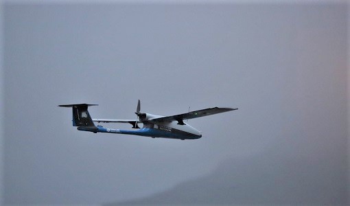
In June and September 2022, the Askos component of the Joint Aeolus Tropical Atlantic Campaign (JATAC), organised by ESA and its international partners, was expanded with new ground-based, drone and radiosonde measurements. The main objective of this campaign was to calibrate and validate Aeolus satellite observations.
Activity - General activities
EO Summer Schools
ESA's series of summer schools, on Monitoring of the Earth System, aims to promote the exploitation of Earth observation (EO) data.
News - Success Stories
Heritage data trains neural networks to detect urban sprawl
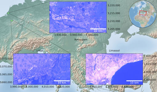
Using data from non-operational ESA remote sensing missions, researchers have trained a network of artificial neurons to recognise how cities change over decades. They hope this will help city planners reduce the impact that urbanisation has on the environment.
News - Events and Proceedings
Data preservation takes centre stage at Living Planet Symposium
Against the backdrop of the famed Rhine River, world-class scientists and Earth observation data-users are gathered this week in the historical city of Bonn, at the Living Planet Symposium (LPS).
News - Thematic area articles
Space data help to unravel the complexities of Earth’s atmosphere
As the impacts of the climate crisis intensify, scientists are using ESA’s Earth observation archives to investigate atmospheric processes and their influences on the planet’s changing environment.
News - Events and Proceedings
Exploring the prevailing achievements and future directions of Aeolus
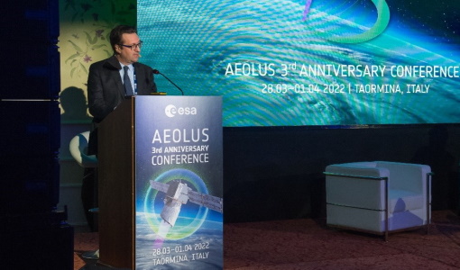
A tight-knit community of European remote sensing experts converged on the Italian island of Sicily last month to discuss how the strong success of ESA’s Aeolus mission is shaping scientists’ understanding of the winds that sweep across the planet.
Tools - Processing
Aeolus VRE
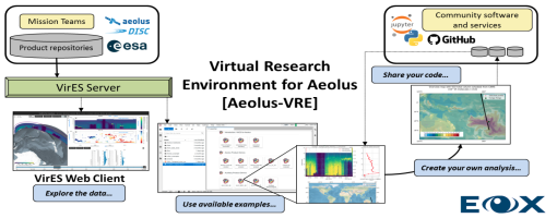
The Aeolus Virtual Research Environment (VRE) is the latest extension to the VirES for Aeolus service, which offers more direct and in-depth data exploitation of the Aeolus mission. The VRE is a cloud service that provides a web-based development environment in the form of a JupyterLab workspace.
News - General News
Launch of Aeolus VRE
The Aeolus Virtual Research Environment (VRE) is a cloud service, which provides users with a web-based development environment in the form of a JupyterLab workspace.
News - Success Stories
Dust aerosol campaign validates Aeolus data
Prepared, implemented and executed by a consortium of French universities and research institutions, under the umbrella of the French Space Agency (CNES) and the French National Centre for Scientific Research (CNRS), the Clouds-Atmospheric Dynamics–Dust Interactions in West Africa (CADDIWA) campaign took place on Sal Island in Cape Verde, from 6 to 25 September 2021.
Tools - Apps
Heritage Missions app for iOS
Download the Heritage Missions application to discover what the missions were about, how it worked and what the elements of the space and ground segment that make these missions unique.
Tools - Apps
Heritage Missions app for Android
Download the Heritage Missions application to discover what the missions were about, how it worked and what the elements of the space and ground segment that make these missions unique.
Data - Announcement of Opportunity (Restrained)
Announcement of Opportunity for Aeolus Cal/Val
An Announcement of Opportunity call is open for the Aeolus mission. Scientists, new groups and individuals are invited to participate in Aeolus Cal/Val throughout the mission lifetime.
News - Success Stories
COVID-19: Aeolus and weather forecasts
The drop in commercial flights has led to fewer measurements for weather forecasts, but fortunately, ESA’s Aeolus satellite mission is helping to fill the gap.
Data - EO Sign In Authentication (Open)
ERS-1/2 SAR IM Single Look Complex L1 [SAR_IMS_1P]
The SAR SLC product is a single look complex acquired in Image Mode. It is a digital image, with slant range and phase preserved, generated from raw SAR data using up-to-date auxiliary parameters. The products are intended for use in SAR quality assessment, calibration and interferometric applications. A minimum number of corrections and interpolations are performed on the data. Absolute calibration parameters (when available) are provided in the product annotation. Product characteristics: Pixel size: 8 m (range - across track) x 4 m (azimuth - along track – varying slightly depending on acquisition Pulse Repetition Frequency) Scene area: 100 km (range) x at least 102.5 km (azimuth) Scene size: 5000 samples (range) x at least 30000 lines (azimuth) Pixel depth: 32 bits signed integer (16 bits I, 16 bits Q) Total product volume: 575 MB Projection: Slant range- Number of looks: 1.
Data - Data Service Request (Restrained)
ERS-1/2 SAR IM L0 [SAR_IM__0P]
This SAR Level 0 product is acquired in Image Mode. The products consist of the SAR telemetry data and are supplied as standard scenes. It also contains all the required auxiliary data necessary for data processing. The product serves two main purposes: For testing ERS SAR processors independently from the HDDR system For users interested in full SAR data processing. Product characteristics: Scene area: 100 km (range - across track) x full segment length (azimuth - along track) Scene size: 5616 samples (range) x full segment length (azimuth) Pixel depth: 10 bits signed integer (5 bits I, 5 bits Q) Projection: Slant range.
Data - EO Sign In Authentication (Open)
ERS-1/2 SAR IM Precision L1 [SAR_IMP_1P]
The SAR Precision product is a multi-look (speckle-reduced), ground range image acquired in Image Mode. This product type is most applicable to users interested in remote sensing applications, but is also suitable for calibration purposes. The products are calibrated and corrected for the SAR antenna pattern and range-spreading loss. Radar backscatter can be derived from the products for geophysical modelling, but no correction is applied for terrain-induced radiometric effects. The images are not geocoded, and terrain distortion (foreshortening and layover) has not been removed. The numbering sequence relates to the satellite position and therefore differs between Ascending and Descending scenes. Product characteristics: Pixel size: 12.5 m (range - across track) x 12.5 m (azimuth - along track) Scene area: 100 km (range) x at least 102.5 km (azimuth) Scene size: 8000 pixels range x at least 8200 lines (azimuth) Pixel depth: 16 bits unsigned integer Total product volume: 125 MB Projection: Ground-range Number of looks: 3.
Data - EO Sign In Authentication (Open)
ERS-1/2 SAR IM Medium Resolution L1 [SAR_IMM_1P]
This ERS Medium Resolution stripline product is generated from the Image Mode Level 0 Product. Stripline image products contain image data for an entire segment, up to a maximum size of 10 minutes per product for IM mode. The processor concatenates together several sub-images called "slices" that were processed separately on a dataset-by-dataset basis in order to form the entire stripline image. The product is processed to an approximately 150 m x 150 m resolution and has a radiometric resolution that is good enough for ice applications. This product has a lower spatial resolution than the SAR_IMP_1P and SAR_IMS_1P products. Product Characteristics: Pixel size: 5 m (ground range – across track) x 75 m (azimuth – along track) Scene area: 100 km (range) x at least 102.5 km Scene Size: 1300 pixels (range) x at least 1350 lines (azimuth) Pixel depth: 16 bits unsigned integer- Total product volume: at least 3.5 MB Projection: Ground-range Number of looks: 8 (azimuth) x 7 (range).
Mission - Earth Explorers
Aeolus
The Aeolus mission which was launched into space on 22 August 2018 and was retired on 30 April 2023, provided global observations of wind profiles from space to improve the quality of weather forecasts, and to advance our understanding of atmospheric dynamics and climate processes.
Mission - Heritage Missions
ERS
The ERS programme was composed of two missions, ERS-1 and ERS-2, which together observed the Earth for 20 years, from 1991 to 2011.


