- All Categories (55)
- Data (9)
- News (6)
- Missions (1)
- Events (12)
- Tools (1)
- Campaigns (3)
- Documents (23)
Mission - Heritage Missions
MOS-1/1B
MOS-1 and 1B, Japan’s first marine observation satellites, were designed to monitor ocean currents, sea surface temperature, atmospheric water vapour, ocean chlorophyll levels, precipitation, and land vegetation.
Event - Conference
International Symposium on Sea Ice 2023
The International Glaciological Society, the Alfred-Wegener-Institute, Helmholtz-Zentrum für Polar- und Meeresforschung, and the University of Bremen jointly organize the symposium which will be held in Bremerhaven, Germany from 4 to 9 June 2023.
News - Thematic area articles
Monitoring water on Earth's surface
ESA's Earth observation satellites are playing a leading role in furthering our understanding of how Earth's terrestrial hydrosphere is being influenced by humankind.
Data - Data Description
Envisat AATSR L1B Brightness Temperature/Radiance [ENV_AT_1_RBT]
- AATSR Full Resolution land and ocean cover image of the Iberian Peninsula from 28 October 2006 AATSR Full Resolution land cover image of the Iberian Peninsula from 28 October 2006. The Envisat AATSR Level 1B Brightness Temperature/Radiance product (RBT) contains top of atmosphere (TOA) brightness temperature (BT) values for the infra-red channels and radiance values for the visible channels, on a 1-km pixel grid. Values for each channel and for the nadir and oblique views occupy separate NetCDF files within the Sentinel-SAFE format, along with associated uncertainty estimates. Additional files contain cloud flags, land and water masks, and confidence flags for each image pixel, as well as instrument and ancillary meteorological information. This AATSR product [ENV_AT_1_RBT] in NetCDF format stemming from the 4th AATSR reprocessing, is a continuation of ERS ATSR data and a precursor of Sentinel-3 SLSTR data. It has replaced the former L1B product [ATS_TOA_1P] in Envisat format from the 3rd reprocessing. Users with Envisat-format products are recommended to move to the new Sentinel-SAFE like/NetCDF format products. The 4th reprocessing of Envisat AATSR data was completed in 2022; the processing updates that have been put in place and the expected scientific improvements have been outlined in full in the User Documentation for (A)ATSR 4th Reprocessing Products.
Document - Product Readme Note

SMOS-Wind-Data-Service-Read-Me-First-Note.pdf
A Read Me First Note for the SMOS Wind Data Service (SMOS Near Real Time Sea Surface Wind Speed Processor)
News - Data Release news
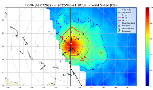
Minor Update for the SMOS Near Real Time Sea Surface Wind Speed Processor
An updated version of the SMOS Near Real Time Sea Surface Wind Speed Processor - Version 302 - was released on the 23 November 2022.
News - Success Stories

Robust airborne radar instrument aids CryoSat ice data
During the 12 years that ESA’s ice mission – CryoSat – has been monitoring Earth’s ice masses from space, simultaneous airborne measurements were made by ASIRAS.
Event - Training

EO Summer School 6
ESA's series of summer schools, on Monitoring of the Earth System, aims to promote the exploitation of Earth observation data.
Event - Training
EO Summer School 5
ESA's series of summer schools, on Monitoring of the Earth System, aims to promote the exploitation of Earth observation data.
Event - Training
EO Summer School 3
ESA's series of summer schools, on Monitoring of the Earth System, aims to promote the exploitation of Earth observation data.
News - Thematic area articles

Satellite data central to ocean monitoring
Over 95% of Earth’s water is found in our oceans, and yet sadly, oceans are under stress from climate change and pollution. Monitoring our oceans is vital for Earth’s survival and satellites are the primary means of long-term and independent observation of our vast ocean bodies and their associated coastal zones.
Document - Product Document

L2OSv700_release_note_20220321.pdf
This note summarises the quality of the SMOS Level 2 Sea Surface Salinity data products generated by version 7 of the Level 2 Processor.
News - Success Stories

10 years of Envisat data help to illuminate ocean processes
A decade after Envisat beamed its final image to the planet, the pioneering ESA mission is continuing to foster improved understanding of Earth’s systems.
Event - Workshop

SEASAR 2008
The "Advances in SAR Oceanography from Envisat and ERS missions" was a thematic workshop on SAR remote sensing techniques for oceanography.
Event - Workshop
Space and the Arctic 2009 Workshop
Temperatures in the Arctic are rising at an unprecedented rate. This workshop looked at the needs and challenges of working and living in the rapidly changing Arctic and explore how space-based services might help to meet those needs.
Event - Training
2nd Advanced Training Course on Ocean Remote Sensing 2009
This advanced training course focused on ocean remote sensing theory and applications.
Document - Product Document
SMOS-Level-2-Sea-Surface-Salinity-release-note-v700.pdf
This note summarises the quality of the SMOS Level 2 Sea Surface Salinity data products generated by version 7 of the Level 2 Processor.
Tools - Processing

SMOS Artificial Scene Library (ASL)
The ASL function allows users to directly use the L1B product version 7 by mimicking the Gibbs-2 image reconstruction correction algorithm as it is implemented in the level 1 operational processor.
Data - EO Sign In Authentication (Open)
AVHRR Level-1B Local Area Coverage Imagery
This collection is composed of AVHRR L1B products (1.1 km) reprocessed from the NOAA POES and Metop AVHRR sensors data acquired at the University of Dundee and University of Bern ground stations and from the ESA and University of Bern data historical archive. The product format is the NOAA AVHRR Level 1B that combines the AVHRR data from the HRPT stream with ancillary information like Earth location and calibration data which can be applied by the user. Other appended parameters are time codes, quality indicators, solar and satellite angles and telemetry. Two data collections cover Europe and the neighbouring regions in the period of 1 January 1981 to 31 December 2020 and the acquired data in the context of the 1-KM project in the ‘90s. During the early 1990’s various groups, including the International Geosphere-Biosphere Programme (IGBP), the Commission of the European Communities (CEC), the Moderate Resolution Imaging Spectrometer (MODIS) Science Team and ESA concluded that a global land 1 KM AVHRR data set would have been crucial to study and develop algorithms for several land products for the Earth Observing System. USGS, NOAA, ESA and other non-U.S. AVHRR receiving stations endorsed the initiative to collect a global land 1-km multi-temporal AVHRR data set over all land surfaces using NOAA's TIROS "afternoon" polar-orbiting satellite. On 1 April 1992, the project officially began up to the end of 1999 with the utilisation of 23 stations worldwide plus the NOAA local area coverage (LAC) on-board recorders. The global land 1-km AVHRR dataset is composed of 5 channels, raw AVHRR dataset at 1.1 km resolution from the NOAA-11 and NOAA-14 satellites covering land surfaces, inland water and coastal areas. Global Land 1 km AVHRR Data Set Project HRPT Ground Station Network (as of 1 April 1992) and Acquisition Areas for LAC Recorded Data Spatial coverage: Check the spatial coverage of the collection on a map available on the Third Party Missions Dissemination Service: AVHRR L1B 1.1 KM AVHRR L1B LAC Out-of-Europe.
News - Data Release news
New SMOS sea surface wind speed products now available
The SMOS Wind Data Service provides, in near real time (NRT), surface wind speed over the ocean derived from the brightness temperature measurements of SMOS.