- News
- Robust airborne radar instrume...
Robust airborne radar instrument aids CryoSat ice data
22 Nov 2022
During the 12 years that ESA’s ice mission – CryoSat – has been monitoring Earth’s ice masses from space, simultaneous airborne measurements were made by ASIRAS.
This resilient radar instrument helped improve CryoSat data with frequent airborne campaigns over the polar regions during its 15-year lifetime.
Changes in Earth’s polar ice are a key indicator of climate change. Satellite data from CryoSat – which is part of ESA’s Earth Explorer programme – have contributed to numerous scientific publications.
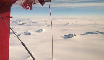
From an altitude of about 720 kilometres, the satellite’s altimeter – the Synthetic Aperture Interferometric Radar Altimeter (SIRAL) delivers insight into small changes in the thickness of floating sea ice in the polar regions and the thickness of the polar ice sheets.
However, using space-borne instruments to perform such precise measurements of polar ice is prone to error. The altimeter sends out a radar pulse and times how long it takes to receive back these radar waves as they are reflected from the polar surface.
If the properties of snow and ice change, for example due to seasonal fluctuations, this can impact the reflected radar wave and cause errors in the data.
Validation of the data through airborne campaigns helps reduce errors associated with transforming these radar measurements into geophysical quantities of interest, such as ice thickness.
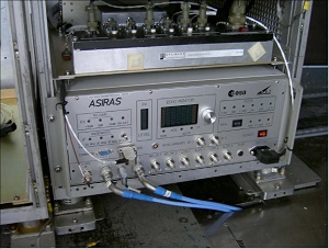
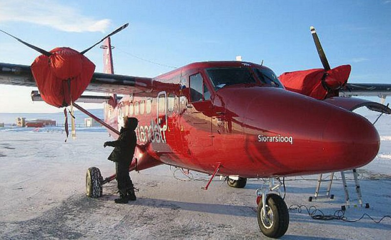
ESA’s Airborne SAR Interferometric Radar System (ASIRAS) was designed to mimic the characteristics of the altimeter onboard CryoSat – in effect acting as a CryoSat airborne simulator.
It was first flown during the CryoVex 2004 field calibration/validation campaign, before the actual launch of Cryosat-2.
“ASIRAS’ biggest achievement has been its ability to resolve internal annual layers in the dry-snow zone of Greenland, something that had never been done before,” says ESA’s campaign scientist, Tânia Casal.
“Thanks to the validation campaigns with ASIRAS, scientists have been able to quantify the magnitude of some the error sources in CryoSat data to achieve accurate measurements of sea ice thickness. This also led to the understanding that one of the most relevant error is the snow depth, which needs to be accurately computed.”
ASIRAS was used in yearly, intense airborne campaigns – flying thousands of kilometres over the poles - and only in the latter stages of its lifetime did this sturdy radar instrument prove challenging to maintain.
Finally, the instrument retired after the 2019 CryoVEx (CryoSat Validation Experiment) campaign in the Arctic. Datasets from the CryoVEx activities in the Spring and Summer of 2019 have recently been released.
“ASIRAS was an integral part of the success of the campaigns,” explains Casal. “The instruments resilience for 15 years was impressive,
especially as it operated in the challenging environments of the polar regions, under icy temperatures and high winds. The datasets it provided are still proving invaluable for scientific advances in polar ice measurements.”Now that ASIRAS is retired, there is the need for a new airborne system to support the upcoming Copernicus Polar Ice and Snow Topography Altimeter – CRISTAL.
With this in mind, ESA has issued a new invitation for tender for the CRISTAL Airborne Demonstrator (CRISTALair). CRISTALair is expected to support the pre-launch, and post-launch activities of CRISTAL and will hopefully prove to be a spectacular a radar as ASIRAS.