- All Categories (62)
- Data (16)
- News (16)
- Missions (4)
- Events (12)
- Tools (1)
- Campaigns (1)
- Documents (12)
News - Events and Proceedings
EarthCARE pre-launch science workshop a success
Held between 13 and 17 November 2023, in ESA’s Earth Observation facility in Frascati, Italy, the ESA-JAXA pre-launch EarthCARE science and validation workshop brought together nearly 250 participants, representing a vibrant worldwide scientific community that is eagerly awaiting the mission’s launch.
Mission - Heritage Missions
MOS-1/1B
MOS-1 and 1B, Japan’s first marine observation satellites, were designed to monitor ocean currents, sea surface temperature, atmospheric water vapour, ocean chlorophyll levels, precipitation, and land vegetation.
News - Spotlight on EO community
An overview of the EarthCARE mission
In this video, meet Björn Frommknecht, Mission Manager of ESA's upcoming EarthCARE satellite.
News - Spotlight on EO community
Introducing the EarthCARE Mission Manager
In this video, Björn Frommknecht describes his role as Mission Manager of EarthCARE, and what he enjoys most about his involvement with this upcoming Earth Explorer.
News - Events and Proceedings
Last call for EarthCARE workshop abstracts
The abstract submission deadline for the EarthCARE Pre-Launch Science and Validation Workshop is just a week away. If you would like to present your work at the workshop, submit your abstract by 10 July.
News - Events and Proceedings
Submit your abstracts for EarthCARE Pre-Launch Science and Validation Workshop
Invitations are now open for the EarthCARE Pre-Launch Science and Validation Workshop, which will take place at ESRIN in Frascati, Italy, from 13 to 17 November.
Event - Workshop
EarthCARE pre-launch science and validation workshop
The EarthCARE pre-launch Science and Validation Workshop will bring together the community to discuss the science of this upcoming cloud and aerosol mission, and offer the opportunity to discuss validation activities.
Data - Data Description
Envisat AATSR L1B Brightness Temperature/Radiance [ENV_AT_1_RBT]
- AATSR Full Resolution land and ocean cover image of the Iberian Peninsula from 28 October 2006 AATSR Full Resolution land cover image of the Iberian Peninsula from 28 October 2006. The Envisat AATSR Level 1B Brightness Temperature/Radiance product (RBT) contains top of atmosphere (TOA) brightness temperature (BT) values for the infra-red channels and radiance values for the visible channels, on a 1-km pixel grid. Values for each channel and for the nadir and oblique views occupy separate NetCDF files within the Sentinel-SAFE format, along with associated uncertainty estimates. Additional files contain cloud flags, land and water masks, and confidence flags for each image pixel, as well as instrument and ancillary meteorological information. This AATSR product [ENV_AT_1_RBT] in NetCDF format stemming from the 4th AATSR reprocessing, is a continuation of ERS ATSR data and a precursor of Sentinel-3 SLSTR data. It has replaced the former L1B product [ATS_TOA_1P] in Envisat format from the 3rd reprocessing. Users with Envisat-format products are recommended to move to the new Sentinel-SAFE like/NetCDF format products. The 4th reprocessing of Envisat AATSR data was completed in 2022; the processing updates that have been put in place and the expected scientific improvements have been outlined in full in the User Documentation for (A)ATSR 4th Reprocessing Products.
News - Infographics
The JATAC campaign - Supporting ESA's Aeolus mission
A new infographic has been released for the Joint Aeolus Tropical Atlantic Campaign (JATAC).
News - Success Stories
Robust airborne radar instrument aids CryoSat ice data
During the 12 years that ESA’s ice mission – CryoSat – has been monitoring Earth’s ice masses from space, simultaneous airborne measurements were made by ASIRAS.
News - Infographics
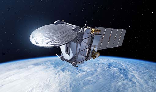
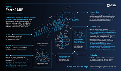
EarthCARE - ESA's cloud, aerosol and radiation explorer mission
Learn about ESA’s upcoming cloud, aerosol and radiation explorer mission – EarthCARE – in our latest infographic.
Event - Training
EO Summer School 6
ESA's series of summer schools, on Monitoring of the Earth System, aims to promote the exploitation of Earth observation data.
Event - Training
EO Summer School 5
ESA's series of summer schools, on Monitoring of the Earth System, aims to promote the exploitation of Earth observation data.
Event - Training
EO Summer School 3
ESA's series of summer schools, on Monitoring of the Earth System, aims to promote the exploitation of Earth observation data.
News - Infographics
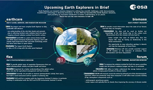
What are the next Earth Explorers?
Learn about the planned missions in the Earth Explorers programme - EarthCARE, Biomass, FLEX, and FORUM - which will further our understanding of Earth’s climate.
News - Events and Proceedings
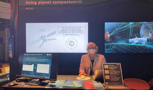
Highlights from Living Planet Symposium
As remote sensing scientists and data-users from around the world converged at the Living Planet Symposium (LPS) in Bonn recently, a common thread was evident in many scientific sessions and meetings – the right environmental data can accelerate our understanding of the rapid changes in Earth’s system.
News - Events and Proceedings
Data preservation takes centre stage at Living Planet Symposium
Against the backdrop of the famed Rhine River, world-class scientists and Earth observation data-users are gathered this week in the historical city of Bonn, at the Living Planet Symposium (LPS).
News - Thematic area articles
Satellite data central to ocean monitoring
Over 95% of Earth’s water is found in our oceans, and yet sadly, oceans are under stress from climate change and pollution. Monitoring our oceans is vital for Earth’s survival and satellites are the primary means of long-term and independent observation of our vast ocean bodies and their associated coastal zones.
News - Success Stories
10 years of Envisat data help to illuminate ocean processes
A decade after Envisat beamed its final image to the planet, the pioneering ESA mission is continuing to foster improved understanding of Earth’s systems.
News - Success Stories
How Envisat helped to shape global understanding of Earth’s systems
Twenty years have passed since a ground-breaking European spacecraft designed to deliver unprecedented insight into the planet’s changing environment was lofted into orbit.
