- All Categories (4394)
- Data (52)
- News (163)
- Missions (8)
- Events (41)
- Tools (15)
- Activities (13)
- Campaigns (13)
- Documents (4089)
DATA
Discover and download the Earth observation data you need from the broad catalogue of missions the European Space Agency operate and support.
Data - Campaigns (Open)

PolarGap
The primary objective of the PolarGap campaign was to carry out an airborne gravity survey covering the southern polar gap of the gravity field mission GOCE, beyond the coverage of the GOCE orbit.
Data - Campaigns (Open)
PhotoProxy 2019
The Photosynthetic-Proxy Experiment campaign address relevant open aspects that are related to the quantitative assessment of vegetation photosynthesis and vegetation stress from space.
Data - Campaigns (Open)
GWEX
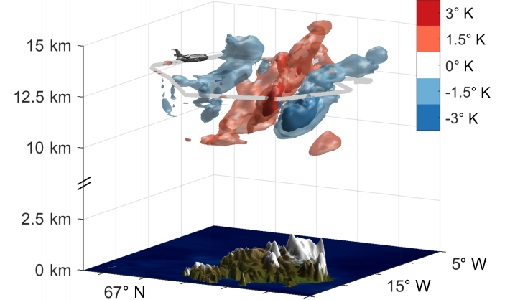
The aim of this study was to perform Gravity Wave (GW) observations with the airborne IRLI GLORIA on board of HALO. In this way for a first time 3-D tomographic reconstructions of mesoscale GW events in the lower stratosphere were taken.
Data - Campaigns (Open)
WindVal III
The objectives the WindVal III campaign were Early correlative observations between Aeolus and the airborne A2D and 2-µm DWL wind lidar systems
Data - Campaigns (Open)

WindVal II
The objectives for the WindVal II campaign in 2016 were derived from the results, experience and lessons learnt from these last airborne campaigns in 2009 and 2015.
Data - Campaigns (Open)
WindVal I
The objectives of the WindVal 1 campaign in 2015 were derived from results, experience and lessons learnt from the previous airborne campaign in 2009.
Data - Campaigns (Open)

AfriScat
AfriScat campaign, a follow on to TropiSCAT campaign, was to acquire long-term P-Band radar data in an African tropical forest.
Data - Campaigns (Open)

AirScatterGNSS
In this project an Airborne Wind Vector Scatterometer (AWVS) system was designed and built for measurements of sea surface backscattering from an aircraft.
Data - EO Sign In Authentication (Open)
Envisat MERIS Reduced Resolution - Level 2 [MER_RR__2P/ME_2_RRG]
MERIS RR Level 2 is a Reduced Resolution (RR) Geophysical product for Ocean, Land and Atmosphere. Each MERIS Level 2 geophysical product is derived from a MERIS Level 1 product and auxiliary parameter files specific to the MERIS Level 2 processing. The MERIS RR Level 2 product has a Sentinel 3-like format starting from the 4th reprocessing data released to users in July 2020. The data package is composed of NetCDF 4 files containing instrumental and scientific measurements, and a Manifest file, which contains metadata information related to the description of the product. A Level 2 product is composed of 64 measurement files containing mainly: 13 files containing Water-leaving reflectance, 13 files containing Land surface reflectance and 13 files containing the TOA reflectance (for all bands except those dedicated to measurement of atmospheric gas - M11 and M15), and several files containing additional measurement on Ocean, Land and Atmospheric parameters. The Auxiliary data used are listed in the Manifest file associated to each product. MERIS was operating continuously on the day side of the Envisat orbit (descending track). RR data was acquired over 43.5 minutes in each orbit, i.e. 80% of the descending track.
Data - EO Sign In Authentication (Open)
Envisat MERIS Reduced Resolution - Level 1 [MER_RR__1P/ME_1_RRG]
The MERIS Level 1 Reduced Resolution (RR) product contains the Top of Atmosphere (TOA) upwelling spectral radiance measurements at reduced resolution. The in-band reference irradiances for the 15 MERIS bands are computed by averaging the in-band solar irradiance of each pixel. The in-band solar irradiance of each pixel is computed by integrating the reference solar spectrum with the band-pass of each pixel. The MERIS RR Level 1 product has Sentinel 3-like format starting from the 4th reprocessing data released to users in July 2020. Each measurement and annotation data file is in NetCDF 4. The Level 1 product is composed of 22 measurements data files, 15 files containing radiances at each band (one band per file), accompanied by the associated error estimates, and 7 annotation data files. The band-pass of each pixel is derived from on-ground and in-flight characterisation via an instrument model. The values "Band wavelength" and "Bandwidth" provided in the Manifest file of the Level 1 products are the averaged band-pass of each pixel over the instrument field of view. The Auxiliary data used are listed in the Manifest file associated to each product. MERIS was operating continuously on the day side of the Envisat orbit (descending track). RR data was acquired over 43.5 minutes in each orbit, i.e. 80% of the descending track.
Data - Fast Registration with approval (Restrained)
ALOS PALSAR International Polar Year Antarctica
International Polar Year (IPY), focusing on the north and south polar regions, aimed to investigate the impact of how changes to the ice sheets affect ocean and climate change to the habitats in these regions. IPY was a collaborative project involving over sixty countries for two years from March 2007 to March 2009. To meet the project goal, world space agencies observed these regions intensively using their own Earth observation satellites. One of these satellites, ALOS - with the PALSAR (Phased Array type L-band Synthetic Aperture Radar) sensor - observed these regions independently from day-night conditions or weather conditions. Carrying on this initiative, ESA is providing the ALOS PALSAR IPY Antarctica dataset, which consists of full resolution ALOS PALSAR ScanSAR WB1 products (100 m spatial resolution) over Antarctica from July 2008 (cycle 21) to December 2008 (Cycle 24) and from May 2009 (cycle 27) to March 2010 (cycle 31). Missing products between the two periods above is due to L0 data over Antarctica not being available in ADEN archives and not processed to L1. Spatial coverage: Check the spatial coverage of the collection on a map available on the Third Party Missions Dissemination Service.
Data - EO Sign In Authentication (Open)
Envisat MERIS Full Resolution - Level 2 [MER_FRS_2P/ME_2_FRG]
MERIS FR Level 2 is a Full-Resolution Geophysical product for Ocean, Land and Atmosphere. Each MERIS Level 2 geophysical product is derived from a MERIS Level 1 product and auxiliary parameter files specific to the MERIS Level 2 processing. The MERIS FR Level 2 product has Sentinel 3-like format starting from the 4th reprocessing data released to users in July 2020. The data package is composed of NetCDF 4 files containing instrumental and scientific measurements, and a Manifest file which contains metadata information related to the description of the product. A Level 2 product is composed of 64 measurement files containing: 13 files containing Water-leaving reflectance, 13 files containing Land surface reflectance and 13 files containing the TOA reflectance (for all bands except those dedicated to measurement of atmospheric gas - M11 and M15), and several files containing additional measurements on Ocean, Land and Atmospheric parameters and annotation. The Auxiliary data used are listed in the Manifest file associated to each product. The Level 2 FR product covers the complete instrument swath. The product duration is not fixed and it can span up to the time interval of the input Level 0/Level 1. Thus the estimated size of the Level 2 FR is dependent on the start/stop time of the acquired segment. During the Envisat mission, acquisition of MERIS Full Resolution data was subject to dedicated planning based on on-demand ordering and coverage of specific areas according to operational recommendations and considerations. See yearly and global density maps to get a better overview of the MERIS FR coverage.
Data - Project Proposal (Restrained)
COSMO-SkyMed full archive and tasking
The archive and new tasking X-band SAR products are available from COSMO-Skymed (CSK) and COSMO-SkyMed Second Generation (CSG) missions in ScanSAR and Stripmap modes, right and left looking acquisition (20 to 60° incidence angle). COSMO-SkyMed modes: Acquisition Mode Single look Resolution [Az. X. Rg, SCS] (m) Scene size [Az. X. Rg] (km) Polarisation Scene duration (seconds) Number of looks Multilook resolution (m) Geolocation accuracy ±3 s (m) [DGM, GEC, GTC] Stripmap Himage 2.6 x 3 40 x 40 Single: HH, HV, VH, VV 7 3 5 25 Stripmap PingPong 9.7 x 11 30 x 30 Alternate: HH/VV, HH/HV, VV/VH 6 3 20 25 ScanSAR Wide 23 x 13.5 100 x 100 Single: HH, HV, VH, VV 15 4 - 9 30 30 ScanSAR Huge 38 x 13.5 200 x 200 Single: HH, HV, VH, VV 30 25 - 66 100 100 COSMO-Skymed Second Generation Modes: Acquisition Mode Single look Resolution [Az. X. Rg, SCS] (m) Scene size [Az. X. Rg] (km) Polarisation Scene duration (seconds) Number of looks Multilook resolution (m) Geolocation accuracy ±3σ (m) [DGM, GEC, GTC] Stripmap 3 x 3 40 x 40 Single (HH, VV, HV, VH) or Dual (HH+HV, VV+VH) 7 2 x 2 4 x 4 6 x 7 11 x 14 3.75 Stripmap PingPong 12 x 5 30 x 30 Alternate (HH/VV, HH/HV+VV/VH) 6 1 x 2 2 x 5 12 x 10 23 x 26 12 QuadPol 3 x 3 40 x 15 Quad (HH+HV+VV+VH) N/A 2 x 2 4 x 4 6 x 7 11 x 14 3.75 ScanSAR 1 20 x 4 100 x 100 Single (HH, VV, HV, VH) or Dual (HH+HV, VV+VH) 15 1 x 3 1 x 5 2 x 8 20 x 14 23 x 27 35 x 40 12 ScanSAR 2 40 x 6 200 x 200 Single (HH, VV, HV, VH) or Dual (HH+HV, VV+VH) 30 1 x 4 1 x 7 3 x 16 40 x 27 47 x 54 115 x 135 12 Following Processing Levels are available, for both CSK and CSG: SCS (Level 1A, Single-look Complex Slant): Data in complex format, in slant range projection (the sensor's natural acquisition projection) and zero doppler projection, weighted and radiometrically equalised; the coverage corresponds to the full resolution area illuminated by the SAR instrument DGM (Level 1B, Detected Ground Multi-look): Product obtained detecting, multi-looking and projecting the Single-look Complex Slant data onto a grid regular in ground: it contains focused data, amplitude detected, optionally despeckled by multi-looking approach, radiometrically equalised and represented in ground/azimuth projection GEC (Level 1C, Geocoded Ellipsoid Corrected): Focused data, amplitude detected, optionally despeckled by multi-looking approach, geolocated on the reference ellipsoid and represented in a uniform preselected cartographic presentation. Any geometric correction derived by usage of terrain model isn't applied to this product by default GTC (Level 1D, Geocoded Terrain Corrected): Focused data, fully calibrated with the usage of terrain model, amplitude detected, optionally despeckled by multi-looking approach, geolocated on a DEM and represented in a uniform preselected cartographic presentation. The image scene is located and accurately rectified onto a map projection, through the use of Ground Control Points (GCPs) and Digital Elevation Model (DEM); it differs from GEC for the use of the DEM (instead of reference ellipsoid) for the accurate conversion from slant to ground range and to approximate the real earth surface. The list of available data can be retrieved using the CLEOS COSMO-SkyMed products catalogue. User registration is required to use the catalogue. As per ESA policy, very high-resolution data over conflict areas cannot be provided.
Data - Project Proposal (Restrained)
COSMO-SkyMed ESA archive
The COSMO-SkyMed archive collection consists of COSMO-SkyMed products requested by ESA supported projects over their areas of interest around the world. The dataset regularly grows as ESA collects new products over the years. The following list delineates the characteristics of the SAR measurement modes that are disseminated under ESA Third Party Missions (TPM). STRIPMAP HIMAGE (HIM): Achieving medium resolution (3 m x 3 m single look), wide swath imaging (swath extension ≥40 km). STRIPMAP PINGPONG (SPP): Achieving medium resolution (15 m), medium swath imaging (swath ≥30 km) with two radar polarization's selectable among HH, HV, VH and VV. SCANSAR WIDE (SCW): Achieving radar imaging with swath extension of 100 x 100 km2 and a spatial resolution of 30 x 30 m2. SCANSAR HUGE (SCH): Achieving radar imaging with swath extension of 200 x 200 km2 and a spatial resolution selectable of 100 x 100 m2. Processing Levels: Level 1A - Single-look Complex Slant - (SCSB and SCSU): RAW data focused in slant range-azimuth projection, that is the sensor natural acquisition projection; product contains In-Phase and Quadrature of the focused data, weighted and radiometrically equalised.The processing of the 1A_SCSU product differs from that of the 1A_SCSB product for the following features:a non-weighted processing is performed, which means that windowing isn't applied on the processed bandwidth; radiometric equalisation (in terms of compensation of the range antenna pattern and incidence angle) is not performed; hence only compensation of the antenna transmitter gain and receiver attenuation and range spreading loss is applied. Level 1B - Detected Ground Multi-look (DGM): Product obtained detecting, multi-looking and projecting the Single-look Complex Slant data onto a grid regular in ground. Spotlight Mode products are not multi-looked. Level 1C - Geocoded Ellipsoid Corrected (GEC) and Level 1D - Geocoded Terrain Corrected (GTC): Obtained projecting the Level 1A product onto a regular grid in a chosen cartographic reference system. In case of Lev 1C the surface is the earth ellipsoid while for the Lev 1D a DEM (Digital Elevation Model) is used to approximate the real earth surface. Spatial coverage: Check the spatial coverage of the collection on a map available on the Third Party Missions Dissemination Service. As per ESA policy, very high-resolution data over conflict areas cannot be provided.
Data - EO Sign In Authentication (Open)
Envisat MERIS Full Resolution - Level 1 [MER_FRS_1P/ME_1_FRG]
The MERIS Level 1 Full Resolution (FR) product contains the Top of Atmosphere (TOA) upwelling spectral radiance measurements. The in-band reference irradiances for the 15 MERIS bands are computed by averaging the in-band solar irradiance of each pixel. The in-band solar irradiance of each pixel is computed by integrating the reference solar spectrum with the band-pass of each pixel. The MERIS FR Level 1 product has Sentinel 3-like format starting from the 4th reprocessing data released to users in July 2020. Each measurement and annotation data file is in NetCDF 4. The Level 1 product is composed of 22 data files: 15 files containing radiances at each band (one band per file), accompanied by the associated error estimates, and 7 annotation data files. The 15 sun spectral flux values provided in the instrument data file of the Level 1 products are the in-band reference irradiances adjusted for the Earth-sun distance at the time of measurement. The band-pass of each pixel is derived from on-ground and in-flight characterisation via an instrument model. The values "Band wavelength" and "Bandwidth" provided in the Manifest file of the Level 1b products are the averaged band-pass of each pixel over the instrument field of view. Auxiliary data are also listed in the Manifest file associated to each product. The Level 1 FR product covers the complete instrument swath. The product duration is not fixed and it can span up to the time interval of the input Level 0 (for a maximum of 20 minutes). Thus the estimated size of the Level 1 FR is dependent on the start/stop time of the acquired segment. During the Envisat mission, acquisition of MERIS Full Resolution data was subject to dedicated planning based on on-demand ordering and coverage of specific areas according to operational recommendations and considerations. See yearly and global density maps to get a better overview of the MERIS FR coverage.
Data - Fast Registration with immediate access (Open)

Envisat DORIS Doppler [DOR_DOP_1P]
This product was generated by the Centre de Traitement Doris Poseidon (CTDP). The DORIS Doppler product (DOR_DOP_1P) was consolidated offline 2-4 weeks after sensing and stored in the F-PAC archive. The file size is 0.5 Mbytes per orbit.
Data - Fast Registration with immediate access (Open)
Envisat DORIS Precise Orbit [DOR_VOR_AX]
The latest version of the Envisat DORIS Precise Orbit product, DOR_VOR_AX, was generated by the Centre de Traitement Doris Poseidon (CTDP) using the Geophysical Data Records F standards (GDR-F). The product is used to obtain the satellite orbital parameters (latitude, longitude, height and height rate) by using orbit computation routines. The most significant changes related to the GDR-F standards concern the new ocean tide model (FES2014) and the updated Terrestrial Reference Frame (ITRF2014). The new standards significantly improve all Precise Orbit Determination (POD) metrics with respect to GDR-E. The mean difference and variance of Sea Surface Height (SSH) at crossovers is slightly reduced. The DOR_VOR_AX product adopts the Envisat format, and the size is 0.2 Mbytes per orbit. Users are recommended to apply the GDR-F version, but the previous datasets are still available (i.e. GDR-D and GDR-E versions). See further details in the readme file for Envisat DORIS Precise Orbit Determination files. Comparison of Envisat Sea Level Anomaly trends obtained using DORIS Precise Orbit GDR-E and F standards. North/South patterns are evident. Credits: CNES/CLS.
Data - Fast Registration with immediate access (Open)
ERS-1/2 SCATTEROMETER Ocean Wind field and Sea Ice probability [ASPS20.H/ASPS20.N]
The ASPS Level 2 products contain, for each node: the radar backscattering sigma nought for the three beams of the instrument, the four aliased wind solutions (Rank 1-4 wind vector) and the de-aliased wind vector flag, the sea-ice probability and sea-ice flag, the YAW quality flag. The wind retrieval is performed with the CMOD5N geophysical model function derived by ECMWF to compute the neutral winds rather than 10 m winds. ASPS L2.0 High resolution products are provided with a spatial resolution of 25x25 km and a grid spacing of 12.5 km. ASPS L2.0 Nominal resolution products are provided with a spatial resolution of 50x50 km and a grid spacing of 25 km. One product covers one orbit from ascending node crossing. Please consult the Product Quality Readme file before using the ERS ASPS data.
Data - Fast Registration with immediate access (Open)
ERS-1/2 SCATTEROMETER Nominal Resolution back-scattering measurements, Ocean Wind field [UWI]
The ERS data reprocessed with the ASPS facility is also available in the UWI format to maintain the compatibility with the FD (Fast Delivery) products. The ASPS UWI product is organised in frames of 500 x 500 km providing the radar backscattering sigma nought for the three beams of the instrument plus the wind speed and direction. The wind retrieval is performed with the CMOD5N geophysical model function derived by ECMWF to compute the neutral winds rather than 10m winds. ASPS UWI products are provided with a spatial resolution of 50 x 50 km and a grid spacing of 25 km. One product covers one orbit from ascending node crossing. Please consult the Product Quality Readme file before using the ERS ASPS data.
Data - EO Sign In Authentication (Open)
GOCE Global Gravity Field Models and Grids
This collection contains gravity gradient and gravity anomalies grids at ground level and at satellite height. In addition it contains the GOCE gravity field models (EGM_GOC_2, EGM_GCF_2) and their covariance matrices (EGM_GVC_2): GOCE Gravity solution GRIDS Gridded Gravity gradients and anomalies at ground level: GO_CONS_GRC_SPW_2__20091101T000000_20111231T235959_0001.TGZ GO_CONS_GRC_SPW_2__20091101T055147_20120731T222822_0001.TGZ GO_CONS_GRC_SPW_2__20091101T055226_20131020T033415_0002.TGZ GO_CONS_GRC_SPW_2__20091009T000000_20131021T000000_0201.TGZ. Latest baseline is: GO_CONS_GRC_SPW_2__20091009T000000_20131021T000000_0201.TGZ. Gridded Gravity gradients and anomalies at satellite height: GO_CONS_GRD_SPW_2__20091101T055147_20100630T180254_0001.TGZ GO_CONS_GRD_SPW_2__20091101T055147_20120731T222822_0001.TGZ GO_CONS_GRD_SPW_2__20091101T055226_20131020T033415_0002.TGZ GO_CONS_GRD_SPW_2__20091009T000000_20131021T000000_0201.TGZ. Latest baseline is: GO_CONS_GRD_SPW_2__20091009T000000_20131021T000000_0201.TGZ. As output from the ESA-funded GOCE+ GeoExplore project, GOCE gravity gradients were combined with heterogeneous other satellite gravity information to derive a combined set of gravity gradients complementing (near)-surface data sets spanning all together scales from global down to 5 km. The data is useful for various geophysical applications and demonstrate their utility to complement additional data sources (e.g., magnetic, seismic) to enhance geophysical modelling and exploration. The GOCE+ GeoExplore project is funded by ESA through the Support To Science Element (STSE) and was undertaken as a collaboration of the Deutsches Geodätisches Forschungsinstitut (DGFI), Munich, DE, the Christian-Albrechts-Universität zu Kiel, the Geological Survey of Norway (NGU), Trondheim, Norway, TNO, the Netherlands and the University of West Bohemia, Plzen, CZ. Read more about gravity gradients and how GOCE delivered them in this Nature article: Satellite gravity gradient grids for geophysics. View images of the GOCE original gravity gradients and gradients with topographic reduction grids. Available data GRIDS File Type Gridded data: full Gravity Gradients, at 225 km and 255 km with and without topographic correction GGG_225 Computed from GOCE/GRACE gradients lower orbit phase February 2010 - October 2013 GGG_255 Computed from GOCE/GRACE gradients nominal orbit phase February 2010 - October 2013 TGG_225 Gravity gradient grids from topography at fixed height of 225/255 km above ellipsoid given in LNOF (Local North Oriented Frame) TGG_225 Gravity gradient grids from topography at fixed height of 225/255 km above ellipsoid given in LNOF (Local North Oriented Frame) MAPS File Type Maps of Gravity Gradients with and without topographic corrections Vij_225km_Patch_n.jpg Maps of grids from lower orbit phase with and without topographic correction from ETOPO1 Along-orbit File Type Full Gravity Gradients, along-orbit, in GRF and TRF reference frames. A detailed description is provided in the data set user manual GGC_GRF Combined gradients from GRACE (long wavelengths) & GOCE (measurement band) in the GRF (Gradiometer Reference Frame) GGC_TRF Combined gradients from GRACE (long wavelengths) & GOCE (measurement band) rotated from GRF to TRF (Terrestrial Reference Frame: North, West, Up) Direct solution First Generation Product: GO_CONS_EGM_GOC_2__20091101T000000_20100110T235959_0002.TGZ Variance/Covariance matrix: GO_CONS_EGM_GVC_2__20091101T000000_20100110T235959_0002.TGZ Second Generation Product: GO_CONS_EGM_GOC_2__20091101T000000_20100630T235959_0002.TGZ Variance/Covariance matrix: GO_CONS_EGM_GVC_2__20091101T000000_20100630T235959_0001.TGZ Third Generation Product: GO_CONS_EGM_GOC_2__20091101T000000_20110419T235959_0001.TGZ Variance/Covariance matrix: GO_CONS_EGM_GVC_2__20091101T000000_20110419T235959_0001.TGZ Coefficients (ICGEM format): GO_CONS_EGM_GCF_2__20091101T000000_20110419T235959_0001.IDF Fourth Generation Product: GO_CONS_EGM_GOC_2__20091101T000000_20120801T060000_0001.TGZ Variance/Covariance matrix: GO_CONS_EGM_GVC_2__20091101T000000_20120801T060000_0002.TGZ Fifth Generation Product: GO_CONS_EGM_GOC_2__20091101T000000_20131020T235959_0002.TG Variance/Covariance matrix: GO_CONS_EGM_GVC_2__20091101T000000_20131020T235959_0001.TGZ Coefficients (ICGEM format): GO_CONS_EGM_GOC_2__20091101T000000_20131020T235959_0001.IDF Sixth Generation Product: GO_CONS_EGM_GOC_2__20091009T000000_20131020T235959_0201.TGZ Variance/Covariance matrix: GO_CONS_EGM_GVC_2__20091009T000000_20131020T235959_0201.TGZ Coefficients (ICGEM format): GO_CONS_EGM_GOC_2__20091009T000000_20131020T235959_0201.IDF Release 6 gravity model validation report. Time-Wise solution First Generation Product: GO_CONS_EGM_GOC_2__20091101T000000_20100111T000000_0002.TGZ Variance/Covariance matrix: GO_CONS_EGM_GVC_2__20091101T000000_20100111T000000_0002.TGZ Second Generation Product: GO_CONS_EGM_GOC_2__20091101T000000_20100705T235500_0002.TGZ Variance/Covariance matrix: GO_CONS_EGM_GVC_2__20091101T000000_20100705T235500_0001.TGZ Third Generation Product: GO_CONS_EGM_GOC_2__20091101T000000_20110430T235959_0001.TGZ Variance/Covariance matrix: GO_CONS_EGM_GVC_2__20091101T000000_20110430T235959_0001.TGZ Coefficients (ICGEM format): GO_CONS_EGM_GCF_2__20091101T000000_20110430T235959_0001.IDF Fourth Generation Product: GO_CONS_EGM_GOC_2__20091101T000000_20120618T235959_0002.TGZ Variance/Covariance matrix: GO_CONS_EGM_GVC_2__20091101T000000_20120618T235959_0001.TGZ Fifth Generation Product: GO_CONS_EGM_GOC_2__20091101T000000_20131021T000000_0002.TGZ Variance/Covariance matrix: GO_CONS_EGM_GVC_2__20091101T000000_20131021T000000_0001.TGZ Coefficients (ICGEM format): GO_CONS_EGM_GOC_2__20091101T000000_20131021T000000_0001.IDF Sixth Generation Product: GO_CONS_EGM_GOC_2__20091009T000000_20131021T000000_0201.TGZ Variance/Covariance matrix: GO_CONS_EGM_GVC_2__20091009T000000_20131021T000000_0202.TGZ Coefficients (ICGEM format): GO_CONS_EGM_GOC_2__20091009T000000_20131021T000000_0201.IDF Combined gravity field GOCE model plus Antarctic and Arctic data (ICGEM format): GO_CONS_EGM_GOC_2__20091009T000000_20160119T235959_0201.IDF Download release 6 gravity model validation report.