- All Categories (348)
- Data (71)
- News (127)
- Missions (18)
- Events (43)
- Tools (9)
- Activities (4)
- Campaigns (39)
- Documents (37)
CAMPAIGNS
Learn about the ground-based, ship-borne, balloon-borne, and airborne campaigns and small satellite field experiments that validate orbiting ESA EO satellites and support future mission development.
Campaign
 2011 - 2012
TropiScat
The major objectives of the experiment were the temporal survey of the variation of the measurements in time scales ranging from diurnal, weekly, monthly, up to 12 months of observation.
Campaign
 2009
2009TropiSAR 2009
The TropiSAR campaign objectives were the evaluation of P-Band radar imaging over tropical forests for biomass and forest height estimation.
Campaign
 2002
2002SIFLEX
The Solar Induced Fluorescence Experiment (SIFLEX) 2002 campaign was to understand whether solar-induced fluorescence measurements might someday be used to monitor and map the photochemical activity of boreal forests from space.
Campaign
 2005
2005SEN2FLEX
SENtinel-2 and FLuorescence EXperiment (SEN2FLEX) campaign combines different activities in support of initiatives related both to fluorescence experiments and Sentinel-2 initiative for prototyping of resolutions to meet mission requirements.
Campaign
 2013
2013SEN2EXP
In the SEN2EXP campaign, the data gap for broad leaf forests is addressed as suitable reference datasets of sufficient quality do not exist.
Campaign
 2009 - 2012
NoSREx-I -II and -III
The Nordic Snow Radar Experiment (NoSREx) took place between November 2009 and May 2010. The objective of the campaign was to provide a continuous time series of active and passive microwave observations of snow cover in a representative location.
Campaign
 2002
2002LaRA
To improve our knowledge of how best to measure ice thickness, the airborne Laser and Radar Altimeter campaign (LaRA) was carried out over the frozen expanses of northern Greenland.
Campaign
 2004
2004INDREX-2
ESA and Indonesian Ministry of Forest Study was a 2004 follow-up campaign to the INDREX project which was to generate a digital elevation model over a non-accessible region in order to model environmental changes.
Campaign
 2012
2012HYFLEX
This HYFLEX campaign aimed to deliver maps of sun-induced fluorescence recorded from airborne measurements using the approaches of the spaceborne FLEX mission.
Campaign
2019FLEXSense 2019
The FLEXSense 2019 campaign activities were undertaken in Germany and Italy with the goal of providing a complete set of high-resolution experimental data, including all relevant elements required for the preparation of the FLEX satellite mission.
Campaign
 2014
2014FLEX EU 2014
The FLEX-EU Campaign was carried out in 2014 over an agricultural area around Jülich, Germany, Latisana, Italy and forest sites in Czech Republic
Campaign
 2002
2002ESAG
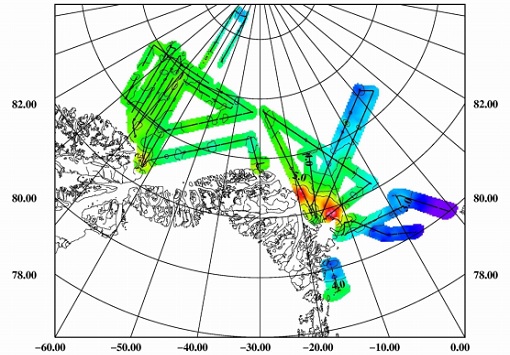
The European Survey of Arctic Gravity (ESAG) campaign objective was to acquire measurements of the Arctic Ocean, in support of GOCE mission; and acquire scanning laser ranging data and profiling laser altimetry over sea-ice north of Greenland.
Campaign
 2006
2006EAGLE
The general purpose of the EAGLE2006 campaign was: Acquisition of simultaneous multi-angular and multi-sensor (from visible to microwave domain) data over a grassland and a forest.
Campaign
 2011
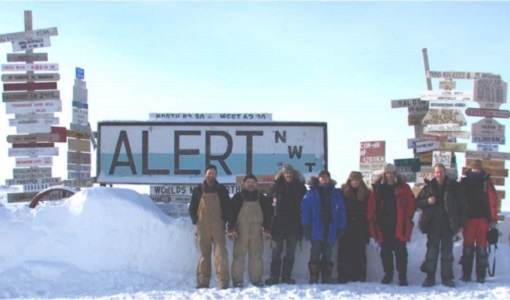
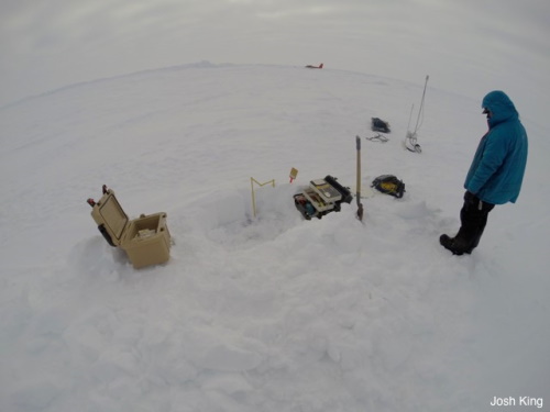
2011CryoVExGround 2011
The aims of the CryoVEx 2011 experiment, operating out of Alert base, was to study the snow and ice characteristics of Arctic sea ice and its snow cover during winter.
Campaign
 2017 - 2018
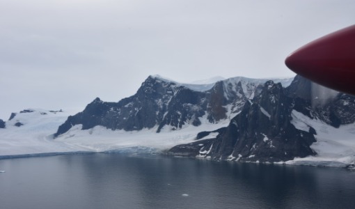
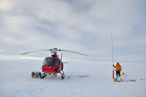
CryoVEx/KAREN Antarctica 2017/18
ESA’s CryoVEx/Karen 2017‐18 campaign took place in Antarctica in from Dec 2017 to Jan 2018. The campaign was composed of an airborne and in‐situ campaign and acquired extensive data sets of scanning lidar, Ku‐ and Ka‐band nadir‐looking radar, and auxiliary imagery for validation of the ESA CryoSat‐2 satellite (Ku‐band radar altimetry) and the French‐Indian AltiKa mission (Ka‐band radar altimetry).
Campaign
 2019
2019CryoVEx/ICESat-2 Spring 2019
The ESA Spring CryoVEx/ICESat-2 campaign 2019 was the first CryoVEx campaign since the launch of NASA ICESat-2 in September 2018, and aimed at cross-validating ESA CryoSat-2 and NASA ICESat-2 missions over sea ice and land ice in the Arctic.
Campaign
 2017
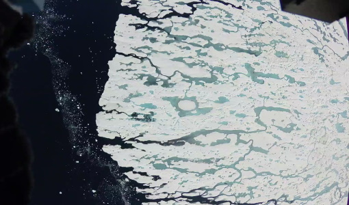
2017CryoVEx KAREN 2017
The CryoVEx-KAREN 2017 Campaign in the Arctic had the goal to collect unique measurements to help us better understand how sea ice is changing.
Campaign
 2016
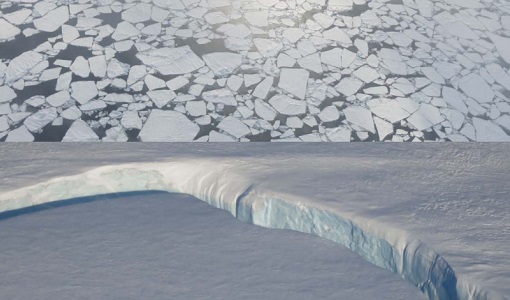
2016CryoVEx KAREN 2016 Fall
The CryoVEx-KAREN 2016 Fall Campaign in Ilulissat, Greenland had the goal to collect unique measurements to help us better understand how snow and ice on the Greenland ice sheet is changing over time, and help ESA design future space missions to monitor the changing climate in our polar regions.
Campaign
 2019
2019CryoVEx ICESat-2 Summer 2019
The ESA CryoVEx/ICESat‐2 summer campaign 2019 is an add‐on to the campaign carried out in the spring 2019, which did not cover all the flights that were planned due to weather obstacles.
Campaign
 2014
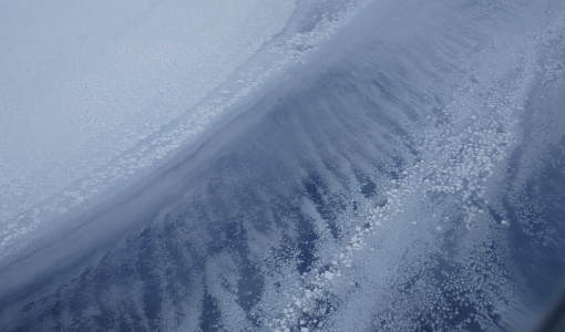
2014CryoVEx ASIRAS 2014
The CryoVEx 2014 airborne campaign was conducted as two separate operational periods. The sea ice activities covering large parts of the western Arctic Ocean were planned to take place early in the season to make sure the weather was stable.