- Campaigns
- SEN2FLEX
SEN2FLEX
Overview
What was the purpose of SEN2FLEX?
In the framework of its Earth Observation Envelope Programme ESA carries out a number of ground-based and airborne campaigns to support geophysical algorithm development, calibration/validation and the simulation of future space borne Earth Observation missions.
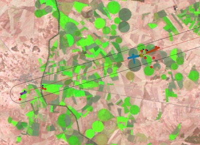
The SENtinel-2 and FLuorescence EXperiment (SEN2FLEX) was a campaign that combines different activities in support of initiatives related both to fluorescence experiments (AIRFLEX) for observation of solar induced fluorescence signal over multiple surface targets and to Copernicus Sentinel-2 initiative for prototyping of spectral bands, spectral widths, and spatial/temporal resolutions to meet mission requirements. Both initiatives require simultaneous airborne hyperspectral and ground measurements for interpretation of fluorescence signal levels (AIRFLEX), and simulation of an optical observing system capable to assess geo- and bio-physical variables and to classify target surfaces by spectral, spatial and temporal distinction (Sentinel-2).
Furthermore, the SEN2FLEX campaign included activities in support of the EC Water Framework Directive (WFD) EO projects for the improvement of protection and management of Europe’s water resources.
The objectives of the SEN2FLEX campaign were:
- To observe solar induced fluorescence signal over multiple agricultural and forest targets to verify signal suitability for observations from space as proposed in the FLEX EO mission
- To provide feedback to ESA on key issues related to the definition of the Sentinel-2 multispectral mission requirements. This includes the simulation of Sentinel-2 products using different sensor configurations (spatial/spectral/temporal coverage) and the evaluation of product performance as a function of configuration.
- To validate retrieval algorithms based on hyperspectral and fluorescence signals.
- To provide feedback to the ESA on EO data requirements necessary to fulfil the EU Water Policy directive.
What was the outcome of SEN2FLEX?
The analysis of Sen2FLEX data will represent a significant advance in the development of algorithms for a proper analysis and interpretation of the new data to be provided by future space missions, with direct relevance for a candidate Earth Explorer Mission (Fluorescence Explorer, FLEX) and a Copernicus mission (Sentinel-2). On the other hand, the dataset is also relevant for the validation of other optical satellite missions (CHRIS, MERIS) and for the development of advanced operational techniques in the context the EU Water Framework Directive.
The availability of the Sen2FLEX dataset to the whole scientific community will open many new possibilities by allowing different teams to test many different algorithms over the same dataset. The results already achieved within the framework of Sen2FLEX activities represent a significant advance, but only a minor step in the potential capabilities for exploitation of such large amount of data. While new campaigns are already in preparation, the analysis and exploitation of the Sen2fLEX dataset will continue over the coming years.
Download SEN2FLEX Final Report
| Data Coverage (Year) | 2005 |
| Geographic Site | Barrax (Albacete, Castilla-La Mancha, Spain) |
| Field of application | Agriculture |
| Data size | More than 50 GB |
| Workshop Proceedings | esa wpp-271 |
| LIDAR data | Available |
Digital Object Identifier: SEN2FLEX, https://doi.org/10.5270/esa-umspxz8
Data
The campaign data is available online via FTPS upon submission of a data access request. An active EO Sign In account is required to submit the request.
The data can be downloaded via an FTP client (e.g., FileZilla or WinSCP) using the option "Implicit FTP over TLS".
For further information about the EO Sign In Service you can visit TellUs
Should you need support please contact EOHelp