- Campaigns
- LaRA
LaRA
Overview
Credit: Johns Hopkins University
What was the purpose of LaRA?
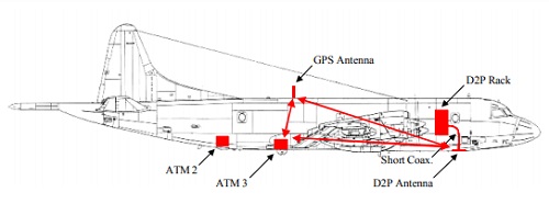
The need for simultaneous laser and radar height measurements over land and sea ice masses has been recognised by both NASA and ESA. To that end, the airborne Laser, Radar Altimeter (LaRA) intercomparison field campaign to the Arctic took place in 2002 to gather this data.
The principal objectives for the resulting datasets were to provide insight into the differences between the estimated height values extracted from coincidental laser (optical) and radar (rf) measurements over various ice and snow surface conditions.
What was the outcome of LaRA?
There were four flights over land and sea ice from 18 May through to 23 May 2002 during which simultaneous radar, laser, and video data were collected.
LaRA has shown that temporally and spatially coincident laser- and radar-derived heights of snow-covered ice sheets can be obtained from a suitable combination of instruments mounted on the same aircraft, and operated simultaneously. Furthermore, the team have shown that such data may be relatively calibrated in height to +/- 1 cm. To the team's knowledge, LaRA was the first field campaign in which such a standard was met.
Download the LaRA campaign final report
| Data Coverage (Year) | 2002 |
| Geographic Site | Greenland, Svalbard |
| Field of Application | Ice-sheets and sea ice |
| Data Size | More than 50 GB |
Digital Object Identifier: https://doi.org/10.5270/esa-b3sjbcw - LaRa: "Technical Support for the Deployment Of Radar and Laser Altimeters during LaRA 2002"
Data
The campaign data is available online via FTPS upon submission of a data access request. An active EO Sign In account is required to submit the request.
The data can be downloaded via an FTP client (e.g., FileZilla or WinSCP) using the option "Implicit FTP over TLS".
For further information about the EO Sign In Service you can visit TellUs
Should you need support please contact EOHelp