earth online
  • Explore Missions
    • Earth Explorers
    • Heritage Missions
    • Third Party Missions
  • Explore Data
    • All Data
    • Open Data
    • Announcement of Opportunity
    • Project Proposal
    • Sample Data
    • Dashboard
  • Explore Tools
    • Analysis Tools
    • Processing Tools
    • Visualisation Tools
    • Catalogues
    • Apps
  • Explore News & Events
    • All News
    • Data Release News
    • Maintenance News
    • Operational News
    • All Events
    • Events Updates
    • Workshop
    • Conference
  • Explore Learn & Discover
    • Data Application Articles
    • Spotlight on EO Community
    • Gallery
    • FAQ
    • Success Stories
    • Infographics
    • Quality Reports Advanced Search
  • SEE ALL
  • GEOSAT-2
  • GEOSAT-2
  • GEOSAT Series
  • Mission
    • GEOSAT-2 Overview
    • GEOSAT-2 Objectives
  • Sample Data
  • GEOSAT-2
  • GEOSAT Series
  • Mission
    • GEOSAT-2 Overview
    • GEOSAT-2 Objectives
  • Sample Data
More

    GEOSAT-2 INSTRUMENTS

    Explore instruments used in GEOSAT-2 mission.

    EXPLORE INSTRUMENTS

    GEOSAT-2 DATA

    Discover how to access GEOSAT-2 data.

    ACCESS MISSION DATA

    GEOSAT-2 is the second satellite of the Deimos Earth Observation system, following GEOSAT-1.

    Featured

    GEOSAT-2 delivers unprecedented coverage of Spain

    GEOSAT-2 delivers unprecedented coverage of Spain

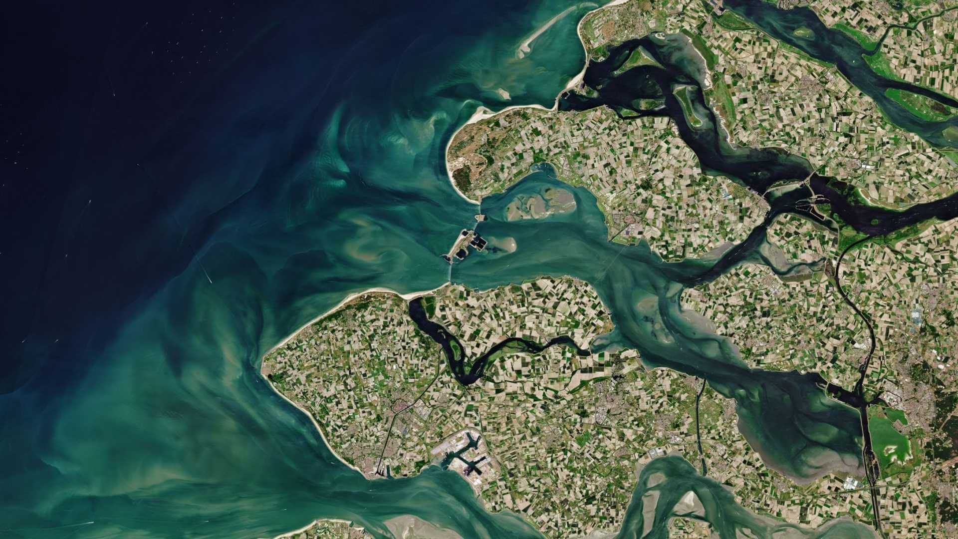
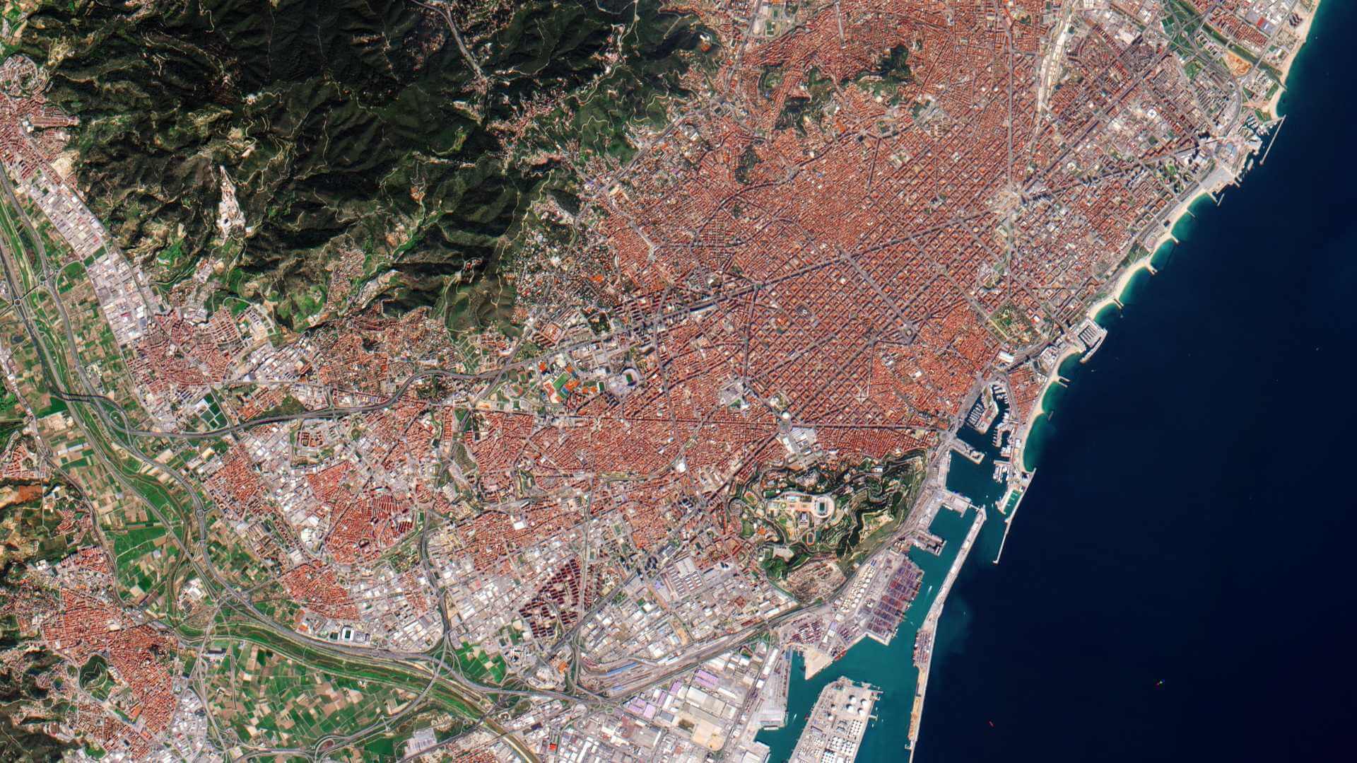
    A new collection of GEOSAT-2 imagery, offering high resolution and near-complete coverage of Spanish territories, is now being disseminated via ESA’s Third Party Missions (TPM) programme.

    GEOSAT-2 Spain Coverage 2023 collection open to users

    GEOSAT-2 Spain Coverage 2023 collection open to users

    ESA’s Earthnet Third Party Missions Programme presents the latest addition to its collection: the GEOSAT-2 Spain Coverage 2023.

    New version of Third Party Missions data access guide

    New version of Third Party Missions data access guide

    ESA’s Third Party Missions data access guide is now updated, providing the details of the latest data collections and changes to existing datasets.

    Meet the future of Earth Observation: Super-Resolution Data

    Meet the future of Earth Observation: Super-Resolution Data

    SUREDOS24 (Super-Resolution and Downscaling for Earth Observation and Earth Science) - provided a deep dive into how recent SR techniques are leveraging deep learning and artificial intelligence to push the boundaries of remote sensing.

    GEOSAT-2 Spain Coverage 2022 collection open to users

    GEOSAT-2 Spain Coverage 2022 collection open to users

    ESA’s Earthnet Third Party Missions Programme presents the latest addition to its collection: the GEOSAT-2 Spain Coverage 2022.

    About GEOSAT-2

    GEOSAT-2 (formerly known as Deimos-2) is an Earth-imaging satellite, built for GEOSAT of Spain, which launched 19 June 2014 and remains operational.

    It is the second satellite of the GEOSAT Earth Observation system, following GEOSAT-1. The expected mission lifetime is at least seven years.

    A high resolution satellite, it became the first European fully-private satellite capable of providing sub-metric multispectral imagery.

    GEOSAT-2 Mission Parameters
    Orbit Height620 km
    Orbit TypeSun synchronous
    Local Time at Ascending Node10:30
    Revisit Time2 days worldwide

    GEOSAT-2 Objectives

    GEOSAT-2 was designed to provide a cost-effective and highly responsive service to cope with the increasing need of fast access to sub-metric imagery.

    It provides near-real time image tasking, downloading, processing and delivery to the end user.

    It has a collection capacity of more than 150,000 km2/day with a two day average revisit time worldwide - one day at mid-latitudes.

    GEOSAT-2 Instruments

    High Resolution Advanced Imaging System (HiRAIS)

    HiRAIS is a 75 cm pan-sharpened multispectral optical instrument with a very-high resolution camera of five spectral channels (one panchromatic, four multispectral).

    HiRAIS Instrument Parameters
    CameraPushbroom type imager
    Optics- Korsch telescope of 42 cm aperture diameter (clear aperture of 40 cm diameter)
    - Focal length = 5.75 m
    - FOV = 1.2º
    Optical components in zerodur, fused silica; Hull: CFRP M55J/RS-3
    GSD (Ground Sample Distance)0.75 m PAN-sharpened, 4 m MS @ 590 km altitude
    Spectral BandsPan: 560-900 nm
    MS1: 466-525 (blue)
    MS2: 532-599 (green)
    MS3: 640-697 (red)
    MS4: 770-892 (NIR)
    FPA (Focal Plane Assembly)CCD detector with TDI capability
    TDI detector exposure levels of the various bandsPAN: 6, 12, 24, 48
    Blue, green: 4, 8, 16
    Red, NIR: 2, 4, 8
    Data Quantisation10 bit
    Swath Width12 km at nadir (24 km in wide area mode)
    Data HandlingLossless compression, real-time encryption
    Downlink Data Rate160 Mbit/s (QPSK)
    HiRAIS instrument mass, power50 kg, ~100 W

    GEOSAT-2 Data

    DATA COLLECTIONS

    ESA is offering, for scientific research and application development, access to Full archive and New Tasking of GEOSAT-2 data upon submission and acceptance of a project proposal. These products are available as part of the GEOSAT.

    ESA will support as many high-quality and innovative projects as possible within the quota limit available, therefore, for the "on demand" TPM, only a limited amount of products can be made available to each project.

    Collections available:

    • GEOSAT-2 Full archive and tasking

    ESA offers registered users access, via the Online Dissemination server, to the following data collections

    • GEOSAT-1 and 2 ESA archive
    • GEOSAT-2 Portugal Coverage
    • GEOSAT-2 Spain Coverage
    Tweet
    Share

    People also search for

    DataNewsMissionsEventsTools and toolboxesLearn & Discover
    European Space Agency
    Terms and conditionsCookie NoticePrivacy NoticeContact UsFAQComplaintsLeave feedback