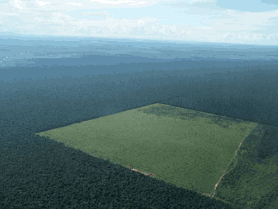
These images show different areas of the Amazon rainforest ecoregions. These images are obtained as a SAR merge of Envisat and ERS-2 satellites, acquired at different dates during the missions. The forest is a moist broadleaf vegetation that covers most of the Amazon Basin of South America, characterised of dense and continuous woodlands. This basin encompasses seven million square kilometres (1.7 billion acres), of which five and a half million square kilometres (1.4 billion acres) are covered by the rainforest. In theory, logging in the Amazon is controlled by strict licensing which allows timber to be harvested only in designated areas. However, there is significant evidence that illegal logging is quite widespread in Brazil. Usually in the tropical areas the cuts are performed by the method of "slash and burn". This system causes severe damage to the balance of the natural environment, because the ash fertilizes the soil for a short time, while the destruction of the forest floor destroys the habitat of the rain forest accelerating erosion of the soil.
The first multicolour image, shows to the south of the city of Manaus (identifiable as a large cluster of white along the Amazon River), many large areas of deforestation (in light brown colour).
|
Technical Information |
|
Product: |
SAR_IMP_1P |
|
Satellite: |
ERS-2 |
|
Instrument: |
Synthetic Aperture Radar (SAR) |
|
Date of acquisition: |
03 Jan 2000, 04 Nov 1996, 14 Dec 1998 |
|
Orbit numbers: |
24599, 19088, 8066 |
|
Band combination: |
Multitemporal image (RGB) |
|
Images used to create the multicolour merge |
This multitemporal image, elaborated with three separate ERS-2 images, shows a large area of deforestation in the Mato Grosso region (Northwest of Lucas city). The deforested areas are visible in light green, red and in yellow are visible the changes that have occurred to the forest between 1992 (Blue Layer) and 1999 (Red layer).
|
Technical Information |
|
Product: |
SAR_IMP_1P |
|
Satellite: |
ERS-2 |
|
Instrument: |
Synthetic Aperture Radar (SAR) |
|
Date of acquisition: |
08 Sep 1999, 27 Jun 1993, 07 Jun 1992 |
|
Orbit numbers: |
24599, 10189, 4678 |
|
Band combination: |
Multitemporal image (RGB) |
|
Images used to create the multicolour merge |
This image below is the result of a merge of three satellite images: ERS-2 and Envisat, acquired at different dates during the missions. The image shows a large area to north of Porto dos Gaychos city. The multicolour image shows the different areas deforested (light blue colour) between 1999 (blue layer) and 2006 (red layer).
|
Images used to create the multicolour merge |
The following radar image is the result of a merge of three different acquisitions from the ERS-1 and ERS-2 satellites. The image shows the evolution of the rain forest in Rondonia Region (Brazil) starting from 1992 until 2010. The progression of deforestation is visible in the image in Green colour (ERS-2 - 06 Oct 2005), and in Blue colour (ERS-2 - 17 Jun 2010). The area in Red colour (ERS-1 - 09 Sep 1992) is relative to the status of the area dating to 20 years ago.
|
Technical Information |
|
Product: |
SAR_IMP_1P |
|
Satellite: |
ERS-1/2 |
|
Instrument: |
Synthetic Aperture Radar (SAR) |
|
Date of acquisition: |
09 Nov 1992, 06 Oct 2005, 17 Jun 2010 |
|
Orbit numbers: |
06897, 54702, 79251 |
|
Band combination: |
Multitemporal image (RGB) |
|
Images used to create the multicolour merge |
This animation shows deforestation of the Amazon Rainforest in the Western Brazilian state of Rondônia from 1986 to 2010.
Read more
Back to top
 Amazon rainforest deforestation (Brazil)


