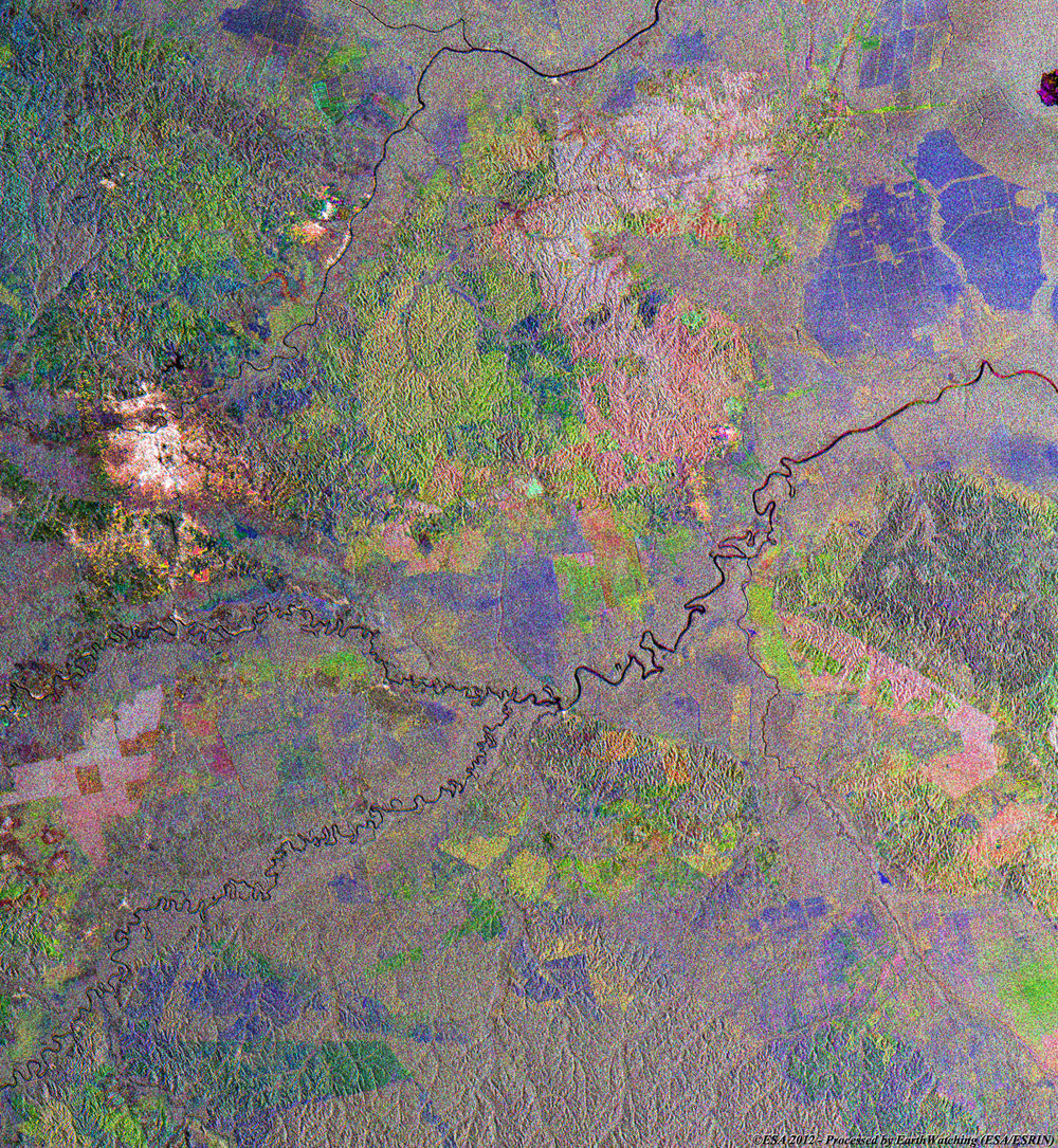
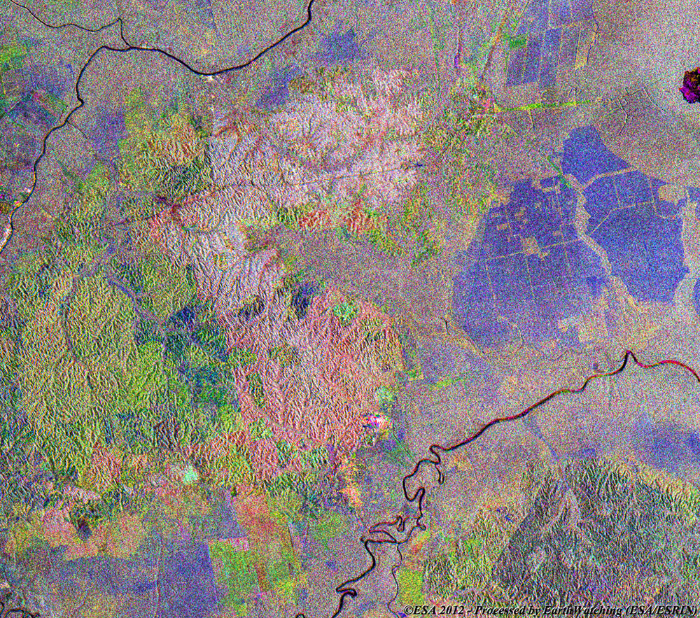
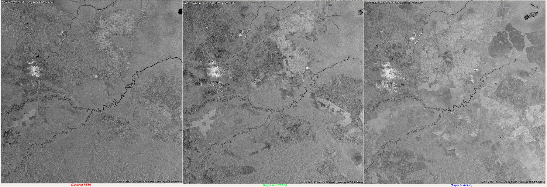
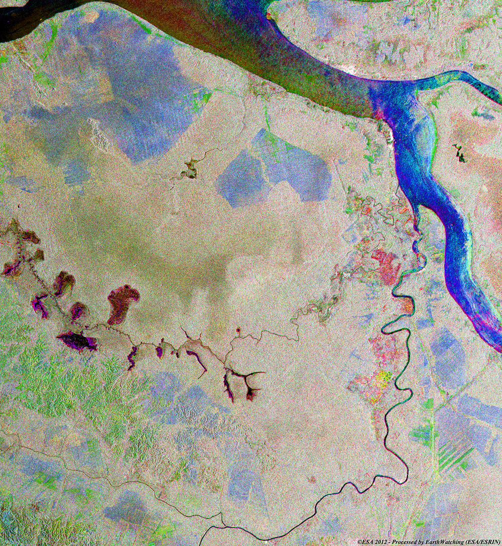
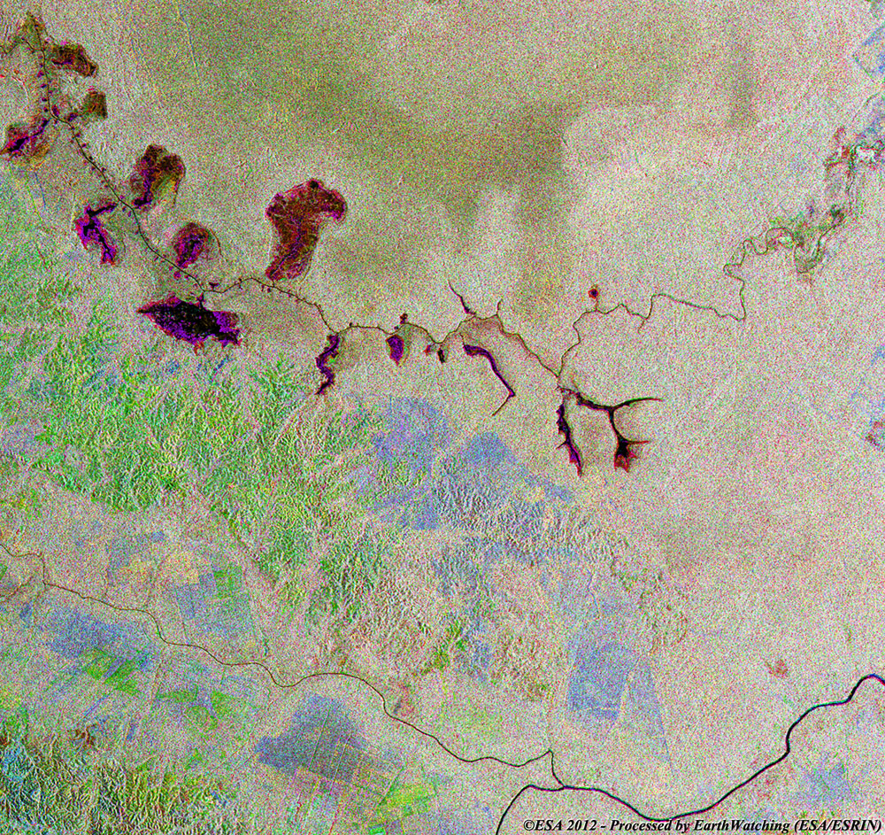
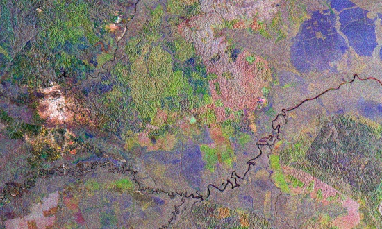
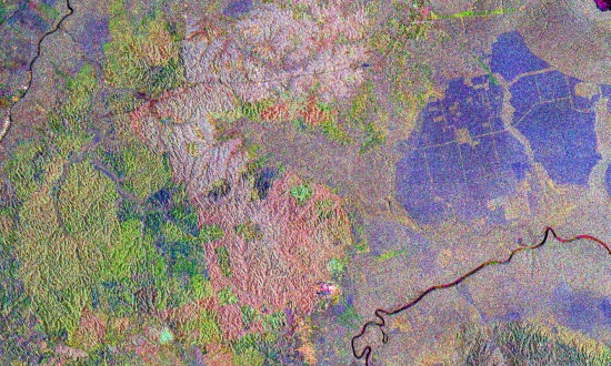
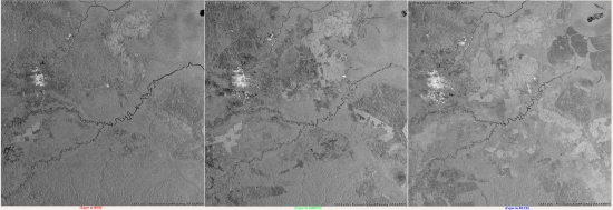
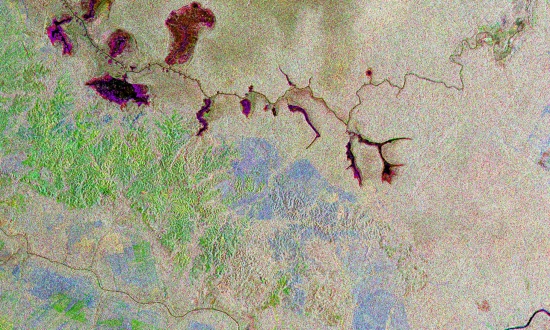
The images below show an area of deforestation in Riau Province, located on the east coast of Sumatra Island (Indonesia). These images were created by merging Envisat and ERS-2 satellite SAR images, acquired at different times during the missions.
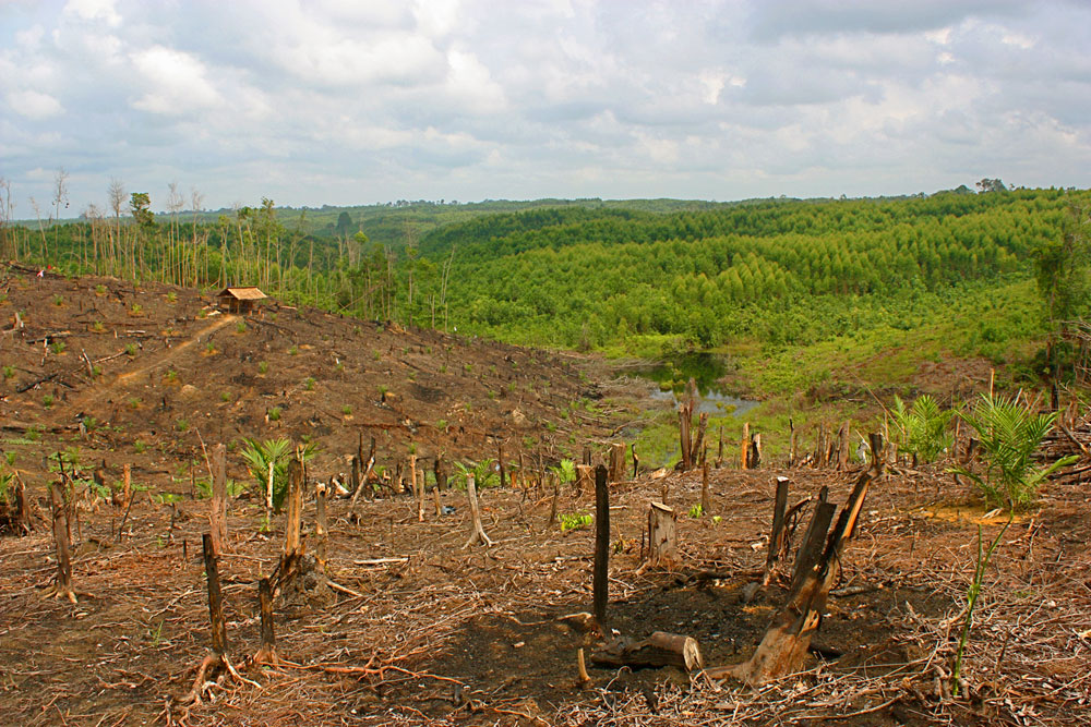
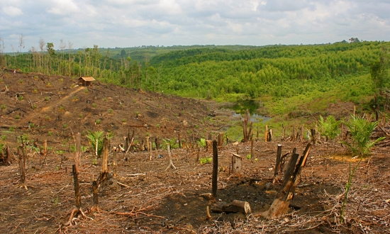
The deforestation in Indonesia has had a significant impact on the nation's ecology. At the turn of the 20th Century it was estimated that 84% of the land mass of Indonesia had been composed of forests. By the end of the century, however, the forest cover had been reduced to almost half the level it had been at the start.
It is believed that at least 80% of the logging taking place in Indonesia is illegal, the result of companies and farmers making space for plantations or selling the wood to other nations. Areas of forest are also being cut down to make room for new habitation.
The logging is being performed using the 'slash and burn' method, which involves the trees being cut down and controlled fires being used to clear the land afterwards. This method causes the soil to become eroded, as the trees are needed to fertilise it. The fires have also contributed to Indonesia becoming the third largest emitter of greenhouse gases in the world; as a by-product of the carbon dioxide from the fires and with fewer trees to produce oxygen.
|
Full multi-temporal image |
The multi-colour images below show large areas of deforestation. To differentiate the state of the areas, the layers are colour coded; in red (orbit acquired in 1993), in green (orbit acquired in 1998) and in blue (orbit acquired in 2005). These areas show where deforestation has occurred during these years.
|
Technical Information |
|
Satellites: |
ERS-2 and Envisat |
|
Instruments: |
SAR and ASAR (30m resolution) |
|
Date of Acquisitions |
27 Mar 1993, 01 Jun 1998, 25 Apr 2005 |
|
Orbits number: |
10555, 16276, 16476 |
|
Product: |
Multi-temporal image (RGB) |
|
Magnified view of deforestation area |
|
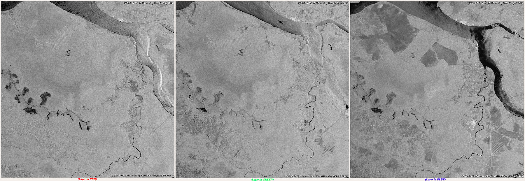
Images used to create the multi-temporal image |
|
Technical Information |
|
Satellite: |
ERS-2 and Envisat |
|
Instrument: |
SAR / ASAR (30m resolution) |
|
Data Product: |
SAR/ASAR_IMP_1P |
|
Date of Acquisition: |
27 Mar 1993, 01 Jun 1998, 25 Apr 2005 |
|
Orbit number: |
10555, 16276, 16476 |
|
Full multi-temporal image |
|
Technical Information |
|
Satellite: |
ERS-2 and Envisat merge (RGB) |
|
Instrument: |
SAR / ASAR (30m resolution) |
|
Data Product: |
SAR/ASAR_IMP_1P |
|
Date of Acquisition: |
27 Mar 1993, 01 Jun 1998, 25 Apr 2005 |
|
Orbit number: |
10555, 16276, 16476 |
|
Magnified view of deforestation area |
|
Images used to create the multi-temporal image |
|
Technical Information |
|
Satellite: |
ERS-2 and Envisat |
|
Instrument: |
SAR / ASAR (30m resolution) |
|
Data Product: |
SAR/ASAR_IMP_1P |
|
Date of Acquisition: |
27 Mar 1993, 01 Jun 1998, 25 Apr 2005 |
|
Orbit number: |
10555, 16276, 16476 |
|
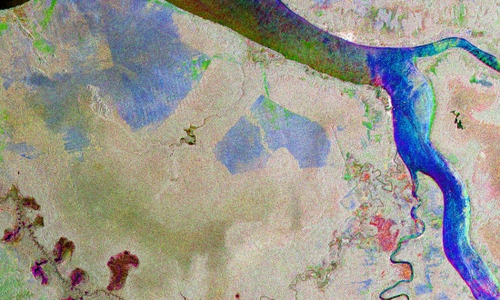
Map of Riau Province and Surrounding Area |
Back To Top
 Browse SAR Events by Year