- All Categories (26)
- News (11)
- Missions (3)
- Events (1)
- Tools (1)
- Activities (2)
- Documents (8)
Document - Product Document
LANDSAT_Products_Description_Document.pdf
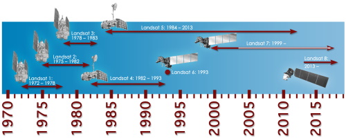
This document acts as a User Guide to the Landsat MSS, TM and ETM+ archives, focussing more specifically on the Landsat TM and ETM+ products from the Kiruna, Maspalomas and Matera archives (including from the Matera, Fucino, Neustralitz, O’Higgins, Malindi, Libreville and Bishkek ground stations) that have been generated as part of the ESA archive bulk-reprocessing project.
Document - User Guide
Planet-Explorer-User-Guide.pdf
This document is designed as a general guideline for customers interested in acquiring Planet Explorer Lab products and services.
Mission - Third Party Missions
PlanetScope
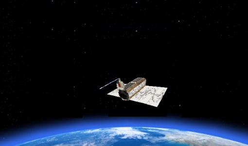
PlanetScope Camera The PlanetScope camera on each Dove cubesat operates currently in eight bands - red edge, red, green,
Tools - Visualisation
HEDAVI
ESA’s Heritage EO data currently cover more than 30 years of observations and enable the analysis of spatio-temporal dynamics
Activity - Quality
SLAP
Currently, in excess of 701,000 Level 1 TM and 84,000 Level 1 ETM+ products have been reprocessed and released under the
News - General News
Three new Third Party Missions under evaluation
Currently it operates five RapidEye satellites, 122 Dove satellites (i.e. PlanetScope), and 15 SkySat satellites.
Activity - Quality
EDAP
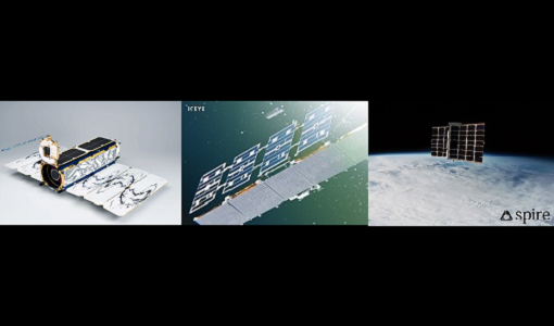
The following missions are currently being considered as part of the Automatic Identification System (AIS) and Radio Frequency
Document - Product Specifications
Planet-combined-imagery-product-specs-2020.pdf
This document describes Planet satellite imagery products.
Mission - Third Party Missions
Multi Spectral Scanner (MSS) Processor Releases
GCP displacement B TM radiometric calibration Update to radiometric calibration strategy for TM reflective bands (Dark Current
Mission - Third Party Missions
Thematic Mapper (TM) Processor Releases
GCP displacement B TM radiometric calibration Update to radiometric calibration strategy for TM reflective bands (Dark Current
Document - Technical Note
Technical Note on Quality Assessment for Landsat 1-7
Technical Note on Quality Assessment for Landsat 1-7
News - Success Stories
Predicting crop yield using Planet data
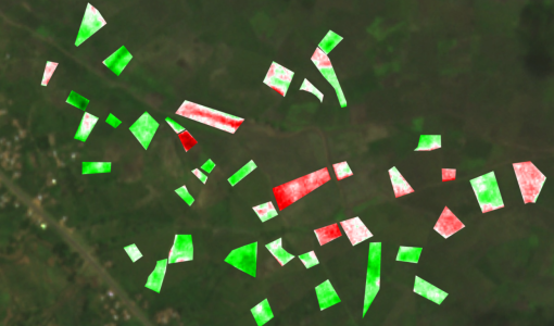
The researchers at Southampton wanted to get a better understanding of the current state of croplands and their spatial variation
News - Data Release news
PlanetScope and Skysat data available through ESA’s Third Party Missions Programme
The PlanetScope camera on each DOVE cubesat operates currently in four bands (red, green, blue and near infra-red) or five
Document - General Reference
Third Party Missions Brochure
This brochure summarises ESA's Third Party Missions programme, providing a timeline and examples of content related to some of the missions.
Document - General Reference
Heritage Missions brochure
This brochure describes ESA's Heritage Space Programme and includes infographics describing some of the missions in the programme.
Event - Training
EO Summer School 3
In line with observations it shows anti-cyclonically rotating surface currents and cyclonically rotating bottom currents.
News - Success Stories
Heritage data trains neural networks to detect urban sprawl
Since they’ve been trained identically, they can help monitor both current and past urban changes.
News - Thematic area articles
How satellite data help to shape society
Title: Current drought situation in Ebro basin Description: The SMOS soil-moisture-based drought monitor is updated monthly
