- All Categories (381)
- Data (3)
- News (25)
- Missions (23)
- Events (25)
- Tools (1)
- Activities (13)
- Documents (291)
Mission - Heritage Missions

Wind Scatterometer (WS) Quality Control Reports
The data includes instrument working modes, temperatures, currents and voltages of the transmitter and calibration chain,
Mission - Heritage Missions
Wind Scatterometer (WS) Processor Releases
The current processor software version for the operational ground segment is ASPS v 10.04.
Mission - Heritage Missions
Wind Scatterometer (WS) Cal/Val
ERS-2 Scatterometer: Mission Performances and Current Reprocessing Achievements Calibration strategy for ERS scatterometer
Event - Meeting

VH-RODA and CEOS SAR workshop
The workshop provided an open forum for the presentation and discussion of current status and future developments related
Event - Workshop

VH-RODA 2021 Workshop
the Workshop will provide an open forum (new space, commercial and institutional) for the presentation and discussion of current
Mission - Earth Watch
Vegetation (VGT) Quality Control Reports
months and provide information about: Absolute and inter-band radiometric accuracy Multi-temporal radiometric accuracy Dark current
Mission - Earth Watch
Vegetation (VGT) Processor Releases
The current processor software version, used for a full reprocessing of the PROBA-V archive and also for the operational
Mission - Earth Watch
Vegetation (VGT) Cal/Val
Greenland (only during June/July): during one week daily acquisitions in uncompressed mode Weekly Calibration acquisition Dark current
Activity - Cal/Val activities

UV nadir viewing galleries
Download chart A new perspective on the current state of the ozone layer derived using the merged total ozone data record
Document - User Guide

User Manual - LEDA 13 Landsat
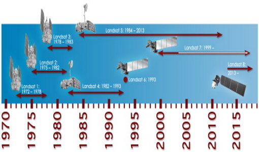
This infosheet describes the Landsat databank. The databank is a catalogue of imagery remotely sensed by the Landsat series of satellites (Landsat l to 5) available at ESA/Earthnet and acquired at Fucino (Italy), Kiruna (Sweden) and Maspalomas (Canaries).
News - Thematic area articles

Transforming space data into climate action
By combining high-quality data from both current and previous missions, scientists are improving their understanding of the
News - Success Stories
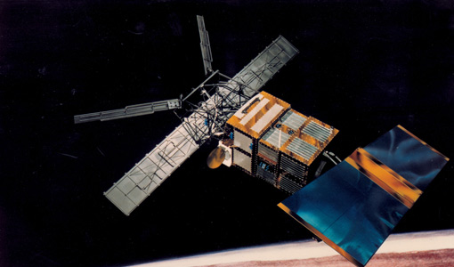
Trailblazing ERS-2 mission enables climate change applications
Varied elevations of Bachu in western China InSAR is currently one of the most accurate methods to generate digital elevation
Mission - Earth Watch

TIRS Product Anomalies
artifacts, how they are addressed and corrected, and provides up-to-date information and details regarding known issues and current
Document - General Reference

Third Party Missions Brochure
This brochure summarises ESA's Third Party Missions programme, providing a timeline and examples of content related to some of the missions.
Document - Proceedings

Third ESA International Conference on Spacecraft Guidance, Navigation and Control Systems
The proceedings from the Third ESA International Conference on Spacecraft Guidance, Navigation and Control Systems, which took place at ESTEC in Noordwijk, the Netherlands, from 26 to 29 November 1996, are presented here.
Mission - Third Party Missions
Thematic Mapper (TM) Processor Releases
GCP displacement B TM radiometric calibration Update to radiometric calibration strategy for TM reflective bands (Dark Current
Document - General Reference
The International Charter- Space and Major Disasters
The Charter is an important step forward in linking the needs of disaster and relief organisations with space technology solutions to help mitigate the effects of disaster on human life, property and the environment.
News - Success Stories

The Earthnet Programme: 40 years of evolution and future challenges
Giuseppe Ottavianelli Title: Current Earthnet TPM Programme Manager Description: Giuseppe Ottavianelli, Earthnet TPM Programme
Document - General Reference
The Earth Observation Handbook, 2010 Update - Key Tables
This is the 2010 update of the CEOS Earth Observation Handbook. You can browse the live database at http://database.eohandbook.com/ or download the printable PDF of key tables based on the 2010 database contents for a handy reference.