- All Categories (33)
- News (10)
- Missions (1)
- Events (4)
- Tools (1)
- Activities (3)
- Documents (14)
News - Events and Proceedings
Φ-Week Triumphs
Opening Session Title: Φ-Week's Opening Session Description: During the fourth edition of ESA’s Φ -Week, Josef Aschbacher, current
Event - Meeting
VH-RODA and CEOS SAR workshop
The workshop provided an open forum for the presentation and discussion of current status and future developments related
Event - Workshop
VH-RODA 2021 Workshop
the Workshop will provide an open forum (new space, commercial and institutional) for the presentation and discussion of current
News - Success Stories
Trailblazing ERS-2 mission enables climate change applications
Varied elevations of Bachu in western China InSAR is currently one of the most accurate methods to generate digital elevation
News - Thematic area articles
Tracking the world’s forests from space
Deforestation in Brazil Scientist’s understanding of the health of the world’s forests is being further improved through current
Document - General Reference
Third Party Missions Brochure
This brochure summarises ESA's Third Party Missions programme, providing a timeline and examples of content related to some of the missions.
Document - Technical Note
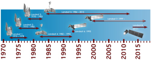
Technical Note on Quality Assessment for Landsat 1-7
Technical Note on Quality Assessment for Landsat 1-7
Activity - Quality
SLAP
Currently, in excess of 701,000 Level 1 TM and 84,000 Level 1 ETM+ products have been reprocessed and released under the
Document - Proceedings
SEASAR-2012-sessions-summaries-seed-questions-recommendations.pdf
This document gathers together the sessions summaries with seed questions discussion and recommendations of the SEASAR 2012 workshop.
Event - Workshop
SEASAR 2012
Aouf 14:00 - 14:20 Towards consistent inversion of wind, waves and surface current from SAR Bertrand Chapron (IFREMER, France
Mission - Third Party Missions
Multi Spectral Scanner (MSS) Processor Releases
GCP displacement B TM radiometric calibration Update to radiometric calibration strategy for TM reflective bands (Dark Current
News - Success Stories
Long-term satellite data show wind farms can affect local air currents
Long-term measurements allow before and after comparison Data from the heritage Envisat satellite currently maintained accessible
Document - Product Document
LANDSAT_Products_Description_Document.pdf
This document acts as a User Guide to the Landsat MSS, TM and ETM+ archives, focussing more specifically on the Landsat TM and ETM+ products from the Kiruna, Maspalomas and Matera archives (including from the Matera, Fucino, Neustralitz, O’Higgins, Malindi, Libreville and Bishkek ground stations) that have been generated as part of the ESA archive bulk-reprocessing project.
News - General News
How SNAP facilitates access to ESA Third Party Missions data
SNAP is currently developed by a consortium that includes Brockmann Consult GmbH, CS France, CS Romania, SenSar and SkyWatch
News - Thematic area articles
How scientists use space data to help advance the energy transition
To build on the current project, the research team plans to use data from ESA’s Third Party Missions programme, which are
News - Thematic area articles
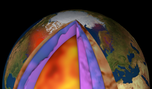
How ESA uses space data to explore deep Earth
Swarm maps core dynamics The swirling, conducting iron in Earth’s liquid outer core create powerful electric currents, which
Document - General Reference
Heritage Missions brochure
This brochure describes ESA's Heritage Space Programme and includes infographics describing some of the missions in the programme.
Activity - General activities
GSCB and LTDP
Envisat data are used in many fields of Earth science, including atmospheric pollution, fire extent, sea ice motion, ocean currents


