- All Categories (9808)
- Data (7)
- News (29)
- Missions (4)
- Events (22)
- Tools (10)
- Activities (6)
- Campaigns (2)
- Documents (9728)
NEWS
Discover the latest news on the European Space Agency's Earth Observation activities. Learn all about new data availability and how ESA's missions are performing.
News - Events and Proceedings
Workshop celebrates end of long-running PROBA-1 satellite
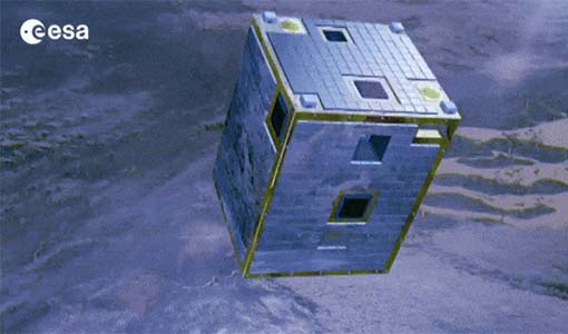
In January, ESA will mark the end of its long-running CHRIS sensor onboard the PROBA-1 satellite in a special workshop.
News - Thematic area articles
Transforming space data into climate action
ESA’s Earth observation activities are playing a key role in the revitalised global drive to combat climate change.
News - Thematic area articles
Space helps monitor Earth’s changing biosphere
Earth’s biosphere is continually changing. Through its pioneering Earth observation missions, ESA is making critical contributions to monitor these changes and their impacts on Earth’s water and carbon cycles.
News - Thematic area articles
Space data help to unravel the complexities of Earth’s atmosphere
As the impacts of the climate crisis intensify, scientists are using ESA’s Earth observation archives to investigate atmospheric processes and their influences on the planet’s changing environment.
News - Success Stories
Satellites track the health of the ozone layer
ESA’s Earth observation activities are contributing to international efforts to monitor and preserve the layer of stratospheric ozone that blankets the planet.
News - Success Stories
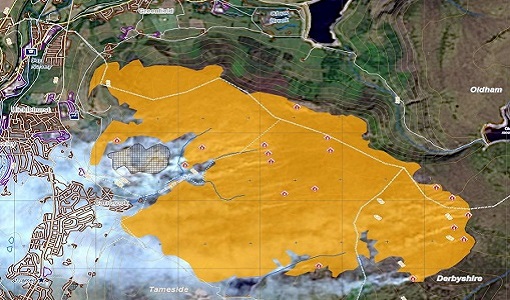
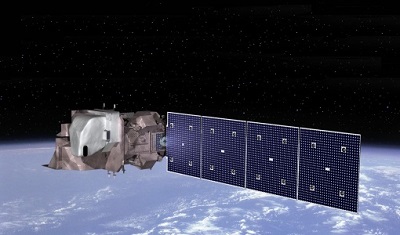
Satellite data allows real-time detection of potential fires
A pilot Fire Detection Service, based on real-time processing of Landsat-8 data being assessed within the framework of ESA's Earthnet Programme.
News - General News
Release of CHRIS PROBA-1 toolbox for SNAP
PROBA -1 continues to provide valuable hyperspectral data to the scientific community, and so the tools to handle this data have been incorporated into ESA’s SNAP multi-mission toolbox.
News - Infographics
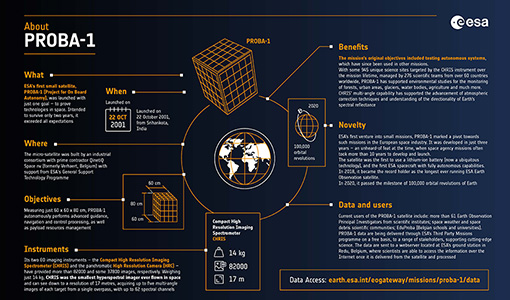
PROBA-1 - From technology demonstration to long-term Earth observation
Learn about ESA's PROBA-1 (Project for On-Board Autonomy) mission in our new infographic.
News - Operational News
PROBA-1 - End of CHRIS acquisitions
The CHRIS instrument onboard PROBA-1 successfully ended its operational phase in December 2022 and will no longer acquire images.
News - Data Release news
New reprocessed Landsat data on a new dissemination server
The full ESA Landsat archive has been reprocessed with the latest version of the processor to provide a homogenous dataset covering MSS, TM and ETM+ data.
News - Success Stories
New cross-calibration readies PROBA-1 data for climate research
While PROBA-1 has already exceeded expectations by suppling over 21 years of Earth observation hyperspectral data, recent cross-calibration activities are aiming to ensure the data will robustly serve long time-series research, even when the satellite ends operations.
News - Events and Proceedings
National missions in the spotlight at the Living Planet Symposium
In the framework of ESA’s Third Party Missions (TPM) programme, the agency offers access to the full data archives of almost 50 satellite missions, which are owned by organisations around the world.
News - Operational News
Landsat-8 web portal now available on new environment
The Landsat-8 Portal service has been migrated to a new server and is accessible on the previous web address.
News - Spotlight on EO community
Introducing Mirko Albani
In this short introduction, ESA's Heritage Missions Programme Manager describes what he likes most about ESA's long term archive of satellite mission data and his role in the programme.
News - Spotlight on EO community
Interviewing Mirko Albani
ESA’s Heritage Space Programme Manager describes the goals of the programme, some of the challenges involved in preserving and improving 40 years of historical Earth observation data, and his passion for curating this long-term archive.
News - Success Stories
How Envisat helped to shape global understanding of Earth’s systems
Twenty years have passed since a ground-breaking European spacecraft designed to deliver unprecedented insight into the planet’s changing environment was lofted into orbit.
News - How to guides
HEDAVI Discover: a step-by-step guide
The Heritage Data Visualisation tool (HEDAVI) is a platform developed by the French Science Consulting for Earth Observation group, VisioTerra, which allows users to freely access over 40 years of ESA Earth Observation Heritage data, Third Party Missions and some Copernicus data.
News - Data Release news
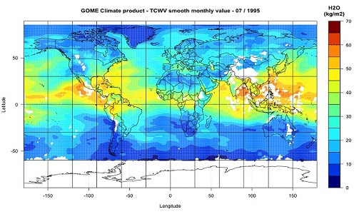
GOME TCWV Climate product available online
GOME Total Column Water Vapour (TCWV) Climate product developed within the ESA GOME-Evolution project is now accessible from the ESA data archives together with the ERS-2 GOME data.
News - Data Release news
Full European Landsat data collection now available under the same catalogue
The Full European Landsat data collection, from Landsat-1 to Landsat-8, is now available under the same catalogue
News - General News
ESA's improved Earth system data records: what is in store for the future?
Fundamental Data Records (FDRs) are instrumental in advancing our understanding of Earth systems and for addressing societal challenges effectively. These long-term records contain uncertainty-quantified, calibrated and geo-located multi-instrument/multi-platform satellite sensor data spanning several decades to support climate-related applications.


