- All Categories (20)
- Data (4)
- News (6)
- Missions (2)
- Events (2)
- Tools (4)
- Activities (1)
- Documents (1)
News - Success Stories
Monitoring the health of wheat crops from space
Very high resolution space data can be used to improve the detection of a plant disease that impacts a major global cereal crop.
News - Success Stories
Space data unearths small-scale mining in Burkina Faso
Satellite data from ESA’s Pléiades Third Party Mission and Copernicus Sentinel-2 were used to demonstrate that deep learning models can accurately and inexpensively identify artisanal and small-scale mining, even in challenging semi-desertic environments.
News - Success Stories

Pléiades unlocks information about rock glaciers in central Himalaya
As climate change accelerates the melting of glacial ice, remote sensing scientists are tapping into the potential of Pléiades data to help vulnerable mountainous communities.
Tools - Catalogues

FedEO
FedEO is a data catalogue that provides a unique entry point to a number of scientific catalogues and services for, but not limited to, European and Canadian missions.
Tools - Catalogues

EO CAT
EO CAT is a data catalogue, offering a Next Generation Earth Observation system designed to manage end-user Earth Observation services.
Event - Conference

Atmospheric Science Conference 2006
The 2006 conference was dedicated the theme atmosphere to provide scientists and data users with the opportunity to present first-hand and up-to-date results from their ongoing research activities ESA Mission instruments.
News - Success Stories

Pléiades celebrates 10 years and extends satellite fleet with Pléiades Neo
ESA is proud to mark the 10-year milestone of the Pléiades programme, a forerunner in providing very high resolution (VHR) commercial satellite imagery ideal for precision mapping and in-depth intelligence.
News - Infographics

An overview of the very high-resolution Pleiades satellites
Find out about the achievements of the Pléiades programme in this infographic.
Activity - General activities

GSCB and LTDP
The Copernicus programme is based on a fleet of European Earth observation satellites, built and operated by ESA, member states and commercial entities. Copernicus will also offer data from non-European satellites.
Tools - Visualisation
EVDC Orbit Prediction Tool
The EVDC Orbit Prediction and Overpass Tool generates and visualises satellite's overpasses.
Data - Project Proposal (Restrained)
Pléiades full archive and tasking
The Pléiades twins (1A and 1B) deliver very high-resolution optical data (up to 0.5 m resolution Panchromatic and Colour and 2 m Multispectral) and offer a daily revisit capability to any point on the globe. The swath width is approximately 20 km (with a nadir footprint). The ortho-products are automatically generated by the Pléiades ground segment, based on SRTM or Reference3D database. The projection available for Pléiades ortho-products is UTM, datum WGS84. Bands combinations:: Pansharpened: colour image at 0.5 m resolution Bundle: (0.5 m panchromatic image + 2 m multispectral image) Processing levels: Primary: The Primary product is the processing level closest to the natural image acquired by the sensor. This product restores perfect collection conditions: the sensor is placed in rectilinear geometry, and the image is clear of all radiometric distortion. Standard Ortho: The Ortho product is a georeferenced image in Earth geometry, corrected from acquisition and terrain off-nadir effects. Tailored Ortho: Aside from the Standard Ortho product, when different specifications are needed, a custom orthorectification, with a more precise 3D model provided by the client or acquired for the purpose, can be provided on demand. As per ESA policy, very high-resolution imagery of conflict areas cannot be provided.
Data - Fast Registration with approval (Restrained)
Pléiades ESA archive
The Pléiades ESA archive is a dataset of Pléiades-1A and 1B products that ESA collected over the years. The dataset regularly grows as ESA collects new Pléiades products. Pléiades Primary and Ortho products can be available in the following modes: Panchromatic image at 0.5 m resolution Pansharpened colour image at 0.5 m resolution Multispectral image in 4 spectral bands at 2 m resolution Bundle (0.5 m panchromatic image + 2 m multispectral image) Spatial coverage: Check the spatial coverage of the collection on a map available on the Third Party Missions Dissemination Service. As per ESA policy, very high-resolution imagery of conflict areas cannot be provided.
Data - External Data (Restrained)
Aura OMI complete NASA dataset
The OMI observations provide the following capabilities and features: A mapping of ozone columns at 13 km x 24 km and profiles at 13 km x 48 km A measurement of key air quality components: NO2, SO2, BrO, HCHO, and aerosol The ability to distinguish between aerosol types, such as smoke, dust and sulfates The ability to measure aerosol absorption capacity in terms of aerosol absorption optical depth or single scattering albedo A measurement of cloud pressure and coverage A mapping of the global distribution and trends in UV-B radiation. The OMI data are available in the following four levels: Level 0, Level 1B, Level 2, and Level 3. Level 0 products are raw sensor counts. Level 0 data are packaged into two-hour "chunks" of observations in the life of the spacecraft (and the OMI aboard it) irrespective of orbital boundaries. They contain orbital swath data. Level 1B processing takes Level 0 data and calibrates, geo-locates and packages the data into orbits. They contain orbital swath data. Level 2 products contain orbital swath data. Level 3 products contain global data that are composited over time (daily or monthly) or over space for small equal angle (latitude longitude) grids covering the whole globe.
Data - Announcement of Opportunity (Restrained)

Closed ESA announcement of opportunities
Find out about closed ESA announcement of opportunities and what these opportunities involved, for historical reference.
Tools - Processing
Atmospheric Toolbox
The Atmospheric Toolbox (previously known as BEAT) is a collection of executable tools and API, developed to facilitate the utilisation, viewing and processing of e.g. GOMOS, MIPAS, SCIAMACHY and GOME data.
Event - Workshop

Copernicus Sentinel-5 Precursor Validation Team Workshop
The purpose of the workshop was to gather feedback from the Sentinel-5P Validation Team (S5PVT) about the uncertainty characterisation of all Copernicus Sentinel-5P products.
Mission - Third Party Missions

Aura
NASA's Aura mission studies the chemistry and dynamics of Earth's atmosphere from the ground through the mesosphere.
News - Data Release news
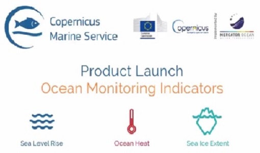
New Ocean Monitoring Indicators provide key reference for climate change
Copernicus Marine Service has released a new ocean information product. The Ocean Monitoring Indicators (OMIs) are free downloadable datasets.
Mission - Third Party Missions

Pléiades
The Pléiades programme followed the SPOT programme satellite series, introducing advanced technologies in Earth observation.
Document - Proceedings

EO-Summer-School-2-Stratospheric-ozone-satellite-observations-DA-and-forecasts.pdf
Stratospheric ozone: satellite observations, data assimilation and forecasts