- All Categories (29)
- Data (6)
- News (6)
- Missions (2)
- Events (3)
- Tools (2)
- Activities (1)
- Documents (9)
Document - General Reference
The-Changing-Earth-New-Scientific-Challenges-for-ESAs-Living-Planet-Programme.pdf
This article is extracted from ESA Bulletin Nr. 129.
Document - Proceedings
The Use and Applications of ERS in Latin America-Uso y Applicaciones de ERS en America Latina
Proceedings of the International Seminar on the use and applications of ERS in Latin America, held on 25-29 November 1996 in Vina del Mar, Chile. In English and Spanish.
Document - General Reference
The Science and Research Elements of ESA Living Planet Programme
This document presents the plans for the Earth Explorer element of the European Space Agency's 'Living Planet' Programme for Earth Observation.
Document - General Reference
Taking-natures-pulse-Europes-ERS-satellites.pdf
This brochure presents an overview of the ERS mission and its applications and benefits.
News - Thematic area articles
Space helps monitor Earth’s changing biosphere
Earth’s biosphere is continually changing. Through its pioneering Earth observation missions, ESA is making critical contributions to monitor these changes and their impacts on Earth’s water and carbon cycles.
News - Data Release news
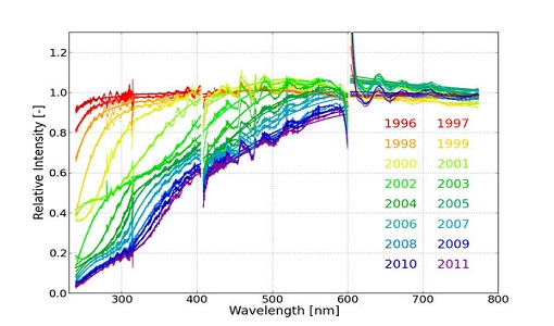
New ERS-2 GOME Level 1 v5.1 dataset available online
A new GOME Level 1b dataset has been generated for the 16-year mission period bringing relevant quality improvements for the revised calibration approach, compensating aging and instrument degradation, and provide enhanced accessibility.
Event - Conference
Living Planet Symposium 2019
ESA's Living Planet Symposia are amongst the biggest Earth observation conferences in the world. Scientists present their latest findings on Earth's environment and climate.
Data - EO Sign In Authentication (Open)
JERS-1 SAR Level 1 Single Look Complex Image
The JSA_SLC_1P product is comparable to the ESA SLC/IMS images generated for Envisat ASAR and ERS SAR instruments. It is a slant-range projected complex image in zero-Doppler SAR coordinates. The data is sampled in natural units of time in range and along track, with the range pixel spacing corresponding to the reciprocal of the platform ADC rate and the along track spacing to the reciprocal of the PRF. Data is processed to an unweighted Doppler bandwidth of 1000Hz, without sidelobe reduction. The product is suitable for interferometric, calibration and quality analysis applications. Data acquired by ESA ground stations. Spatial coverage: Check the spatial coverage of the collection on a map available on the Third Party Missions Dissemination Service.
Data - EO Sign In Authentication (Open)
JERS-1 SAR Level 1 Precision Image
The JSA_PRI_1P product is comparable to the ESA PRI/IMP images generated for Envisat ASAR and ERS SAR instruments. It is a ground range projected detected image in zero-Doppler SAR coordinates, with a 12.5 metre pixel spacing. It has four overlapping looks in Doppler covering a total bandwidth of 1000Hz, with each look covering a 300Hz bandwidth. Sidelobe reduction is applied to achieve a nominal PSLR of less than -21dB. The image is not geocoded, and terrain distortion (foreshortening and layover) has not been removed. Data acquired by ESA ground stations. Spatial coverage: Check the spatial coverage of the collection on a map available on the Third Party Missions Dissemination Service.
Mission - Heritage Missions
JERS-1
The overall objectives of JERS-1 (Japanese Earth Resources Satellite) were the generation of global data sets with SAR and OPS sensors aimed at surveying resources, establishing an integrated Earth observation system
Document - Proceedings
Image Processing Techniques-Tecnicas de Procesamiento de Imagenes
Proceedings of the first Latino-American Seminar on Radar Remote Sensing, held on 2-4 December 1996 in Buenos Aires, Argentina. In English and Spanish.
Document - Proceedings
Image Processing Techniques
Proceedings of the second Latino-American Seminar on Radar Remote Sensing held on 11-12 September 1998 in Santos, San Paulo, Brazil.
Tools - Apps
Heritage Missions app for iOS
Download the Heritage Missions application to discover what the missions were about, how it worked and what the elements of the space and ground segment that make these missions unique.
Tools - Apps
Heritage Missions app for Android
Download the Heritage Missions application to discover what the missions were about, how it worked and what the elements of the space and ground segment that make these missions unique.
News - Success Stories
Heritage data trains neural networks to detect urban sprawl
Using data from non-operational ESA remote sensing missions, researchers have trained a network of artificial neurons to recognise how cities change over decades. They hope this will help city planners reduce the impact that urbanisation has on the environment.
News - Thematic area articles
Global understanding of Earth's land surfaces greatly boosted by satellite data
ESA perform land surface monitoring with a range of instruments onboard satellites acquiring optical and radar data. Collections of data from these missions are freely available for research purposes.
Document - General Reference
Further-Achievements-of-the-ERS-Missions.pdf
This publication shows how with time the various uses of ERS data are developing and consolidating in key areas of science and economic exploitation.
News - Data Release news
FDR4ALT - ESA unveils new cutting-edge ERS/Envisat Altimeter and Microwave Radiometer Datasets
The European Space Agency (ESA) has developed a comprehensive suite of innovative Earth system data records as part of the Fundamental Data Records for Altimetry project - FDR4ALT.
Data - EO Sign In Authentication (Open)
ERS-1/2 SAR IM Single Look Complex L1 [SAR_IMS_1P]
The SAR SLC product is a single look complex acquired in Image Mode. It is a digital image, with slant range and phase preserved, generated from raw SAR data using up-to-date auxiliary parameters. The products are intended for use in SAR quality assessment, calibration and interferometric applications. A minimum number of corrections and interpolations are performed on the data. Absolute calibration parameters (when available) are provided in the product annotation. Product characteristics: Pixel size: 8 m (range - across track) x 4 m (azimuth - along track – varying slightly depending on acquisition Pulse Repetition Frequency) Scene area: 100 km (range) x at least 102.5 km (azimuth) Scene size: 5000 samples (range) x at least 30000 lines (azimuth) Pixel depth: 32 bits signed integer (16 bits I, 16 bits Q) Total product volume: 575 MB Projection: Slant range- Number of looks: 1.
Data - EO Sign In Authentication (Open)
ERS-1/2 SAR IM Precision L1 [SAR_IMP_1P]
The SAR Precision product is a multi-look (speckle-reduced), ground range image acquired in Image Mode. This product type is most applicable to users interested in remote sensing applications, but is also suitable for calibration purposes. The products are calibrated and corrected for the SAR antenna pattern and range-spreading loss. Radar backscatter can be derived from the products for geophysical modelling, but no correction is applied for terrain-induced radiometric effects. The images are not geocoded, and terrain distortion (foreshortening and layover) has not been removed. The numbering sequence relates to the satellite position and therefore differs between Ascending and Descending scenes. Product characteristics: Pixel size: 12.5 m (range - across track) x 12.5 m (azimuth - along track) Scene area: 100 km (range) x at least 102.5 km (azimuth) Scene size: 8000 pixels range x at least 8200 lines (azimuth) Pixel depth: 16 bits unsigned integer Total product volume: 125 MB Projection: Ground-range Number of looks: 3.


