- All Categories (22)
- Data (7)
- News (10)
- Missions (2)
- Events (2)
- Campaigns (1)
News - Success Stories
Commercial space data help to regreen grasslands in Africa
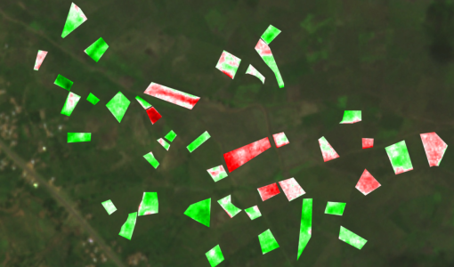
Commercial satellite imagery made available through ESA’s Third Party Missions programme is guiding an ambitious community-focused initiative to regrow natural grasslands in Sub-Saharan Africa.
Event - Workshop
EO for Agriculture Under Pressure 2024
EO for Agriculture Under Pressure 2024 Workshop follows up from previous events, bringing together the large community working on EO-based science and solutions for agriculture.
Mission - Earth Explorers
FLEX
The FLEX mission will provide global maps of vegetation fluorescence, which can be converted into an indicator of photosynthetic activity.
Campaign
FLEXSense 2018
The 2018 Fluorescence Explorer Sense (FLEXSense) campaign combined various field activities in preparation for the FLEX satellite mission.
Data - Campaigns (Open)
FLEXSense 2018
The 2018 Fluorescence Explorer Sense (FLEXSense) campaign combined various field activities in preparation for the FLEX satellite mission.
Event - Meeting
Fluorescence (FLEX) 2019
The FLEX 2019 meeting consisted of a series of events addressing remote sensing of vegetation fluorescence.
News - Thematic area articles
Global understanding of Earth's land surfaces greatly boosted by satellite data
ESA perform land surface monitoring with a range of instruments onboard satellites acquiring optical and radar data. Collections of data from these missions are freely available for research purposes.
News - General News
Improved resolution for SkySat data and extension of Planet data availability
The SkySat satellites orbits has been lowered from 500km to 450km altitude and various processing improvements have been implemented by Planet.
News - Infographics
Measuring photosynthetic fluorescence - ESA's FLEX mission
Learn about ESA's upcoming FLEX mission, which is dedicated to gathering information about photosynthetic activity to shed light on the functioning of Earth's vegetation, in our latest infographic.
News - Success Stories
Monitoring the health of wheat crops from space
Very high resolution space data can be used to improve the detection of a plant disease that impacts a major global cereal crop.
News - Data Release news
New FLEX-related campaign datasets released
New datasets have been released for three campaigns, covering activities supporting the upcoming FLEX mission.
News - Data Release news
PlanetScope and Skysat data available through ESA’s Third Party Missions Programme
Through ESA’s Third Party Missions Programme, researchers, scientists and companies from around the world can apply to access Planet’s high-frequency, high-resolution satellite data for non-commercial use.
News - Data Release news
PlanetScope and SkySat data now available
PlanetScope and SkySat missions under evaluation. Interested users can investigate suitability of the data for scientific and R&D activities.
News - Success Stories
Predicting crop yield using Planet data
The world’s population continues to grow, while the climate crisis is raising Earth’s temperatures and increasing the likelihood of extreme weather events – all of which affect food security.
News - Thematic area articles
Satellite data central to ocean monitoring
Over 95% of Earth’s water is found in our oceans, and yet sadly, oceans are under stress from climate change and pollution. Monitoring our oceans is vital for Earth’s survival and satellites are the primary means of long-term and independent observation of our vast ocean bodies and their associated coastal zones.
Mission - Third Party Missions
SkySat
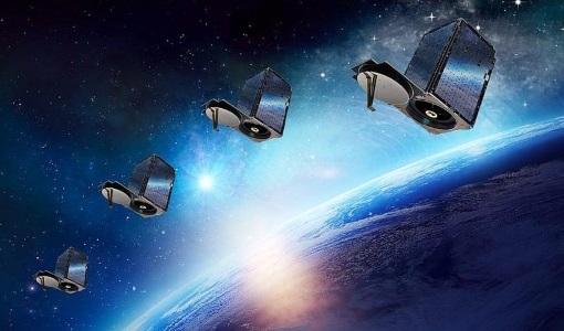
SkySat is a constellation of high-resolution Earth imaging satellites from the commercial company Planet Labs.
Data - Fast Registration with approval (Restrained)
SkySat ESA archive
The SkySat ESA archive collection consists of SkySat products requested by ESA supported projects over their areas of interest around the world and that ESA collected over the years. The dataset regularly grows as ESA collects new products. Two different product types are offered, Ground Sampling Distance at nadir up to 65 cm for panchromatic and up to 0.8m for multi-spectral. EO-SIP Product Type Product Description Content SSC_DEF_SC Basic and Ortho scene Level 1B 4-bands Analytic /DN Basic scene Level 1B 4-bands Panchromatic /DN Basic scene Level 1A 1-band Panchromatic DN Pre Sup resolution Basic scene Level 3B 3-bands Visual Ortho Scene Level 3B 4-bands Pansharpened Multispectral Ortho Scene Level 3B 4-bands Analytic/DN/SR Ortho Scene Level 3B 1-band Panchromatic /DN Ortho Scene SSC_DEF_CO Ortho Collect Visual 3-band Pansharpened Image Multispectral 4-band Pansharpened Image Multispectral 4-band Analytic/DN/SR Image (B, G, R, N) 1-band Panchromatic Image The Basic Scene product is uncalibrated, not radiometrically corrected for atmosphere or for any geometric distortions inherent in the imaging process: Analytic - unorthorectified, radiometrically corrected, multispectral BGRN Analytic DN - unorthorectified, multispectral BGRN Panchromatic - unorthorectified, radiometrically corrected, panchromatic (PAN) Panchromatic DN - unorthorectified, panchromatic (PAN) L1A Panchromatic DN - unorthorectified, pre-super resolution, panchromatic (PAN) The Ortho Scene product is sensor and geometrically corrected, and is projected to a cartographic map projection: Visual - orthorectified, pansharpened, and colour-corrected (using a colour curve) 3-band RGB Imagery Pansharpened Multispectral - orthorectified, pansharpened 4-band BGRN Imagery Analytic SR - orthorectified, multispectral BGRN. Atmospherically corrected Surface Reflectance product. Analytic - orthorectified, multispectral BGRN. Radiometric corrections applied to correct for any sensor artifacts and transformation to top-of-atmosphere radiance. Analytic DN - orthorectified, multispectral BGRN, uncalibrated digital number imagery product Radiometric corrections applied to correct for any sensor artifacts Panchromatic - orthorectified, radiometrically correct, panchromatic (PAN) Panchromatic DN - orthorectified, panchromatic (PAN), uncalibrated digital number imagery product The Ortho Collect product is created by composing SkySat Ortho Scenes along an imaging strip. The product may contain artifacts resulting from the composing process, particular offsets in areas of stitched source scenes. Spatial coverage: Check the spatial coverage of the collection on a map available on the Third Party Missions Dissemination Service. As per ESA policy, very high-resolution imagery of conflict areas cannot be provided.
Data - Project Proposal (Restrained)
SkySat Full Archive and New Tasking
The SkySat Level 2B Basic Scene, Level 3B Ortho Scene and Level 3B Consolidated full archive and new tasking products are available as part of Planet imagery offer. The SkySat Basic Scene product is uncalibrated and in a raw digital number format, not corrected for any geometric distortions inherent in the imaging process. Rational Polynomial Coefficients (RPCs) is provided to enable orthorectification by the user. Basic Scene Product Components and Format Processing Levels Analytic (unorthorectified, radiometrically corrected, multispectral BGRN) Analytic DN (unorthorectified, multispectral BGRN) Panchromatic DN (unorthorectified, panchromatic) Product Components and Format Image File (GeoTIFF format) Metadata File (JSON format) Rational Polynomial Coefficients (Text File) UDM File (GeoTIFF format) Image Configuration 4-band Analytic DN Image (Blue, Green, Red, NIR) 1-band Panchromatic DN Image (Pan) Ground Sampling Distance 3.7 m at nadir (average at reference altitude 475 km) Ground Sampling Distance (nadir) Panchromatic 0.86m and Multispectral 1.0m for SkySat-1&2 Panchromatic 0.65m and Multispectral 0.8m for SkySat-3 to 13 (0.72 m and 1.0m for data acquired before 30/06/2020) Accuracy <50 m RMSE The SkySat Ortho Scene is sensor- and geometrically-corrected (by using DEMs with a post spacing of between 30 and 90 meters) and is projected to a cartographic map projection; the accuracy of the product will vary from region to region based on available GCPs. Different products are available: The SkySat Visual Ortho Scene product is orthorectified, pansharpened, and color-corrected (using a color curve) 3-band RGB Imagery The SkySat Pansharpened Multispectral Scene product is orthorectified, pansharpened 4-band BGRN Imagery The SkySat Analytic DN Ortho Scene product is orthorectified, multispectral BGRN, uncalibrated, digital number imagery product. The product has been processed to remove distortions caused by terrain; It eliminates the perspective effect on the ground (not on buildings), restoring the geometry of a vertical shot. Transformation to at-sensor radiance is not included The SkySat Panchromatic DN Ortho Scene product is orthorectified, panchromatic, uncalibrated, digital number imagery product. It has a finer GSD than the Analytic Product. Transformation to at-sensor radiance is not included. The SkySat Analytic Ortho Scene are calibrated multispectral imagery products with radiometric corrections applied to correct for any sensor artifacts and transformation to top-of-atmosphere radiance. The SkySat Consolidated Product are Ortho Collect product created by composing ~60 SkySat Ortho Scenes (Visual, Pansharpened Multispectral, Analytic DN, Panchromatic DN) along an imaging strip into segments Ortho Scene Product Components and Format Visual Ortho Pansharpened Multispectral Analytic DN Ortho Panchromatic DN Ortho Analytic Ortho Product Components and Format Image File (GeoTIFF format) Metadata File (JSON format) Rational Polynomial Coefficients (Text File) UDM File (GeoTIFF format) Image File (GeoTIFF) Metadata File (JSON format) Rational Polynomial Coefficients (Text File) UDM File (GeoTIFF format) Image File (GeoTIFF format) Metadata File (JSON format) Rational Polynomial Coefficients (Text File) UDM File (GeoTIFF format) Image File (GeoTIFF format) Metadata File (JSON format) Rational Polynomial Coefficients (Text File) UDM File (GeoTIFF format) Image File (GeoTIFF format) Metadata File (JSON format) Rational Polynomial Coefficients (Text File) UDM File (GeoTIFF format) Image Configuration 3-band Pansharpened Image (PS Red, PS Green, PS Blue) 4-band Pansharpened Image (PS Blue, PS Green, PS Red, PS NIR) 4-band Analytic DN Image (B, G, R, N) 1-band Panchromatic Image 4-band Analytic Image (B, G, R, N) Ground Sampling Distance 50 cm 50 cm 50 cm 50 cm 50 cm Projection UTM WGS84 UTM WGS84 UTM WGS84 UTM WGS84 UTM WGS84 Accuracy <10 m RMSE <10 m RMSE <10 m RMSE <10 m RMSE radiometric accuracy: +/- 5% Relative accuracy at < 10 degrees off-nadir angle As per ESA policy, very high-resolution imagery of conflict areas cannot be provided.
Data - Sample Data (Open)
SkySat Sample Data
Download free SkySat sample datasets to preview products available for this mission.
Data - Campaigns (Open)
SoyFLEX 2015
SoyFLEX 2015 took place over the agricultural area around Jülich, Germany and Rzecin wetland site, Poland
