- All Categories (20)
- Data (3)
- News (2)
- Missions (4)
- Events (6)
- Tools (2)
- Activities (1)
- Documents (2)
Data - Announcement of Opportunity (Restrained)
Announcement of Opportunity for S3VT (Sentinel-3 Validation Team)
In the framework of a Copernicus collaborative agreement ESA and EUMETSAT invite interested groups and individuals to support the Sentinel-3 Validation Team (S3VT).
Activity - General activities
EO Summer Schools
ESA's series of summer schools, on Monitoring of the Earth System, aims to promote the exploitation of Earth observation (EO) data.
Event - Training
EO Summer School 8
ESA's series of summer schools, on Monitoring of the Earth System, aims to promote the exploitation of Earth observation data.
Event - Training
EO Summer School 7
ESA's series of summer schools, on Monitoring of the Earth System, aims to promote the exploitation of Earth observation data.
Event - Training
EO Summer School 6
ESA's series of summer schools, on Monitoring of the Earth System, aims to promote the exploitation of Earth observation data.
Event - Conference
Living Planet Symposium 2022
Learn about the 2022 edition of ESA's Living Planet Symposium.
News - Success Stories
How Envisat helped to shape global understanding of Earth’s systems
Twenty years have passed since a ground-breaking European spacecraft designed to deliver unprecedented insight into the planet’s changing environment was lofted into orbit.
Tools - Apps
Heritage Missions app for Android
Download the Heritage Missions application to discover what the missions were about, how it worked and what the elements of the space and ground segment that make these missions unique.
Data - Fast Registration with immediate access (Open)
Envisat DORIS Doppler [DOR_DOP_1P]
This product was generated by the Centre de Traitement Doris Poseidon (CTDP). The DORIS Doppler product (DOR_DOP_1P) was consolidated offline 2-4 weeks after sensing and stored in the F-PAC archive. The file size is 0.5 Mbytes per orbit.
Data - Fast Registration with immediate access (Open)
Envisat DORIS Precise Orbit [DOR_VOR_AX]
The latest version of the Envisat DORIS Precise Orbit product, DOR_VOR_AX, was generated by the Centre de Traitement Doris Poseidon (CTDP) using the Geophysical Data Records F standards (GDR-F). The product is used to obtain the satellite orbital parameters (latitude, longitude, height and height rate) by using orbit computation routines. The most significant changes related to the GDR-F standards concern the new ocean tide model (FES2014) and the updated Terrestrial Reference Frame (ITRF2014). The new standards significantly improve all Precise Orbit Determination (POD) metrics with respect to GDR-E. The mean difference and variance of Sea Surface Height (SSH) at crossovers is slightly reduced. The DOR_VOR_AX product adopts the Envisat format, and the size is 0.2 Mbytes per orbit. Users are recommended to apply the GDR-F version, but the previous datasets are still available (i.e. GDR-D and GDR-E versions). See further details in the readme file for Envisat DORIS Precise Orbit Determination files. Comparison of Envisat Sea Level Anomaly trends obtained using DORIS Precise Orbit GDR-E and F standards. North/South patterns are evident. Credits: CNES/CLS.
Mission - Earth Explorers
Swarm
Swarm is dedicated to creating a highly detailed survey of Earth’s geomagnetic field and its temporal evolution as well as the electric field in the atmosphere using a constellation of three identical satellites.
Mission - Earth Explorers
GOCE
ESA's Gravity field and Ocean Circulation Explorer (GOCE) mission mapped Earth's geoid very accurately, opening a window into Earth's interior structure as well as the currents circulating within the depths of its oceans.
Mission - Heritage Missions
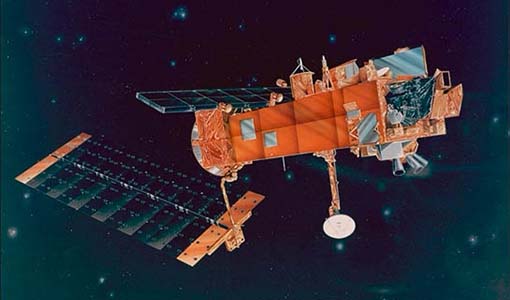
Envisat
Envisat was ESA's successor to ERS. Envisat carried ten instruments aboard for a wide range of Earth observing fields. The mission was operational from 2002 to 2012.
Mission - Heritage Missions
ERS
The ERS programme was composed of two missions, ERS-1 and ERS-2, which together observed the Earth for 20 years, from 1991 to 2011.
Tools - Other
Swarm-Aurora
Swarm-Aurora, a web-based tool, was designed to facilitate and drive the use of Swarm in-situ measurements in auroral science.
News - Success Stories
ESA's Earth Explorers surpassing expectations
In this video, learn how each Earth Explorer mission is contributing to Earth science, and changing the way we look at our beloved planet.
Event - Workshop
10 Years of GOME on ERS-2 Workshop
The workshop summarised 10 years of operation of the Global Ozone Monitoring Experiment (GOME) on board ERS-2.
Event - Conference
3rd ERS Symposium
The ESA Directorate for Observation of the Earth and its Environment held the 3rd ERS Symposium, in 1997, where many of the results from the ERS-1 and ERS-2 missions were presented and discussed by the scientific community.
Document - General Reference
Understanding our Planet - the Earth Observation Envelope Program
This brochure describes the Earth Observation Envelope Programme.
Document - General Reference
Earth-Explorers.pdf
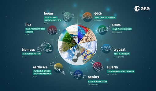
This flyer gives a quick overview of the 6 Earth Explorers missions.


