- All Categories (63)
- Data (8)
- News (31)
- Missions (2)
- Tools (6)
- Activities (1)
- Documents (15)
Document - Technical Note
Visual Inspection Report for PlanetScope (SuperDOVE)
Visual Inspection Report for PlanetScope (SuperDOVE)
News - Events and Proceedings
VHR Data Quality in the limelight
In recent years, the satellite landscape has steadily expanded with a variety of very high resolution (VHR) commercial satellites, also emerging from new space providers. A result of this growth is an increased need to address data quality assurance.
News - Data Release news
Two new ESA archive collections have been opened for PlanetScope and SkySat
PlanetScope ESA archive and SkySat ESA archive collections are available through ESA’s Third Party Missions programme via Fast Approval Registration.
Document - User Guide
TPM-L-OADS-dissemination-service-User-Manual.pdf
This guide describes the Third Party Missions Dissemination System.
News - Success Stories
TPM data help advance plastic litter detection from space
Several innovative ESA Discovery element projects exploring remote sensing of plastic marine litter lean on commercial satellite data disseminated via the Agency’s Third Party Mission programme.
News - General News
Three new Third Party Missions under evaluation
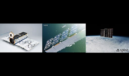
ICEYE, PlanetScope and Spire under evaluation. Interested users can investigate suitability of the data for scientific and R&D activities.
Document - General Reference
Third Party Missions Brochure
This brochure summarises ESA's Third Party Missions programme, providing a timeline and examples of content related to some of the missions.
Document - General Reference
The International Charter- Space and Major Disasters
The Charter is an important step forward in linking the needs of disaster and relief organisations with space technology solutions to help mitigate the effects of disaster on human life, property and the environment.
Document - Technical Note
Technical Note on Quality Assessment for PlanetScope (SuperDOVE)
Technical Note on Quality Assessment for PlanetScope (SuperDOVE)
Document - Technical Note
Technical Note on Quality Assessment for PlanetScope (DOVE-R)
Technical Note on Quality Assessment for PlanetScope (DOVE-R)
News - Thematic area articles
Space helps monitor Earth’s changing biosphere
Earth’s biosphere is continually changing. Through its pioneering Earth observation missions, ESA is making critical contributions to monitor these changes and their impacts on Earth’s water and carbon cycles.
Tools - Analysis
SNAP
SNAP is a common architecture for all Sentinel Toolboxes. It is ideal for Earth observation processing and analysis.
News - Success Stories
Showcasing success stories from ESA's Third Party Missions
ESA’s Third Party Missions programme consists of more than 50 missions from around the world.
Tools - Analysis
Sentinel-2 Toolbox
The Toolbox consists of a rich set of visualisation, analysis and processing tools for the exploitation of optical high-resolution products including the Sentinel-2 MSI sensor.
News - Thematic area articles
Satellites investigate Earth’s terrestrial hydrosphere
ESA’s Earth observation satellites are playing a leading role in furthering our understanding of how Earth’s water cycle is being influenced by humankind.
News - Thematic area articles
Satellite data boost global understanding of land surface
Understanding our changing land surface is essential in the study of climate change. Satellites are used to monitor changes to the material that covers Earth’s surface, so-called land cover, such as vegetation and water.
News - Data Release news
Sample data products from ESA’s Third Party Missions
Samples of data products from a range of Third Party Missions are now available to download, offering a preview of what these missions provide.
News - Thematic area articles
Remote sensing data underpin research on soil
Environmental data disseminated by ESA’s Earth observation programmes provide knowledge about the stresses on Earth’s soils – aiding many applications such as crop management, drought and flood forecasting, and ecosystem protection.
News - Thematic area articles
Remote sensing data map impacts of natural hazards
As climate change increases the frequency and severity of natural disasters, remote sensing data can warn about extreme events and help tackle emergency situations.
Data - EO Sign In Authentication (Open)
RapidEye time series for Sentinel-2
The European Space Agency, in collaboration with BlackBridge collected two time series datasets with a five day revisit at high resolution: February to June 2013 over 14 selected sites around the world April to September 2015 over 10 selected sites around the world. The RapidEye Earth Imaging System provides data at 5 m spatial resolution (multispectral L3A orthorectified). The products are radiometrically and sensor corrected similar to the 1B Basic product, but have geometric corrections applied to the data during orthorectification using DEMs and GCPs. The product accuracy depends on the quality of the ground control and DEMs used. The imagery is delivered in GeoTIFF format with a pixel spacing of 5 metres. The dataset is composed of data over: 14 selected sites in 2013: Argentina, Belgium, Chesapeake Bay, China, Congo, Egypt, Ethiopia, Gabon, Jordan, Korea, Morocco, Paraguay, South Africa and Ukraine. 10 selected sites in 2015: Limburgerhof, Railroad Valley, Libya4, Algeria4, Figueres, Libya1, Mauritania1, Barrax, Esrin, Uyuni Salt Lake. Spatial coverage: Check the spatial coverage of the collection on a map available on the Third Party Missions Dissemination Service.


