- All Categories (1021)
- Data (1)
- News (8)
- Missions (3)
- Events (1)
- Tools (2)
- Activities (1)
- Documents (1005)
News - Data Release news
FDR4ALT - ESA unveils new cutting-edge ERS/Envisat Altimeter and Microwave Radiometer Datasets
The European Space Agency (ESA) has developed a comprehensive suite of innovative Earth system data records as part of the Fundamental Data Records for Altimetry project - FDR4ALT.
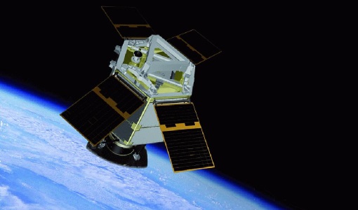
Data - Sample Data (Open)
GEOSAT-2 Sample Data
Download free GEOSAT-2 sample datasets to preview products available for this mission.
News - Data Release news
GEOSAT-2 Spain Coverage 2022 collection open to users
ESA’s Earthnet Third Party Missions Programme presents the latest addition to its collection: the GEOSAT-2 Spain Coverage 2022.
News - Data Release news
GEOSAT-2 Spain coverage new collection open for users
In the framework of ESA’s Earthnet Third Party Missions programme, we are glad to announce that there is a new collection open for users: the GEOSAT-2 Spain Coverage collection.
News - Success Stories
ESA missions help to reveal worldwide lake water loss trend
Climate change, human consumption and sedimentation are depleting more than half of the world’s biggest lakes of water, according to a ground-breaking analysis that drew on three decades of satellite data.
News - Data Release news
New data available: GEOSAT-2 Portugal Coverage 2021
A new collection is available to the public through ESA’s Earthnet Third Party Missions Programme: the GEOSAT-2 Portugal Coverage 2021.
News - Success Stories

Decades of satellite data reveal the risks of climate tipping points
Decades-long time series that draw on ESA’s Earth observation archives are enabling scientists to uncover the threat of sudden and potentially irreversible changes to the icy parts of the planet.
News - Spotlight on EO community

Introducing Mirko Albani
In this short introduction, ESA's Heritage Missions Programme Manager describes what he likes most about ESA's long term archive of satellite mission data and his role in the programme.
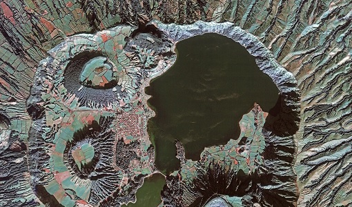
News - Infographics

An overview of the GEOSAT-2 high-resolution mission
The GEOSAT series consists of two very high-resolution satellites, capable of acquiring sub-metric multispectral images. The missions are part of ESA's Third Party Missions programme, and GEOSAT-2 is summarised in our latest infographic.
Activity - Projects
Dragon 2 Cooperation Programme
The Dragon 2 Programme focussed on the exploitation of ESA, ESA's Third Party Missions and Chinese Earth observation data for science and applications development in land, ocean and atmospheric applications.
Tools - Apps

Heritage Missions app for iOS
Download the Heritage Missions application to discover what the missions were about, how it worked and what the elements of the space and ground segment that make these missions unique.
Tools - Apps

Heritage Missions app for Android
Download the Heritage Missions application to discover what the missions were about, how it worked and what the elements of the space and ground segment that make these missions unique.
Mission - Heritage Missions

Envisat
Envisat was ESA's successor to ERS. Envisat carried ten instruments aboard for a wide range of Earth observing fields. The mission was operational from 2002 to 2012.
Mission - Heritage Missions
GEOSAT
The GEOSAT series consists of GEOSAT-1 and GEOSAT-2 missions. They are Earth imaging satellites. GEOSAT-2, a high resolution satellite, became the first European fully-private satellite capable of providing sub-metric multi-spectral imagery.
Document - Proceedings

2004 Envisat and ERS Symposium
The 2004 Envisat and ERS Symposium was held in Salzburg - Austria from 6 to 10 September 2004. The 2004 Envisat and ERS Symposium provided a forum for investigators to present results of ongoing research project activities and assess the development of applications and services.
Mission - Heritage Missions
GEOSAT-2
GEOSAT-2 is the second satellite of the Deimos Earth Observation system, following GEOSAT-1.
Event - Training

3rd Advanced Training Course on Land Remote Sensing 2011
This 2011 advanced ESA training course focused on land remote sensing theory and applications.
Document - General Reference

Taking-the-Measure-of-Earth-Fifteen-Years-of-Progress-in-Radar-Altimetry.pdf
This article is extracted from ESA Bulletin Nr. 128.
Document - General Reference
Mapping-Forest-Fire-Damage-with-Envisat.pdf
This article was published in the ESA Bulletin Nr. 120 and describes how remote sensing from space (and ESA's ENVISAT environment satellite, launched in March 2002, in particular) is suitable for forest-fire-related studies.