- All Categories (140)
- Data (26)
- News (65)
- Missions (3)
- Events (15)
- Tools (1)
- Activities (2)
- Campaigns (10)
- Documents (18)
DATA
Discover and download the Earth observation data you need from the broad catalogue of missions the European Space Agency operate and support.
Data - Campaigns (Open)
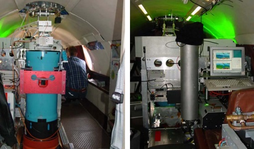
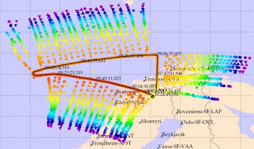
WindVal III
The objectives the WindVal III campaign were Early correlative observations between Aeolus and the airborne A2D and 2-µm DWL wind lidar systems
Data - Campaigns (Open)

WindVal II
The objectives for the WindVal II campaign in 2016 were derived from the results, experience and lessons learnt from these last airborne campaigns in 2009 and 2015.
Data - Campaigns (Open)
WindVal I
The objectives of the WindVal 1 campaign in 2015 were derived from results, experience and lessons learnt from the previous airborne campaign in 2009.
Data - Campaigns (Open)
WALEX
The objective of (WALEX) was to collect valuable data to provide representative lidar measurements of water vapour and aerosol properties in different climatic zones.
Data - Campaigns (Open)
PremierEX
The campaign was based in the Arena Arctica in Kiruna (Sweden). The science campaign has addressed the science objectives and was part of the airborne campaign of the EU project RECONCILE.
Data - Fast Registration with immediate access (Open)
ERS-1/2 SCATTEROMETER Ocean Wind field and Sea Ice probability [ASPS20.H/ASPS20.N]
The ASPS Level 2 products contain, for each node: the radar backscattering sigma nought for the three beams of the instrument, the four aliased wind solutions (Rank 1-4 wind vector) and the de-aliased wind vector flag, the sea-ice probability and sea-ice flag, the YAW quality flag. The wind retrieval is performed with the CMOD5N geophysical model function derived by ECMWF to compute the neutral winds rather than 10 m winds. ASPS L2.0 High resolution products are provided with a spatial resolution of 25x25 km and a grid spacing of 12.5 km. ASPS L2.0 Nominal resolution products are provided with a spatial resolution of 50x50 km and a grid spacing of 25 km. One product covers one orbit from ascending node crossing. Please consult the Product Quality Readme file before using the ERS ASPS data.
Data - Fast Registration with immediate access (Open)
ERS-1/2 SCATTEROMETER Nominal Resolution back-scattering measurements, Ocean Wind field [UWI]
The ERS data reprocessed with the ASPS facility is also available in the UWI format to maintain the compatibility with the FD (Fast Delivery) products. The ASPS UWI product is organised in frames of 500 x 500 km providing the radar backscattering sigma nought for the three beams of the instrument plus the wind speed and direction. The wind retrieval is performed with the CMOD5N geophysical model function derived by ECMWF to compute the neutral winds rather than 10m winds. ASPS UWI products are provided with a spatial resolution of 50 x 50 km and a grid spacing of 25 km. One product covers one orbit from ascending node crossing. Please consult the Product Quality Readme file before using the ERS ASPS data.
Data - Fast Registration with immediate access (Open)
ERS-1/2 Radar Altimeter REAPER Sensor Geophysical Data Record - SGDR [ERS_ALT_2S]
This is a RA Geophysical Data Record (GDR) product containing radar range, orbital altitude, wind speed, wave height and water vapour from the ATSR/MWR as well as geophysical corrections. The REAPER (REprocessing of Altimeter Products for ERS) product is generated by applying a similar processing as for Envisat RA-2 on the Level 1b consolidated waveforms using 4 different re-trackers, RA calibration improvement, new precise orbit solution (POD), new ionospheric corrections (NICO09 until 1998 and GIM up to 2003), ECMWF ERA-interim model and updated SSB tables. This product contains two data rates: a low rate of 1 Hz and a high rate of 20 Hz. Most 1 Hz data is also represented at 20 Hz, while microwave radiometer (ATSR/MWR) data and the atmospheric and geophysical corrections are only given at 1 Hz. The REAPER GDR (ERS_ALT_2_) is a global product including data over ocean, ice and land. It should be noted that this product differs from the Envisat RA2 in the following ways: The product format; which is NetCDF (more details can be found in the Product Handbook, and not PDS The product is delivered based on orbit acquisition and not per pass (pole-to-pole). This product is extended through Envisat RA-2 data.
Data - Data Description
ERS-1/2 Radar Altimeter REAPER METEO Product - [ERS_ALT_2M]
This is a RA Meteo product containing only the 1 Hz parameters for altimeter (surface range, satellite altitude, wind speed and significant wave height at nadir) and ATSR/MWR data (brightness temperature at 23.8 GHz and 36.5 GHz, water vapour content, liquid water content) used to correct altimeter measurements. It also contains the full geophysical corrections. This product corresponds to a subset of the REAPER GDR product (ERS_ALT_2_). The REAPER (REprocessing of Altimeter Products for ERS) product is generated by applying a similar processing as for Envisat RA-2 on the Level 1b consolidated waveforms using 4 different re-trackers, RA calibration improvement, new precise orbit solution (POD), new ionospheric corrections (NICO09 until 1998 and GIM up to 2003), ECMWF ERA-interim model and updated SSB tables. This product contains only the low rate of 1 Hz data. The REAPER Meteo (ERS_ALT_2M) is a global product including data over ocean, ice and land. It should be noted that this product differs from the Envisat RA2 in the following ways: The product format; which is NetCDF (more details can be found in the Product Handbook), and not PDS The product is delivered based on orbit acquisition and not per pass (pole-to-pole). This product is extended through Envisat RA-2 data.
Data - Fast Registration with immediate access (Open)
ERS-1/2 Radar Altimeter REAPER Geophysical Data Record - GDR [ERS_ALT_2]
This is a RA Geophysical Data Record (GDR) product containing radar range, orbital altitude, wind speed, wave height and water vapour from the ATSR/MWR as well as geophysical corrections. The REAPER (REprocessing of Altimeter Products for ERS) product is generated by applying a similar processing as for Envisat RA-2 on the Level 1b consolidated waveforms using 4 different re-trackers, RA calibration improvement, new precise orbit solution (POD), new ionospheric corrections (NICO09 until 1998 and GIM up to 2003), ECMWF ERA-interim model and updated SSB tables. This product contains two data rates: a low rate of 1 Hz and a high rate of 20 Hz. Most 1 Hz data is also represented at 20 Hz, while microwave radiometer (ATSR/MWR) data and the atmospheric and geophysical corrections are only given at 1 Hz. The REAPER GDR (ERS_ALT_2_) is a global product including data over ocean, ice and land. It should be noted that this product differs from the Envisat RA2 in the following ways: The product format; which is NetCDF (more details can be found in the Product Handbook, and not PDS The product is delivered based on orbit acquisition and not per pass (pole-to-pole). This product is extended through Envisat RA-2 data.
Data - Fast Registration with approval (Restrained)
ERS-1/2 ATSR Gridded Surface Temperature [AT1/AT2_NR__2P]
The Gridded Surface Temperature (GST) Product is the Level 2 full resolution geophysical product. The product contains gridded sea-surface temperature images using both nadir and dual view retrieval algorithms. The product includes pixel latitude/longitude positions, X/Y offset and the results of the cloud-clearing/land-flagging. It contains a single measurement data set the content of which is switchable, that is to say, the content of each pixel field will depend on the surface type. Specifically, the contents of the data fields will depend on the setting of the forward and nadir cloud flags and the land flag. The 3rd reprocessing of ATSR data was performed in 2013; the processing updates that have been put in place and the scientific improvements are outlined in full in the User Summary Note for the Third ERS ATSR Reprocessing.
Data - Fast Registration with approval (Restrained)
ERS-1/2 ATSR Gridded Brightness Temperature/Reflectance [AT1/AT2_TOA_1P]
The Gridded Brightness Temperature/Reflectance (GBTR) product contains top of atmosphere (TOA) brightness temperature (BT) values for the infra-red channels and reflectance values for the visible channels. Values for each channel and for the nadir and forward views occupy separate measurement data sets. Additional MDS contain cloud and land/sea flags and confidence flags for each image pixel. The 3rd reprocessing of ATSR data was performed in 2013; the processing updates that have been put in place and the scientific improvements are outlined in full in the User Summary Note for the Third ERS ATSR Reprocessing.
Data - Fast Registration with approval (Restrained)
ERS-1/2 ATSR Averaged Surface Temperature [AT1/AT2_AR__2P]
The Averaged Surface Temperature Product (AST) contains averaged geophysical data at two different resolutions, and with respect to two different averaging schemes: measurement data sets at resolutions of 0.5 by 0.5 degrees and 10 by 10 arcmin with respect to a latitude/longitude grid; other data sets contain data averaged over equal area cells of 50 by 50 km and 17 by 17 km aligned with the satellite ground track. Both top-of-atmosphere and surface data sets are provided. The surface temperature data sets provide, for sea cells, nadir and dual view sea surface temperatures, and for land cells, land surface temperature (currently 11 micron BT) and NDVI. Cloud data is also included. No ADS are included in the AST product; auxiliary data is contained within the MDS. The data sets of the AST product are arranged by surface type and resolution. The 3rd reprocessing of ATSR data was performed in 2013; the processing updates that have been put in place and the scientific improvements are outlined in full in the User Summary Note for the Third ERS ATSR Reprocessing.
Data - Fast Registration with immediate access (Open)
Envisat RA-2 Sensor and Geophysical Data Record - SGDR [RA2_MWS__2P]
This is a RA-2 Sensor and Geophysical Data Record (SGDR) Full Mission Reprocessing (FMR) V3 product. This FMR follows the first Envisat Altimetry reprocessing Version (V2.1) completed in 2012. The GDR and S-GDR data products were reprocessed for all cycles from 6 to 113 (May 2002 to April 2012) into a homogeneous standard in NetCDF format (close to Sentinel-3). The Sensor Data Record (SGDR) Product from RA-2/MWR includes the data in the GDR product (RA-2 geophysical data, MWR data) and also RA-2 averaged waveforms (18Hz) and RA-2 individual waveforms (1800Hz). This product is a continuation of ERS RA data. This data product has a coverage of 1 pass and pole to pole, a spatial sampling of about 390 m along track and a size of 31 to 40 MB, depending on presence of individual waveforms. The radiometric accuracy is 0.2 dB and auxiliary data include: Orbit state vectors (DORIS, FOS), RA2 and MWR characterisation data, Platform attitude, Gain calibration, USO frequency, ECMWF data, time relation, leap second, Ionospheric corrections, geoid, mean sea surface, slope data, and tide model (ocean, earth, loading, pole). Please consult the Envisat RA-2/MWR Product Quality Readme file before using the data.
Data - Fast Registration with immediate access (Open)
Envisat RA-2 Geophysical Data Record - GDR [RA2_GDR__2P]
This is a RA-2 Geophysical Data Record (GDR) Full Mission Reprocessing (FMR) V3 product containing radar range and orbital altitude, wind speed, wave height, water vapour from the MWR and geophysical corrections. This FMR follows the first Envisat Altimetry reprocessing Version (V2.1) completed in 2012. The GDR and S-GDR data products were reprocessed for all cycles from 6 to 113 (May 2002 to April 2012) into a homogeneous standard in NetCDF format (close to Sentinel-3). For many aspects, the V3.0 reprocessed data are better than the previous dataset: In terms of available and valid data, the coverage is better, notably thanks to a better availability of MWR data at the beginning of the mission In terms of performance at cross-overs, the quality is improved: the annual signal and average of Mean SSH is decreased, as well as the standard deviation The new MWR characteristics were shown to improve largely the global quality of data. As well as the new tide model, the new MSS and the new orbit standard The Global and regional Mean Sea Level trend is very weakly impacted though the effort was put, this time, on the mesoscale restitution, rather than long term drift, as during V2.1 reprocessing. Please consult the Envisat RA-2/MWR Product Quality Readme file PDF before using the data.
Data - EO Sign In Authentication (Open)
Envisat MERIS Reduced Resolution - Level 2 [MER_RR__2P/ME_2_RRG]
MERIS RR Level 2 is a Reduced Resolution (RR) Geophysical product for Ocean, Land and Atmosphere. Each MERIS Level 2 geophysical product is derived from a MERIS Level 1 product and auxiliary parameter files specific to the MERIS Level 2 processing. The MERIS RR Level 2 product has a Sentinel 3-like format starting from the 4th reprocessing data released to users in July 2020. The data package is composed of NetCDF 4 files containing instrumental and scientific measurements, and a Manifest file, which contains metadata information related to the description of the product. A Level 2 product is composed of 64 measurement files containing mainly: 13 files containing Water-leaving reflectance, 13 files containing Land surface reflectance and 13 files containing the TOA reflectance (for all bands except those dedicated to measurement of atmospheric gas - M11 and M15), and several files containing additional measurement on Ocean, Land and Atmospheric parameters. The Auxiliary data used are listed in the Manifest file associated to each product. MERIS was operating continuously on the day side of the Envisat orbit (descending track). RR data was acquired over 43.5 minutes in each orbit, i.e. 80% of the descending track.
Data - EO Sign In Authentication (Open)
Envisat MERIS Reduced Resolution - Level 1 [MER_RR__1P/ME_1_RRG]
The MERIS Level 1 Reduced Resolution (RR) product contains the Top of Atmosphere (TOA) upwelling spectral radiance measurements at reduced resolution. The in-band reference irradiances for the 15 MERIS bands are computed by averaging the in-band solar irradiance of each pixel. The in-band solar irradiance of each pixel is computed by integrating the reference solar spectrum with the band-pass of each pixel. The MERIS RR Level 1 product has Sentinel 3-like format starting from the 4th reprocessing data released to users in July 2020. Each measurement and annotation data file is in NetCDF 4. The Level 1 product is composed of 22 measurements data files, 15 files containing radiances at each band (one band per file), accompanied by the associated error estimates, and 7 annotation data files. The band-pass of each pixel is derived from on-ground and in-flight characterisation via an instrument model. The values "Band wavelength" and "Bandwidth" provided in the Manifest file of the Level 1 products are the averaged band-pass of each pixel over the instrument field of view. The Auxiliary data used are listed in the Manifest file associated to each product. MERIS was operating continuously on the day side of the Envisat orbit (descending track). RR data was acquired over 43.5 minutes in each orbit, i.e. 80% of the descending track.
Data - EO Sign In Authentication (Open)
Envisat MERIS Full Resolution - Level 2 [MER_FRS_2P/ME_2_FRG]
MERIS FR Level 2 is a Full-Resolution Geophysical product for Ocean, Land and Atmosphere. Each MERIS Level 2 geophysical product is derived from a MERIS Level 1 product and auxiliary parameter files specific to the MERIS Level 2 processing. The MERIS FR Level 2 product has Sentinel 3-like format starting from the 4th reprocessing data released to users in July 2020. The data package is composed of NetCDF 4 files containing instrumental and scientific measurements, and a Manifest file which contains metadata information related to the description of the product. A Level 2 product is composed of 64 measurement files containing: 13 files containing Water-leaving reflectance, 13 files containing Land surface reflectance and 13 files containing the TOA reflectance (for all bands except those dedicated to measurement of atmospheric gas - M11 and M15), and several files containing additional measurements on Ocean, Land and Atmospheric parameters and annotation. The Auxiliary data used are listed in the Manifest file associated to each product. The Level 2 FR product covers the complete instrument swath. The product duration is not fixed and it can span up to the time interval of the input Level 0/Level 1. Thus the estimated size of the Level 2 FR is dependent on the start/stop time of the acquired segment. During the Envisat mission, acquisition of MERIS Full Resolution data was subject to dedicated planning based on on-demand ordering and coverage of specific areas according to operational recommendations and considerations. See yearly and global density maps to get a better overview of the MERIS FR coverage.
Data - EO Sign In Authentication (Open)
Envisat MERIS Full Resolution - Level 1 [MER_FRS_1P/ME_1_FRG]
The MERIS Level 1 Full Resolution (FR) product contains the Top of Atmosphere (TOA) upwelling spectral radiance measurements. The in-band reference irradiances for the 15 MERIS bands are computed by averaging the in-band solar irradiance of each pixel. The in-band solar irradiance of each pixel is computed by integrating the reference solar spectrum with the band-pass of each pixel. The MERIS FR Level 1 product has Sentinel 3-like format starting from the 4th reprocessing data released to users in July 2020. Each measurement and annotation data file is in NetCDF 4. The Level 1 product is composed of 22 data files: 15 files containing radiances at each band (one band per file), accompanied by the associated error estimates, and 7 annotation data files. The 15 sun spectral flux values provided in the instrument data file of the Level 1 products are the in-band reference irradiances adjusted for the Earth-sun distance at the time of measurement. The band-pass of each pixel is derived from on-ground and in-flight characterisation via an instrument model. The values "Band wavelength" and "Bandwidth" provided in the Manifest file of the Level 1b products are the averaged band-pass of each pixel over the instrument field of view. Auxiliary data are also listed in the Manifest file associated to each product. The Level 1 FR product covers the complete instrument swath. The product duration is not fixed and it can span up to the time interval of the input Level 0 (for a maximum of 20 minutes). Thus the estimated size of the Level 1 FR is dependent on the start/stop time of the acquired segment. During the Envisat mission, acquisition of MERIS Full Resolution data was subject to dedicated planning based on on-demand ordering and coverage of specific areas according to operational recommendations and considerations. See yearly and global density maps to get a better overview of the MERIS FR coverage.
Data - EO Sign In Authentication (Open)
AVHRR Level-1B Local Area Coverage Imagery
This collection is composed of AVHRR L1B products (1.1 km) reprocessed from the NOAA POES and Metop AVHRR sensors data acquired at the University of Dundee and University of Bern ground stations and from the ESA and University of Bern data historical archive. The product format is the NOAA AVHRR Level 1B that combines the AVHRR data from the HRPT stream with ancillary information like Earth location and calibration data which can be applied by the user. Other appended parameters are time codes, quality indicators, solar and satellite angles and telemetry. Two data collections cover Europe and the neighbouring regions in the period of 1 January 1981 to 31 December 2020 and the acquired data in the context of the 1-KM project in the ‘90s. During the early 1990’s various groups, including the International Geosphere-Biosphere Programme (IGBP), the Commission of the European Communities (CEC), the Moderate Resolution Imaging Spectrometer (MODIS) Science Team and ESA concluded that a global land 1 KM AVHRR data set would have been crucial to study and develop algorithms for several land products for the Earth Observing System. USGS, NOAA, ESA and other non-U.S. AVHRR receiving stations endorsed the initiative to collect a global land 1-km multi-temporal AVHRR data set over all land surfaces using NOAA's TIROS "afternoon" polar-orbiting satellite. On 1 April 1992, the project officially began up to the end of 1999 with the utilisation of 23 stations worldwide plus the NOAA local area coverage (LAC) on-board recorders. The global land 1-km AVHRR dataset is composed of 5 channels, raw AVHRR dataset at 1.1 km resolution from the NOAA-11 and NOAA-14 satellites covering land surfaces, inland water and coastal areas. Global Land 1 km AVHRR Data Set Project HRPT Ground Station Network (as of 1 April 1992) and Acquisition Areas for LAC Recorded Data Spatial coverage: Check the spatial coverage of the collection on a map available on the Third Party Missions Dissemination Service: AVHRR L1B 1.1 KM AVHRR L1B LAC Out-of-Europe.