- All Categories (62022)
- Data (204)
- News (351)
- Missions (72)
- Events (105)
- Tools (22)
- Activities (45)
- Campaigns (83)
- Documents (61140)
CAMPAIGNS
Learn about the ground-based, ship-borne, balloon-borne, and airborne campaigns and small satellite field experiments that validate orbiting ESA EO satellites and support future mission development.
Campaign
 2015
2015AfriSAR 2015
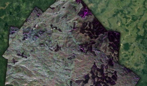
During the AfriSAR 2015 campaign, shared between ONERA (dry season, July 2015) and DLR (wet season 2016), Pol-InSAR and TomoSAR airborne data set were collected over four test sites over Africa, therefore covering different forest structures.
Campaign
 2016
2016AfriSAR 2016
In order to further support the BIOMASS mission development, especially concerning the mission concept verification and the development of geophysical algorithms, ESA funded the AfriSAR campaign.
Campaign
 2006
2006AGRISAR 2006
The AGRISAR 2006 campaign, carried out between 18 April and 2 August 2006, was established to address important specific programmatic needs of Sentinel-1 and -2.
Campaign
 2009
2009AgriSAR 2009
The AgriSAR 2009 campaign was defined to leverage the RADARSAT-2 mission to better understand and demonstrate the potential for GMES land monitoring user services, particularly in agriculture.
Campaign
 2006
2006AIRFIRE
The fires observational campaign was performed during summer 2006 and dedicated to the study of fire emission in the spectral region VNIR-SWIR.
Campaign
 2015
2015AirScatterGNSS
In this project an Airborne Wind Vector Scatterometer (AWVS) system was designed and built for measurements of sea surface backscattering from an aircraft.
Campaign
 2005
2005AquiferEx
The AquiferEx Optical and Radar Campaign was in support of information product generation based on satellite data, harmonisation of satellite data acquisition performed among Aquifer and AquiferEx project partners.
Campaign
 2014
2014AROMAT-I
The main objective of this AROMAT-I campaign was to test newly developed airborne sensors and to evaluate their capabilities as validation tools for future air quality space borne sensors, in particular TROPOMI.
Campaign
 2015 - 2016
AROMAT-II
This campaign covers the fields of atmospheric composition: NO2, SO2, aerosols, over Romania (Bucharest and Turceni) and Germany (Berlin).
Campaign
 2005
2005BACCHUS-DOC
The BACCHUS-DOC Radar and Optical Campaign was an area mapping project of vineyards near Frascati (Italy). ESA required high resolution geo-referenced airborne SAR data of different wavelength and polarisation (preferably polarimetric).
Campaign
 2018
2018BelSAR 2018
The BelSAR project intended to carry out an airborne campaign for SAR bistatic interferometric measurements at L-band and full polarisation, over a test site in Belgium.
Campaign
 2007
2007BioSAR 2007
The BioSAR campaign aimed to support geophysical algorithm development, calibration/validation and the simulation of future spaceborne Earth Observation missions.
Campaign
 2008
2008BioSAR 2008
The main objective of BioSAR-2 (BioSAR 2008) campaign was to record SAR data over boreal forests with topographic effects to investigate the effect on biomass retrieval.
Campaign
 2010
2010BioSAR 2010
The BioSAR-3 (BioSAR 2010) campaign was specifically planned and implemented to investigate possibilities for a future spaceborne P-band polarimetric and interferometric SAR with a life-time of multiple years.
Campaign
2017BorealScat
The main objective of “BorealScat – Technical Assistance for the Deployment of a Tower-based Radar and Geophysical Measurements during the BorealScat Experiment” was to characterise and quantify the temporal variations of radar observations of a forest stand over timescales ranging from seconds to years and to investigate the effects of environmental variables.
Campaign
 2012
2012C-MAPExp
The C‐MAPExp campaign was planned and executed to support the demonstration of CarbonSat capabilities.
Campaign
 2007
2007CEFLES2
The objective of the CEFLES2 campaigns was to provide key reference data and background knowledge for the preparatory phases of the Sentinel‐2 and FLEX missions.
Campaign
 2014
2014CHARADMexp
The ESA CHARADMExp campaign focuses on marine and marine-dust aerosol mixture characterisation.
Campaign
 2019
2019CIMREx
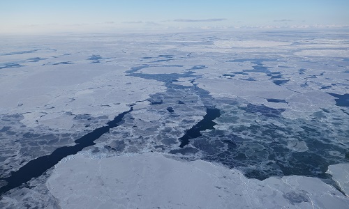
CIMREx airborne campaign aimed to sample the sea ice microwave emissions from various sea ice regimes around Svalbard and Greenland.
Campaign
 1998 - 2000
CLARE
CLARE 2000: Cloud Lidar and Radar Experiments were to provide an extended data base and develop new analysis methods.