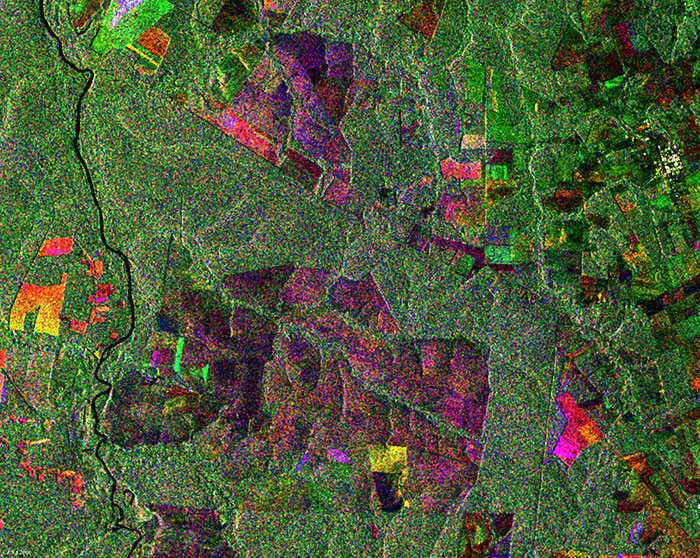
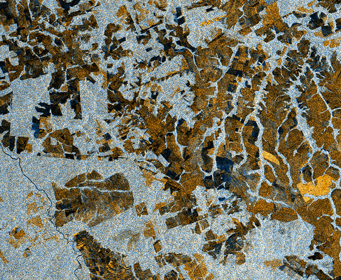
These two Envisat images examine an area of deforestation in the Mato Grosso region of Brazil, utilising multi-layer compositions to track changes over time.
This Envisat (IMP) radar image is a multi-layer composite made by merging three different acquisitions taken by Envisat on different dates. The image shows a large area along the Rio Arinos (lower right border) an area north of Cuiabà (Brazil), in the state of Mato Grosso. Originally uniform tropical rain forest dissected by a course drainage pattern, the area is now a patchwork of deforested zones (light violet and brown colour), sprawling along roads and around centres.
This ASAR wide swath mode multi-layer composite image shows the same area, but with a different orbit direction, acquisition date and resolution. The area is now a patchwork of deforested zones and visible in light brown.
Back to top
 Brazil deforestation - August 2006