Philippines, Tuesday 22 August 2006 - Sludge has washed up on Panay, a large island in the central Philippines, as an oil spill from a sunken tanker spread, threatening rich fishing grounds. Eleven days after the tanker chartered by Petron Corp., the largest oil refiner in the Philippines, sunk off the island of Guimaras, an average of 100-200 litres of oil continued to gush every hour.
The tanker was carrying about 2 million litres of bunker oil, an industrial fuel, when it sank in rough weather on August 11 and initially spilled 200,000 litres into the sea. The sunken ship is too deep for divers to reach and the Philippines, lacking heavy salvage equipment, has appealed for international help to prevent the disaster from getting worse.
Experts from the United States and Japan were on the way to help assess the cleanup operations and suggest measures on how to stop the slick from spreading further to vast mangrove areas and fishing grounds.
Philippine officials have said the pollution from the spill could take up to three years to clean up completely, with nearly 40,000 people and 200 km (120 miles) of coastline affected.
Philippines, Wednesday 23 August 2006 - The oil spill in the central Philippines has claimed its first human victim, with a man dying from breathing the toxic fumes. In the 12 days since the tanker sank, the huge slick has washed sludge onto huge areas of coastline. The oil spill has damaged fishing grounds, and polluted dive spots and a national marine reserve. Health officials say the man inhaled fumes of the thick, tar-like substance outside his home on Guimaras island. Villagers say skin and breathing problems have become commonplace. The government has hired locals for the clean-up, paying them less than $4 a day to scoop up the sludge on the shores. Many have no masks and use their bare hands.
The tanker delivering 2 million litres of industrial fuel sank on 11 August, but rescue workers are still battling to contain the spill. Petron Corporation, a Philippine state-controlled oil company which chartered the tanker, said the cost of the clean-up and any losses incurred would be covered by insurance. The Philippine coastguard says it has handed Petron a bill for nearly $2m (£1.06m) to cover the initial cost. But a spokesman has challenged the claim that Petron could be held responsible, saying the vessel was seaworthy and blaming bad weather on the accident. Only one of the ship's 10 containers is known to have burst, emptying 200,000 litres of industrial fuel oil into the sea. Petron said it is bringing in Japanese experts for underwater assessment of the tanker, which is in deep water beyond the reach of divers.
|
06 September 2006 |
|
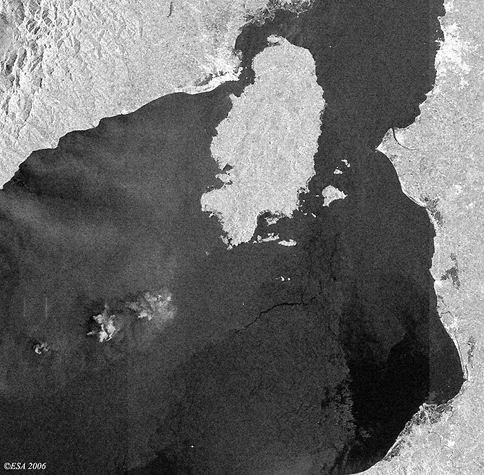
The Envisat image (Wide Swath) below was acquired south of Guimaras island (central Philippines), where the oil slick from the sunken oil ship has occurred. |
|
Envisat satellite image - after oil spill |
|
28 August 2006 |
|
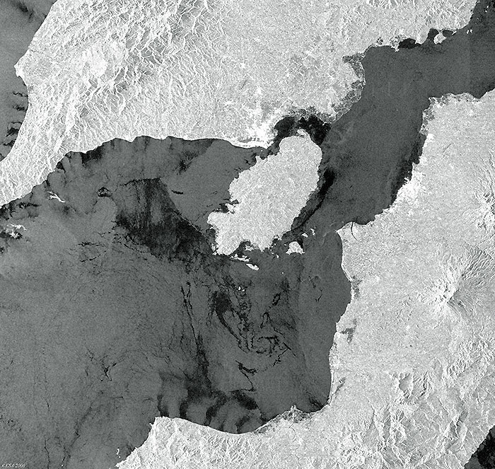
The Envisat image (Wide Swath) below was acquired on 28 August 2006 south of Guimaras Island (central Philippines), where the oil slick from the sunken oil ship has occurred. |
|
Envisat satellite image - after oil spill |
|
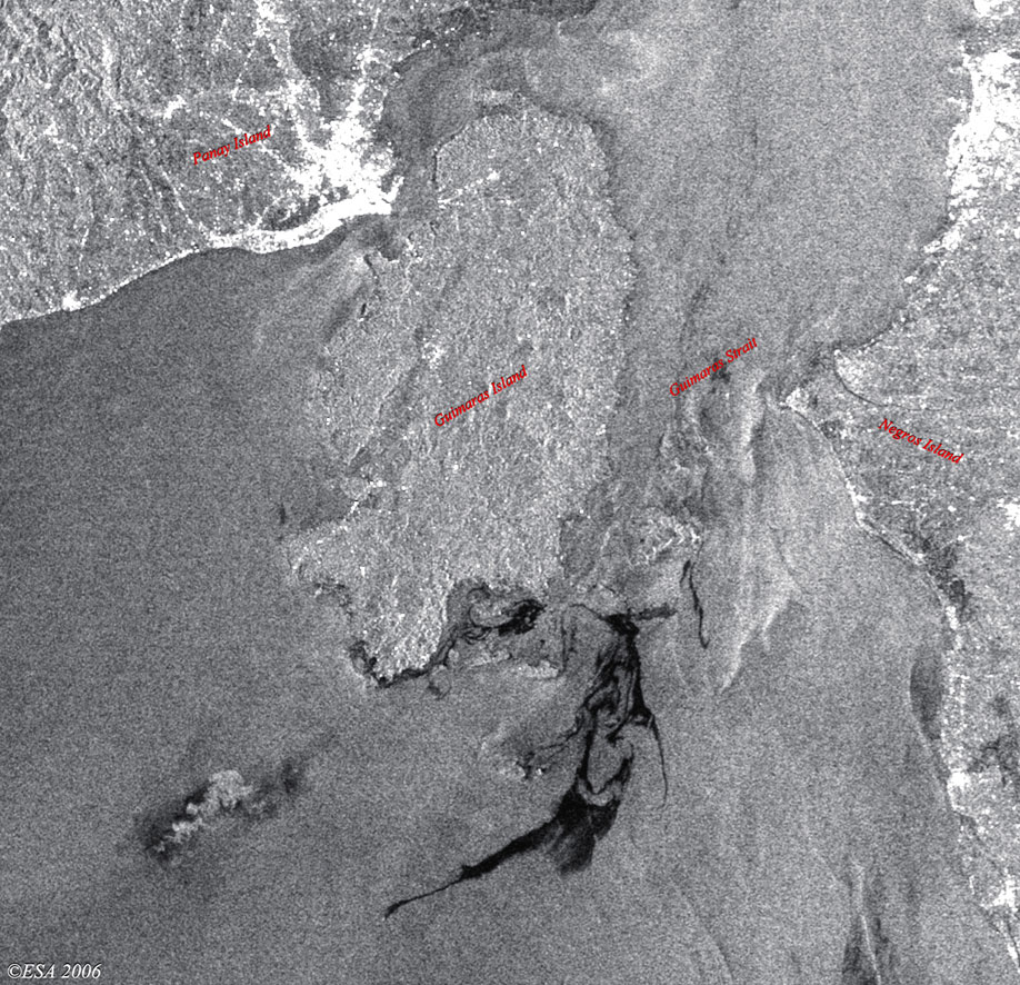
25 August 2006 |
|
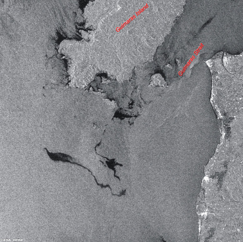
The Envisat image (Wide Swath) below, acquired on 25 August 2006 over central Philippines, shows the oil slick from the sunken oil ship, south of Guimaras island (middle image). |
|
Envisat satellite image - Magnified view of oil spill |
|
24 August 2006 |
|
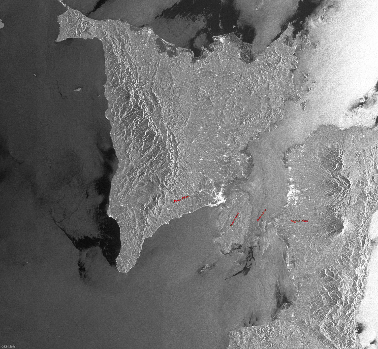
The Envisat image (Wide Swath) below, acquired in near real time over central Philippines, shows the oil slick from the sunken oil ship, south of Guimaras Island (seen as white dot around the southern area of the oil slick). |
|
Envisat satellite image - Magnified view of oil spill |
Back to top
 Philippines, August 2006