CANCUN, Mexico, July 17 (From AFP) - Tens of thousands of residents and tourists fled Mexico's Caribbean coast Sunday, as Hurricane Emily barreled toward Mexico's Yucatan peninsula. Two persons died while evacuating an oil platform when their helicopter crashed. Forecasters said the "extremely dangerous" category four storm, packing winds near 230 kilometers per hour, would reach the peninsula late Sunday or early Monday. "Fluctuations in intensity are common in major hurricanes, but little overall change in strength is expected before Emily makes landfall," the Miami-based National Hurricane Center said. Emily is the second major storm to hit the region in two weeks following Hurricane Dennis, which left at least 62 dead, mostly in Haiti. Officials in the peninsula states of Quintana Roo and Yucatan issued emergency alerts Saturday and advisories to evacuate tourist resorts and other vulnerable coastal areas in advance of the storm. Jamaica suspended hurricane warnings for the island. The eye of the storm passed about 160 kilometers south of Jamaica on Saturday, apparently sparing it from major damage.
|
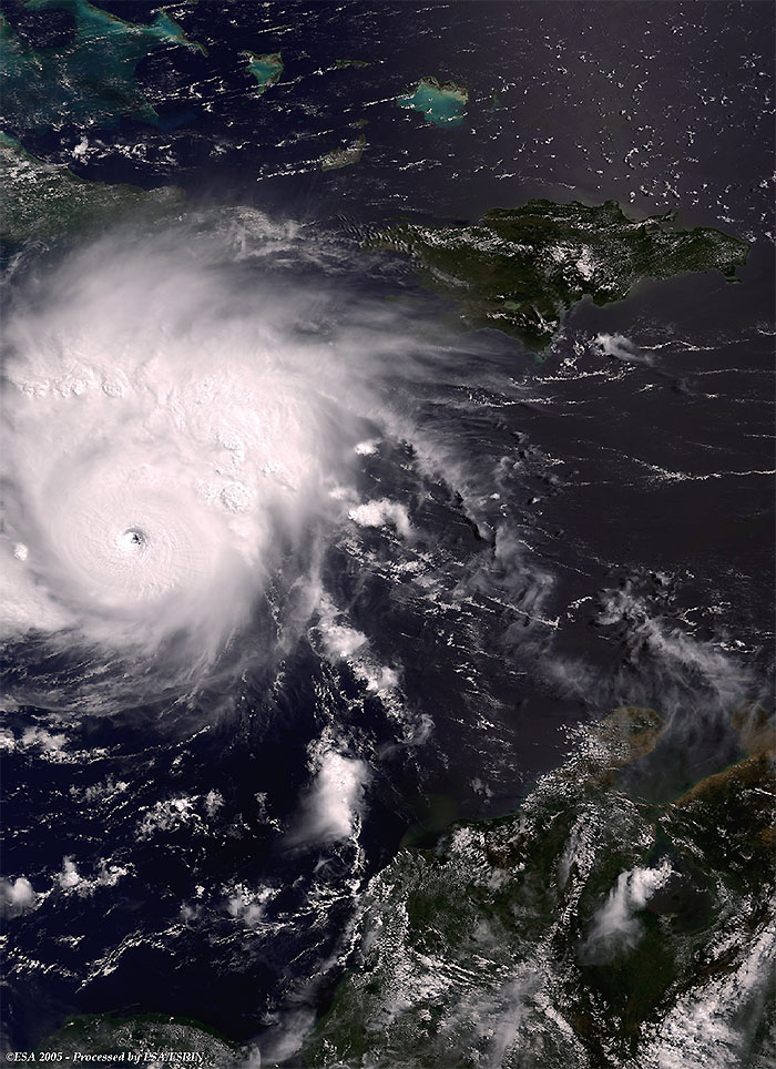
Envisat views of Hurricane Emily |
This Medium Resolution Imaging Spectrometer (MERIS) Level 1 image, shows the Hurricane Emily (centre border right image), located on the south-east of Cuba after hitting Mexico's coast, along the Yucatan Peninsula. Emily is the second severe Hurricane that hit the Caribbean Sea this season.
This ASAR Global Monitoring image (ASA_GM1) was acquired over the Caribbean Sea, and shows Hurricane Emily (centre lower image), south-east of Jamaica with a different Envisat instrument to the one above.
|
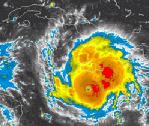
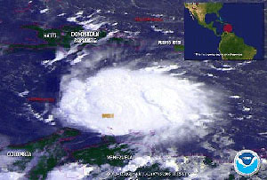
Other views of Hurricane Emily |
From Republica newspaper
From NOAA
 Hurricane Emily (Mexico) - July 2005