 Fires in Portugal
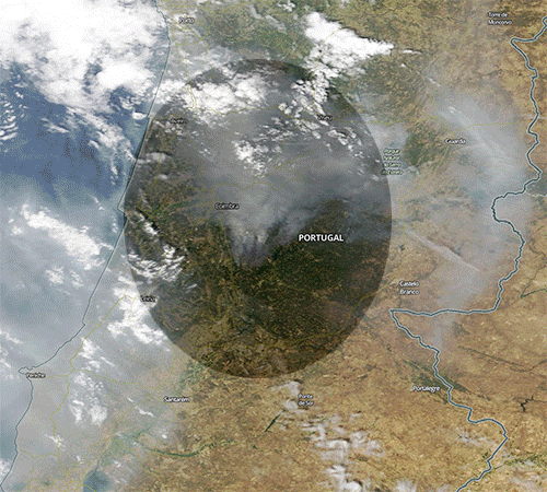
A series of four initial deadly wildfires erupted across central Portugal in the afternoon of 17 June 2017 within minutes of each other, resulting in at least 64 deaths and 204 injured people. The majority of deaths took place in Pedrógão Grande when a fire swept across a road filled with evacuees escaping in their cars. Portuguese officials dispatched more than 1,700 firefighters nationwide to combat the blazes and Prime Minister António Costa declared three days of national mourning. Spain, France, Morocco and Italy deployed firefighters and Water Bombers Canadairs to help extinguish the fires. Although most official reports point to a dry thunderstorm as the cause of the tragedy, the president of the Portuguese Firefighters League expressed his conviction the fire was provoked by arsonists. More information is available on Wikipedia An intense heat wave preceded the fires, with many areas of Portugal seeing temperatures in excess of 40°C. During the night of 17–18 June, a total of 156 fires erupted across the country, particularly in mountainous areas 200 km north-northeast of Lisbon. The fires began in the Pedrógão Grande municipality before spreading dramatically causing a firestorm. Dry thunderstorms preceded the event and may have ignited some fires: the National Director of the Judiciary Police, Almeida Rodrigues, has stated that the police, along with the National Republican Guard, have since found the tree that started the fire when it was struck by lightning. The forests of Pinhal Interior Norte, where Pedrógão Grande is located, are predominately composed of pine trees and the invasive species, eucalyptus, the latter having surpassed pine as the dominant tree in the country in the last ten years.
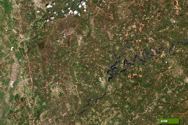
This week our Landsat 8 imagery tour stops over central Portugal. The purpose of this image comparison, acquired in a time window of 15 days (before/after), is to show the large area of forest which was affected by the fires in the middle of June 2017. In this comparison created using bands in false colour, users can see the extent of this area in dark brown. Another aim of these images is to promote the opportunity to download Landsat data through the ESA portals, where images captured every day are made available in near real time to the users and the scientific community. Landsat full resolution data products are freely available for immediate download at: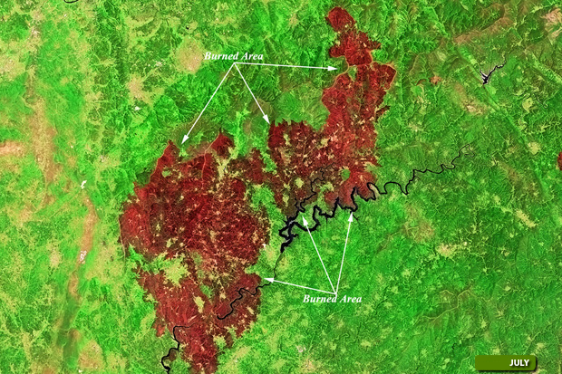 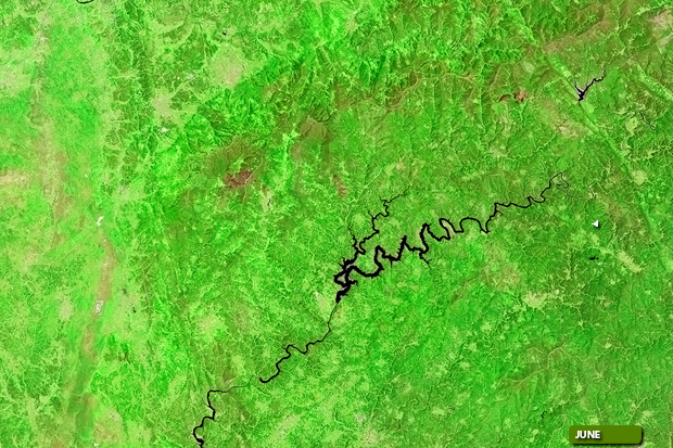 View Landsat 8 OLI large format slider View high resolution image (Before) (JPG 4.5 MB) View high resolution image (After) (JPG 4.8 MB)
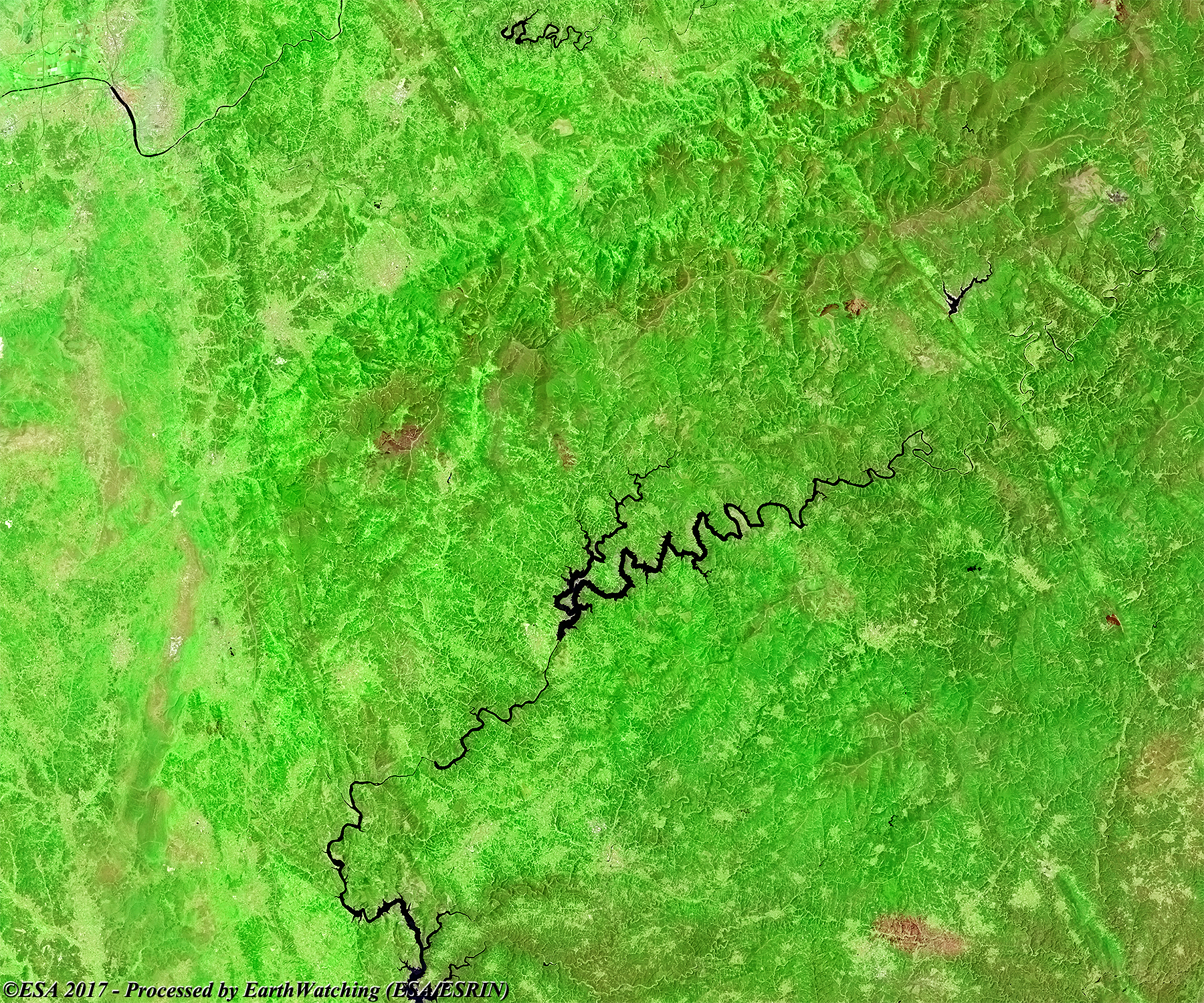
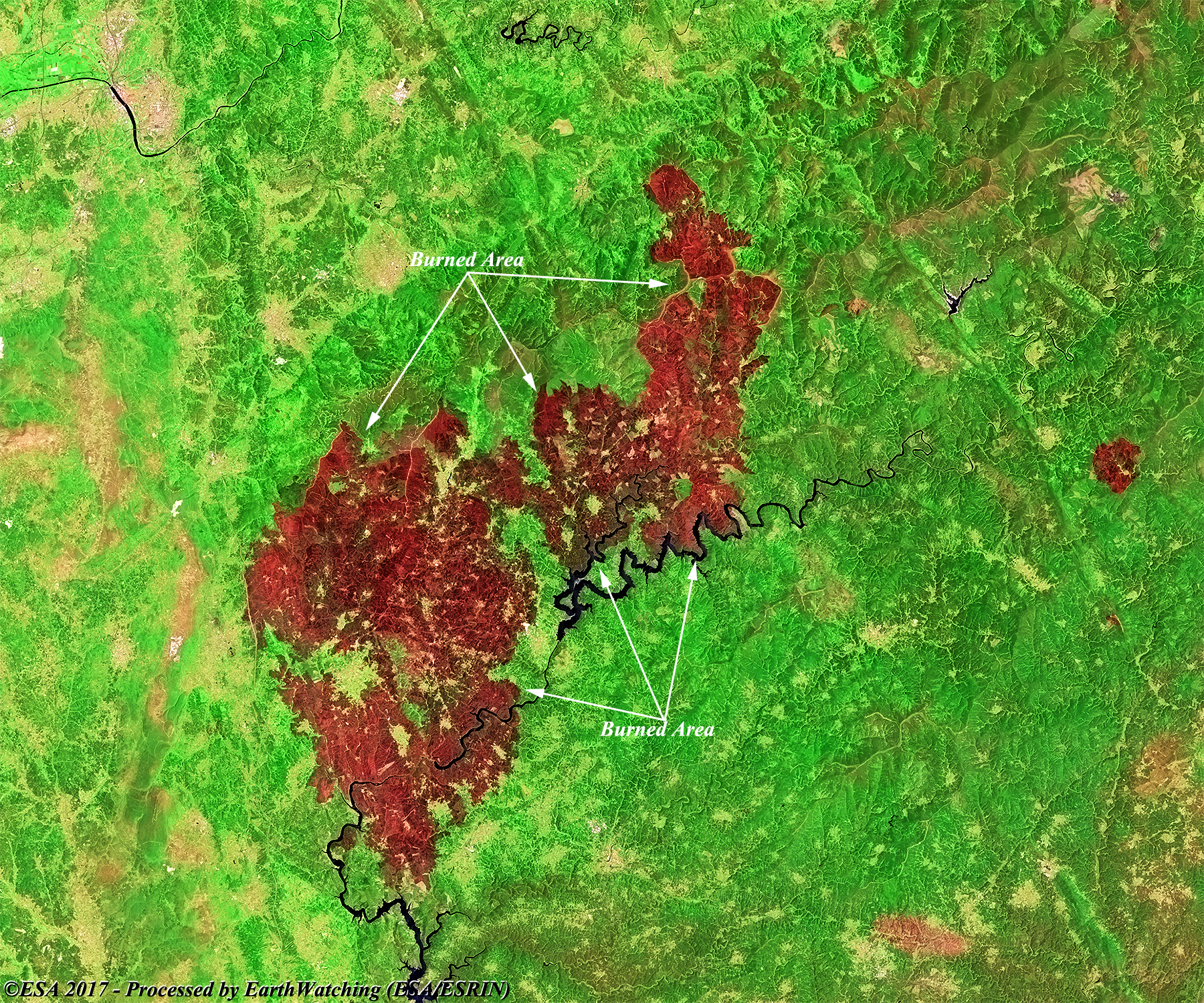
These images acquired through a combination of optical bands in false colour and in visible colour, in this case with Sentinel-2, show the area in central Portugal (before/after) taht was affected by fires. In the comparison the users can see the large area of forest destroyed by fire. The area burned is visible in black in the images in false colour bands and in brown in the image in visible bands. With this demonstration of images taken by the Sentinel-2 (Optical sensor instrumets), we aim to show another application which the Copernicus satellite family can cover. 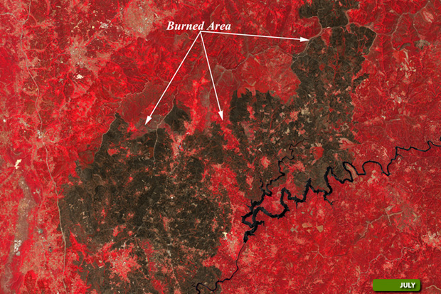 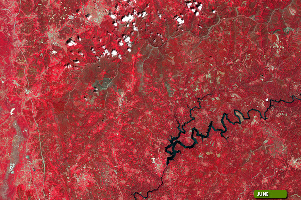 View Sentinel-2 large format slider using band 843 View high resolution image (Before) (JPG 9.3 MB) View high resolution image (After) (JPG 8.7 MB)
  View Sentinel-2 large format slider using band 432 View high resolution image (Before) (JPG 10.4 MB) View high resolution image (After) (JPG 9.6 MB)
|
||||||||||||||||||||||||||||||||||||||||||||||